Toggle navigation
LMEC Home
Exhibitions
Georeferencing
Tools for Teachers
Collections
My Favorites
Sign Up / Log In
Search
Search the map portal
Map Collection
Map Collection
Map Sets
Search
Search
Search for
Search In
All Fields
Creator
Title
Subject
Place
Search All Digital Collections
Advanced Search
8751 Results
My Search
Start Over
More Like
commonwealth:d791w1582
Remove constraint More Like: commonwealth:d791w1582
Filter your Search
Place
North and Central America
5,982
United States
4,900
Massachusetts
2,081
Europe
1,396
Suffolk (county)
1,102
Boston
1,075
Canada
449
Asia
438
more
Place
»
Topic
Boston (Mass.)--Maps
586
United States--Maps
282
Real property--Massachusetts--Boston--Maps
180
Massachusetts--Maps
162
Landowners--Massachusetts--Boston--Maps
133
City planning--Massachusetts--Boston--Maps
119
North America--Maps--Early works to 1800
103
New England--Maps
102
more
Topic
»
Date
Date range begin
–
Date range end
Current results range from
1482
to
2023
View distribution
Creator
United States. Hydrographic Office
595
O.H. Bailey & Co
148
Des Barres, Joseph F. W. (Joseph Frederick Wallet), 1722-1824
123
United States. Post Office Dept
120
Boston Redevelopment Authority
117
Ptolemy, 2nd cent
100
Walling, Henry Francis, 1825-1888
94
Geological Survey (U.S.)
86
more
Creator
»
Format
Maps/Atlases
8,691
Manuscripts
215
Prints
56
Books
36
Objects/Artifacts
10
Drawings/Illustrations
8
Posters
5
Georeferenced
Yes
869
No
7,882
Collection
Norman B. Leventhal Map & Education Center Collection
8,695
Boston and New England Maps
2,289
Urban Maps
2,080
Maritime Charts and Atlases
1,083
American Revolutionary War-Era Maps
616
Boston Redevelopment Authority Collection
143
Applied Geographics, Inc. Records
1
Available to use
No known restrictions
8,609
Creative Commons license
47
Search Constraints
Sort by relevance
relevance
title
date (asc)
date (desc)
Number of results to display per page
20 per page
10
per page
20
per page
50
per page
100
per page
View results as:
grid view
map view
Search Results
4621.
Map showing Indian reservations within the limits of the United States, 1906
4622.
Map showing Japanese-Chinese warfre [sic] now in Shanghai
4623.
Map showing lines of the Bell telephone companies in the United States and Canada : July 1st, 1904
4624.
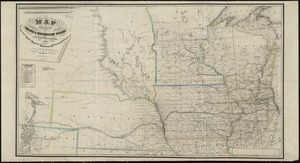
Map showing location of the Chicago & Northwestern Railway with its branches & connections through Illinois, Iowa, Nebraska,...
4625.
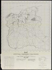
Map showing locations of temporary field works erected by the Spanish for the land defense of Havana, 1897-1898
4626.
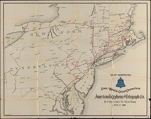
Map showing long distance telephone lines and metallic circuit connections
4627.
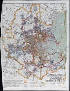
Map showing Metropolitan Sewerage District : January 1, 1921
4628.
Map showing metropolitan sewerage district : January 1, 1910
4629.
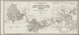
Map showing metropolitan water district, Wachusett, Sudbury and Cochituate watersheds and locations of reservoirs, aqueducts...
4630.
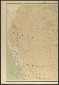
Map showing mounted police stations in north-western Canada
4631.
Map showing mounted police stations in the North West Territories
4632.
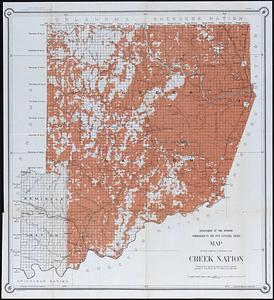
Map showing progress of allotment in Creek Nation
4633.
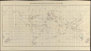
Map showing recorded dates of influenza epidemic in 1889 and 1890
4634.
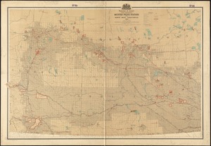
Map showing route from Edmonton to Yukon River as followed by a party of North-West Mounted Police under command of Insp. J.D....
4635.
Map showing route of marches of the army of Genl. W.T. Sherman, from Atlanta, Ga. to Goldsboro, N.C : to accompany the report...
4636.
Map showing siege operations against Forts Sumter and Wagner between July 13th & Sept. 7th, 1863
4637.
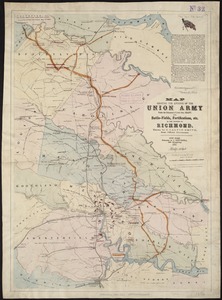
Map showing the advance of the Union army under the command of Lieut.-Gen. Grant, also, battle-fields, fortifications, etc. in...
4638.
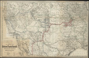
Map showing the Atchison, Topeka and Santa Fe railroad system : with its connections
4639.
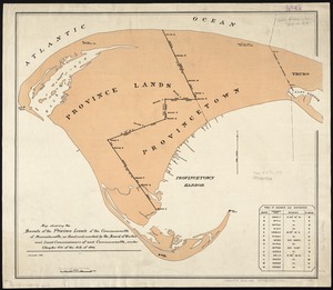
Map showing the bounds of the Province lands of the Commonwealth of Massachusetts, as fixed and marked by the Board of Harbor...
4640.
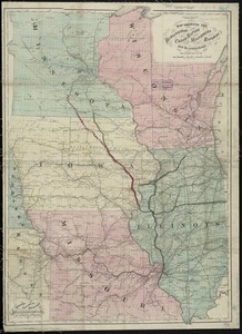
Map showing the Burlington, Cedar Rapids and Minnesota Railway and its connections
‹ Prev
Next ›
1
2
…
228
229
230
231
232
233
234
235
236
…
437
438

![Map showing Japanese-Chinese warfre [sic] now in Shanghai](https://bpldcassets.blob.core.windows.net/derivatives/images/commonwealth:9s161h819/image_thumbnail_300.jpg)