Toggle navigation
LMEC Home
Exhibitions
Georeferencing
Tools for Teachers
Collections
My Favorites
Sign Up / Log In
Search
Search the map portal
Map Collection
Map Collection
Map Sets
Search
Search
Search for
Search In
All Fields
Creator
Title
Subject
Place
Search All Digital Collections
Advanced Search
8853 Results
My Search
Start Over
More Like
commonwealth:cj82m568c
Remove constraint More Like: commonwealth:cj82m568c
Filter your Search
Place
North and Central America
6,080
United States
4,926
Massachusetts
2,080
Europe
1,397
Suffolk (county)
1,046
Boston
1,019
Canada
540
Asia
438
more
Place
»
Topic
Boston (Mass.)--Maps
586
United States--Maps
284
Real property--Massachusetts--Boston--Maps
175
Massachusetts--Maps
163
United States--History--French and Indian War, 1754-1763--Maps
162
Landowners--Massachusetts--Boston--Maps
133
New England--Maps
104
North America--Maps--Early works to 1800
103
more
Topic
»
Date
Date range begin
–
Date range end
Current results range from
1482
to
2023
View distribution
Creator
United States. Hydrographic Office
595
O.H. Bailey & Co
148
Des Barres, Joseph F. W. (Joseph Frederick Wallet), 1722-1824
123
United States. Post Office Dept
120
Ptolemy, 2nd cent
100
Jefferys, Thomas, -1771
98
Walling, Henry Francis, 1825-1888
94
Geological Survey (U.S.)
86
more
Creator
»
Format
Maps/Atlases
8,792
Manuscripts
215
Prints
57
Books
36
Objects/Artifacts
10
Drawings/Illustrations
8
Posters
5
Georeferenced
Yes
869
No
7,984
Collection
Norman B. Leventhal Map & Education Center Collection
8,694
Boston and New England Maps
2,233
Urban Maps
2,023
Maritime Charts and Atlases
1,083
American Revolutionary War-Era Maps
774
William L. Clements Library Collection
149
Boston Redevelopment Authority Collection
87
Richard H. Brown Revolutionary War Map Collection at Mount Vernon
5
more
Collection
»
Available to use
No known restrictions
8,553
Creative Commons license
52
Search Constraints
Sort by relevance
relevance
title
date (asc)
date (desc)
Number of results to display per page
20 per page
10
per page
20
per page
50
per page
100
per page
View results as:
grid view
map view
Search Results
41.
Hudson's River from New York to Albany
42.
Karte derer englischen unternehmungen zur zee aus denen franzosischen kusten ... = Carte des entrep: anglo:ises par mer sur les...
43.
Lake Champlain
44.
Lake Megantic and the Chaudière River : Québec July 25th, 1761
45.
Map from Albany to Crown Point
46.
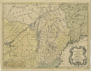
A Map of that part of America which was the principal seat of war in 1756
47.
A map of the British and French settlements in North America
48.
A Map of the British dominions in North America as settled by the late treaty of Peace 1763
49.
Map of the British landings at Louisbourg
50.
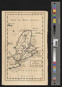
A map of the island of Cape Breton
51.
Moosehead Lake and the immediate area to the west : Québec July 25th, 1761
52.
A New & accurate map of North America, : including the British acquisitions gain'd by the late war, 1763
53.
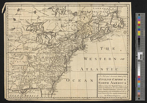
A new and accurate map of the English empire in North America : representing their rightful claim as confirm'd by charters, &...
54.
A new and accurate map of the English empire in North America : representing their rightful claim as confirm'd by charters, and...
55.
A new and accurate map of the present seat of war in North America
56.
A new and accurate map of the present war in North America
57.
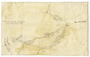
Oneida Lake to the Mohawk River
58.
Parish of Batiscant. Parish of St. Pierre Becquet. Parish of Champlain. Parish of Gentilly
59.
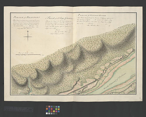
Parish of Beauport. Parish of L'Ange Gardien. Parish of Chateau Richer
60.
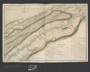
Parish of Berthier. Parish of St. François. Parish of St. Thomas
‹ Prev
Next ›
1
2
3
4
5
6
7
…
442
443