Toggle navigation
LMEC Home
Exhibitions
Georeferencing
Tools for Teachers
Collections
My Favorites
Sign Up / Log In
Search
Search the map portal
Map Collection
Map Collection
Map Sets
Search
Search
Search for
Search In
All Fields
Creator
Title
Subject
Place
Search All Digital Collections
Advanced Search
8858 Results
My Search
Start Over
More Like
commonwealth:cj82m439q
Remove constraint More Like: commonwealth:cj82m439q
Filter your Search
Place
North and Central America
6,010
United States
4,859
Massachusetts
2,079
Europe
1,396
Suffolk (county)
1,046
Boston
1,019
Canada
454
Asia
442
more
Place
»
Topic
Boston (Mass.)--Maps
586
United States--Maps
282
North America--Maps--Early works to 1800
240
Real property--Massachusetts--Boston--Maps
175
Massachusetts--Maps
162
Landowners--Massachusetts--Boston--Maps
133
New England--Maps
102
Europe--Maps
79
more
Topic
»
Date
Date range begin
–
Date range end
Current results range from
1482
to
2023
View distribution
Creator
United States. Hydrographic Office
595
O.H. Bailey & Co
148
Des Barres, Joseph F. W. (Joseph Frederick Wallet), 1722-1824
123
United States. Post Office Dept
120
Ptolemy, 2nd cent
100
Jefferys, Thomas, -1771
94
Walling, Henry Francis, 1825-1888
94
Sayer, Robert, 1725-1794
89
more
Creator
»
Format
Maps/Atlases
8,798
Manuscripts
217
Prints
56
Books
36
Objects/Artifacts
10
Drawings/Illustrations
8
Posters
5
Georeferenced
Yes
872
No
7,986
Collection
Norman B. Leventhal Map & Education Center Collection
8,707
Boston and New England Maps
2,234
Urban Maps
2,023
Maritime Charts and Atlases
1,083
American Revolutionary War-Era Maps
753
Boston Redevelopment Authority Collection
87
MacLean Collection Map Library
66
New York Public Library Collection
36
more
Collection
»
Available to use
No known restrictions
8,556
Creative Commons license
121
Search Constraints
Sort by relevance
relevance
title
date (asc)
date (desc)
Number of results to display per page
20 per page
10
per page
20
per page
50
per page
100
per page
View results as:
grid view
map view
Search Results
81.
A new map of America from the latest observations
82.
A new map of the whole continent of America, divided into North and South and West Indies : wherein are exactly described the...
83.
A new mapp of America devided according to the best and latest observations and discoveries wherein are described by thear...
84.
A new, plaine, and exact map of America : described by N.I. Visscher, and don into English, enlarged, and corrected, according...
85.
Nieuwe kaart van America uitgegeven te Amsterdam
86.
Nieuwe kaart van het westelykste deel der weereld, dienende tot aanwyzing van de scheepstogten der Nederlanderen naar Westindie...
87.
Nouvelle carte de l'Amerique : avec tous ses royaumes, etats, iles, ports, bayes et rivieres, dressée suivant les plus...
88.
Nova totivs Americae descriptio
89.
Novissima et accuratissima totius Americae descriptio
90.
Novissima et accuratissima totius Americae descriptio
91.
Novus orbis sive America Meridionalis et Septentrionalis, per sua regna, provincias et insulas iuxta observationes et...
92.
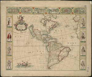
Nov[us] orbis sive America septentrionalis, divisa per sua regna provinc. et insul : cura et opera
93.
Oceani occidetalis seu terre nove tabula
94.
Recentissima novi orbis sive Americae septentrionalis et meridionalis tabula
95.
Recentissima novi orbis sive Americae septentrionalis et meridionalis tabula
96.
Recentissima novi orbis, sive Americae Septentrionalis et Meridionalis tabula
97.
Totius Americae septentrionalis et meridionalis novissima repræsentatio quam ex singulis recantium geographorum tabulis...
98.
An accurate map of North America : describing and distinguishing the British, Spanish and French dominions on this great...
99.
An accurate map of North America : describing and distinguishing the British and Spanish dominions of this great continent;...
100.
America septentrionalis
‹ Prev
Next ›
1
2
3
4
5
6
7
8
9
…
442
443


![Nov[us] orbis sive America septentrionalis, divisa per sua regna provinc. et insul](https://bpldcassets.blob.core.windows.net/derivatives/images/commonwealth:wd376505f/image_thumbnail_300.jpg)


