Toggle navigation
LMEC Home
Exhibitions
Georeferencing
Tools for Teachers
Collections
My Favorites
Sign Up / Log In
Search
Search the map portal
Map Collection
Map Collection
Map Sets
Search
Search
Search for
Search In
All Fields
Creator
Title
Subject
Place
Search All Digital Collections
Advanced Search
8181 Results
My Search
Start Over
More Like
commonwealth:cj82m115h
Remove constraint More Like: commonwealth:cj82m115h
Filter your Search
Place
North and Central America
4,930
United States
3,755
Suffolk (county)
1,026
Boston
999
Europe
963
Canada
427
France
269
Massachusetts
258
more
Place
»
Topic
Boston (Mass.)--Maps
574
United States--Maps
270
Real property--Massachusetts--Boston--Maps
174
Massachusetts--Maps
160
Landowners--Massachusetts--Boston--Maps
132
North America--Maps--Early works to 1800
103
New England--Maps
99
Europe--Maps
78
more
Topic
»
Date
Date range begin
–
Date range end
Current results range from
1482
to
2023
View distribution
Creator
United States. Hydrographic Office
357
O.H. Bailey & Co
148
Des Barres, Joseph F. W. (Joseph Frederick Wallet), 1722-1824
123
United States. Post Office Dept
120
Ptolemy, 2nd cent
100
Walling, Henry Francis, 1825-1888
94
Jefferys, Thomas, -1771
84
Geological Survey (U.S.)
82
more
Creator
»
Format
Maps/Atlases
8,122
Manuscripts
219
Prints
51
Books
36
Objects/Artifacts
10
Drawings/Illustrations
8
Posters
4
Georeferenced
Yes
869
No
7,312
Collection
Norman B. Leventhal Map Center Collection
8,162
Boston and New England Maps
2,184
Urban Maps
1,925
Maritime Charts and Atlases
750
American Revolutionary War-Era Maps
634
Boston Redevelopment Authority Collection
86
Richard H. Brown Revolutionary War Map Collection at Mount Vernon
12
New-York Historical Society Collection
3
more
Collection
»
Available to use
No known restrictions
8,024
Creative Commons license
61
Search Constraints
Sort by relevance
relevance
title
date (asc)
date (desc)
Number of results to display per page
10 per page
10
per page
20
per page
50
per page
100
per page
View results as:
grid view
map view
Search Results
1.
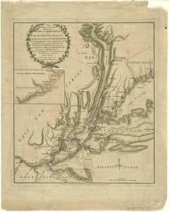
A plan of New York Island, with part of Long Island, Staten Island & east New Jersey, with a particular description of the...
2.
Chart and plan of the harbour of New York & the couny. adjacent, from Sandy Hook to Kingsbridge, comprehending the whole of New...
3.
A plan of New York Island, with part of Long Island, Staten Island & east New Jersey, with a particular description of the...
4.
The seat of action, between the British and American forces : or an authentic plan of the western part of Long Island, with the...
5.
The seat of action, between the British and American forces : or an authentic plan of the western part of Long Island, with the...
6.
Sketch of the country illustrating the late engagement in Long Island
7.
A plan of New York Island, part of Long Island &c. shewing the position of the American and British Armies, before, at, and...
8.
A New and accurate map of the present seat of war in North America, comprehending New Jersey, Philadelphia, Pensylvania,...
9.
A new and accurate map of the province of New York and part of the Jerseys, New England and Canada, shewing the scenes of our...
10.
A plan of the operations of the King's army under the command of General Sr. William Howe, K.B. in New York and east New Jersey...
‹ Prev
Next ›
1
2
3
4
5
…
818
819