Toggle navigation
LMEC Home
Exhibitions
Georeferencing
Tools for Teachers
Collections
My Favorites
Sign Up / Log In
Search
Search the map portal
Map Collection
Map Collection
Map Sets
Search
Search
Search for
Search In
All Fields
Creator
Title
Subject
Place
Search All Digital Collections
Advanced Search
8720 Results
My Search
Start Over
More Like
commonwealth:cj82kn462
Remove constraint More Like: commonwealth:cj82kn462
Filter your Search
Place
North and Central America
5,951
United States
4,869
Massachusetts
2,083
Europe
1,396
Suffolk (county)
1,048
Boston
1,021
Canada
456
Asia
438
more
Place
»
Topic
Boston (Mass.)--Maps
588
United States--Maps
282
Real property--Massachusetts--Boston--Maps
175
Massachusetts--Maps
164
Landowners--Massachusetts--Boston--Maps
133
New England--Maps
127
North America--Maps--Early works to 1800
103
Europe--Maps
79
more
Topic
»
Date
Date range begin
–
Date range end
Current results range from
1482
to
2023
View distribution
Creator
United States. Hydrographic Office
595
O.H. Bailey & Co
148
Des Barres, Joseph F. W. (Joseph Frederick Wallet), 1722-1824
123
United States. Post Office Dept
120
Ptolemy, 2nd cent
100
Walling, Henry Francis, 1825-1888
94
Geological Survey (U.S.)
86
Jefferys, Thomas, -1771
86
more
Creator
»
Format
Maps/Atlases
8,660
Manuscripts
215
Prints
56
Books
36
Objects/Artifacts
10
Drawings/Illustrations
8
Posters
5
Georeferenced
Yes
871
No
7,849
Collection
Norman B. Leventhal Map & Education Center Collection
8,698
Boston and New England Maps
2,238
Urban Maps
2,023
Maritime Charts and Atlases
1,083
American Revolutionary War-Era Maps
633
Boston Redevelopment Authority Collection
87
American Antiquarian Society Collection
9
David Judkins Weaver Papers
4
more
Collection
»
Available to use
No known restrictions
8,556
Creative Commons license
50
Search Constraints
Sort by relevance
relevance
title
date (asc)
date (desc)
Number of results to display per page
20 per page
10
per page
20
per page
50
per page
100
per page
View results as:
grid view
map view
Search Results
4161.
Map of the Department of Dakota including Minnesota, Dakota and Montana
4162.
Map of the Department of Dakota including Minnesota, North Dakota, Montana, Yellowstone National Park, and that portion of...
4163.
Map of the Department of the Columbia
4164.
Map of the Department of the Columbia
4165.
Map of the Diocese of Massachusetts showing the location of the Episcopal parishes and Missionary Stations
4166.
A map of the discoveries made by Capts. Cook & Clerke in the years 1778 & 1779 between the eastern coast of Asia and the...
4167.
A map of the discoveries made by the Russians on the North West coast of America
4168.
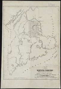
Map of the disputed territory [Maine] : reduced from the original of Messrs. Featherstonehaugh & Mudge, British commissioners
4169.
Map of the disputed territory with the boundaries claimed by Maine & Great Britain and that proposed by the King of the...
4170.
Map of the disputed territory,with a full description
4171.
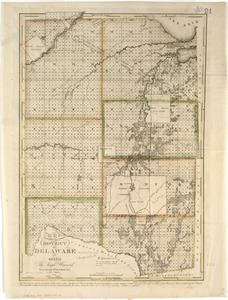
Map of the district of Delaware in Ohio
4172.
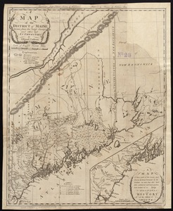
A map of the district of Maine, drawn from the latest surveys and other best authorities
4173.
Map of the district of Maine from the latest and best authorities
4174.
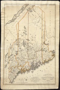
Map of the district of Maine, Massachusetts : compiled from actual surveys made by order of the General Court and under the...
4175.
Map of the Dominion of Canada : indicating natural resources, transportation and trade routes
4176.
Map of the Dominion of Canada : indicating natural resources, transportation and trade routes
4177.
Map of the Dominion of Canada
4178.
A map of the Dutch settlements of Surinam, Demerary, Issequibo, Berbices, and the islands of Curassoa, Aruba, Bonaire, &c :...
4179.
Map of the eastern division and branches, Erie Railway
4180.
Map of the eastern junc. Broad Sound Pier, & Pt. Shirley railroad : steamboat lines and connections : established for the...
‹ Prev
Next ›
1
2
…
205
206
207
208
209
210
211
212
213
…
435
436


![Map of the disputed territory [Maine]](https://bpldcassets.blob.core.windows.net/derivatives/images/commonwealth:7h14b025h/image_thumbnail_300.jpg)