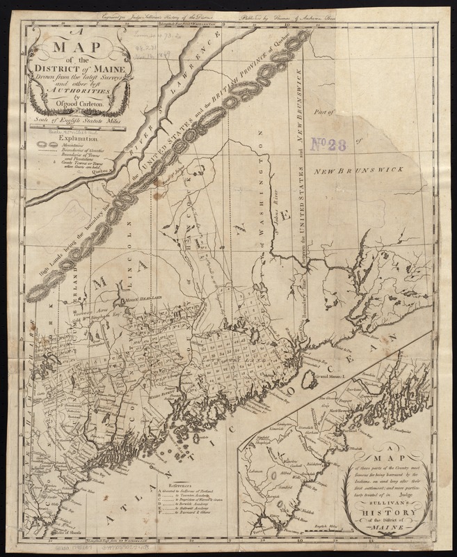
A map of the district of Maine, drawn from the latest surveys and other best authorities
This map is also available in American Revolutionary Geographies Online (ARGO), a collections portal especially built for material relating to the American Revolutionary War Era. Visit ARGO to learn more about this item and explore the historical geography of North America in the late eighteenth century.
Item Information
- Title:
- A map of the district of Maine, drawn from the latest surveys and other best authorities
- Creator:
- Carleton, Osgood, 1742-1816
- Name on Item:
-
by Osgood Carleton ; Doolittle, sc., Newhaven.
- Date:
-
1795
- Format:
-
Maps/Atlases
- Location:
-
Boston Public Library
Norman B. Leventhal Map & Education Center - Collection (local):
-
Norman B. Leventhal Map & Education Center Collection
- Subjects:
-
Maine--Maps--Early works to 1800
- Places:
-
Maine
- Extent:
- 1 map : hand col. ; 51 x 40 cm.
- Terms of Use:
-
No known copyright restrictions.
No known restrictions on use.
- Publisher:
-
Boston :
Thomas & Andrews
- Scale:
-
Scale [ca. 1:1,170,000].
- Language:
-
English
- Notes:
-
Shows town and county boundaries.
Relief shown by hachures.
In upper margin: Engraved for Judge Sullivan's History of the district of Maine.
Inset: [Southeastern Maine]. Scale [ca. 1:337,920].
Includes references to land grants.
Prime meridian: Washington, D.C.
- Identifier:
-
06_01_004065
- Call #:
-
G3730 1795 .C37
- Barcode:
-
39999059022408


