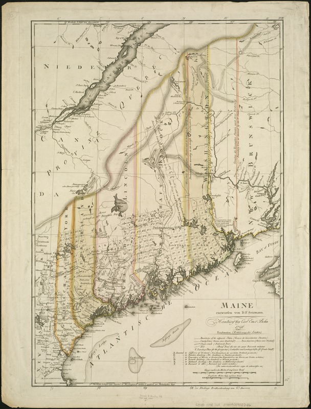
Maine
This map is also available in American Revolutionary Geographies Online (ARGO), a collections portal especially built for material relating to the American Revolutionary War Era. Visit ARGO to learn more about this item and explore the historical geography of North America in the late eighteenth century.
Item Information
- Title:
- Maine
- Creator:
- Sotzmann, D. F.
- Name on Item:
-
entworfen von D.F. Sotzmann.
- Date:
-
1798
- Format:
-
Maps/Atlases
- Location:
-
Boston Public Library
Norman B. Leventhal Map & Education Center - Collection (local):
-
Norman B. Leventhal Map & Education Center Collection
- Subjects:
-
Maine--Maps--Early works to 1800
- Places:
-
Maine
- Extent:
- 1 map : col. ; 63 x 43 cm.
- Terms of Use:
-
No known copyright restrictions.
No known restrictions on use.
- Publisher:
-
Hamburg :
Carl Ernst Bohn
- Scale:
-
Scale 1:1,020,000.
- Language:
-
German
- Notes:
-
Relief shown by hachures.
Engraved by: Sander.
Above neat line at right: No IV.
Below neat line at right: zu Ebelings Erdbeschreibung von Amerika.
From atlas accompanying Ebeling, C.D. Erdbeschreibung und geschicte von Amerika.
- Identifier:
-
06_01_004064
- Call #:
-
G3730 1798 .S68
- Barcode:
-
39999059022416