Toggle navigation
LMEC Home
Exhibitions
Georeferencing
Tools for Teachers
Collections
My Favorites
Sign Up / Log In
Search
Search the map portal
Map Collection
Map Collection
Map Sets
Search
Search
Search for
Search In
All Fields
Creator
Title
Subject
Place
Search All Digital Collections
Advanced Search
8743 Results
My Search
Start Over
More Like
commonwealth:cj82kk087
Remove constraint More Like: commonwealth:cj82kk087
Filter your Search
Place
North and Central America
5,974
United States
4,884
Massachusetts
2,079
Europe
1,396
Suffolk (county)
1,046
Boston
1,019
Canada
450
Asia
438
more
Place
»
Topic
Boston (Mass.)--Maps
586
United States--Maps
282
Real property--Massachusetts--Boston--Maps
175
Massachusetts--Maps
162
Landowners--Massachusetts--Boston--Maps
133
New England--Maps
106
North America--Maps--Early works to 1800
103
Europe--Maps
79
more
Topic
»
Date
Date range begin
–
Date range end
Current results range from
1482
to
2023
View distribution
Creator
United States. Hydrographic Office
595
O.H. Bailey & Co
148
Des Barres, Joseph F. W. (Joseph Frederick Wallet), 1722-1824
123
United States. Post Office Dept
119
Ptolemy, 2nd cent
100
Walling, Henry Francis, 1825-1888
94
Geological Survey (U.S.)
86
Jefferys, Thomas, -1771
86
more
Creator
»
Format
Maps/Atlases
8,683
Manuscripts
218
Prints
56
Books
36
Objects/Artifacts
10
Drawings/Illustrations
8
Posters
5
Georeferenced
Yes
869
No
7,874
Collection
Norman B. Leventhal Map & Education Center Collection
8,695
Boston and New England Maps
2,233
Urban Maps
2,023
Maritime Charts and Atlases
1,084
American Revolutionary War-Era Maps
664
Boston Redevelopment Authority Collection
87
William L. Clements Library Collection
30
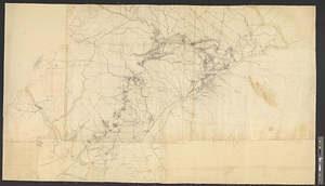
American Antiquarian Society Collection
9
more
Collection
»
Available to use
No known restrictions
8,553
Creative Commons license
50
Search Constraints
Sort by relevance
relevance
title
date (asc)
date (desc)
Number of results to display per page
20 per page
10
per page
20
per page
50
per page
100
per page
View results as:
grid view
map view
Search Results
121.
The provinces of New York, and New Jersey, : with part of Pensilvania [sic], and the province of Quebec
122.
The road from New Bridge and Hackinsack to Burlington
123.
Situation of ye rebels just before the attack upon Trenton
124.
Southern New York and northern New Jersey
125.
The State of New Jersey
126.
Carte de la Nouvelle Angleterre, Nouvelle Yorck, et Pensilvanie. : Pour servir à l'Histoire générale des voyages
127.
A map of Pensylvania, with part of the adjacent states, from the latest surveys
128.
A map of Pensylvania, with part of the adjacent states, from the latest surveys
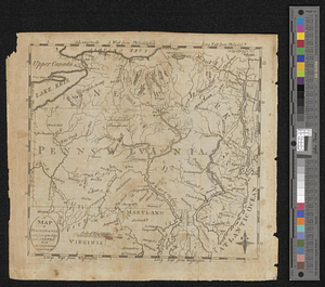
129.
A map of the state of Pennsylvania
130.
A map of the western parts of the colony of Virginia
131.
Part of the modern counties of Philadelphia, Bucks, Chester, Montgomery, Lehigh, Northampton, Lancaster, and Lebanon
132.
Part of the modern counties of Philadelphia, Bucks, Montgomery, Delaware, Chester, and Lancaster in Pennsylvania; New Castle in...
133.
Plan of the Indian countrys through which the troops marchd in 1764 under the command of Col. Henry Bouquet
134.
A plan of the river Ohio from Fort Pitt to the Mississipi : by order of ye chief engineer
135.
Progress of the British army from Elk River to Philadelphia, 1777
136.
Sketch from information of the different roads about Freehold in the Jerseys
137.
A sketch of the several Indian roads leading from Fort Pitt to Sioto, Lake Erie &c. : takn. from a draft (made on a tour thro'...
138.
The 100th anniversary map of Abraham Lincoln's visit to Massachusetts, September 11-23, 1848
139.
1630 shoreline
140.
1879. Progress map of the U.S. Geographical Surveys west of the 100th Meridian : prepared under the direction of 1st Lieut....
‹ Prev
Next ›
1
2
3
4
5
6
7
8
9
10
11
…
437
438