Toggle navigation
LMEC Home
Exhibitions
Georeferencing
Tools for Teachers
Collections
My Favorites
Sign Up / Log In
Search
Search the map portal
Map Collection
Map Collection
Map Sets
Search
Search
Search for
Search In
All Fields
Creator
Title
Subject
Place
Search All Digital Collections
Advanced Search
1048 Results
My Search
Start Over
More Like
commonwealth:bc3890380
Remove constraint More Like: commonwealth:bc3890380
Filter your Search
Place
North and Central America
1,044
United States
1,039
Suffolk (county)
1,024
Boston
1,023
Massachusetts
714
Roxbury
53
South End
45
Downtown Boston
40
more
Place
»
Topic
Boston (Mass.)--Maps
752
City planning--Massachusetts--Boston--Maps
367
Urban renewal--Massachusetts--Boston--Maps
234
Real property--Massachusetts--Boston--Maps
131
Land use--Massachusetts--Boston--Maps
99
Buildings--Massachusetts--Boston--Maps
86
Landowners--Massachusetts--Boston--Maps
76
Local transit--Massachusetts--Boston--Maps
58
more
Topic
»
Date
Date range begin
–
Date range end
Current results range from
1743
to
2023
View distribution
Creator
Boston Redevelopment Authority
355
Geo. H. Walker & Co
27
Boynton, George W., d. 1884
21
Sampson, Davenport & Co
21
Sampson, Murdock & Co
20
Bromley, George Washington
18
Bromley, Walter Scott
17
Lufkin, Richard F. (Richard Friend)
17
more
Creator
»
Format
Maps/Atlases
1,048
Manuscripts
9
Prints
1
Georeferenced
Yes
98
No
950
Collection
Boston and New England Maps
868
Urban Maps
769
Norman B. Leventhal Map & Education Center Collection
627
Boston Redevelopment Authority Collection
404
American Revolutionary War-Era Maps
25
Mapping Boston Collection
20
Massachusetts Real Estate Atlases
12
William L. Clements Library Collection
10
more
Collection
»
Available to use
No known restrictions
980
Creative Commons license
34
Search Constraints
Sort by relevance
relevance
title
date (asc)
date (desc)
Number of results to display per page
20 per page
10
per page
20
per page
50
per page
100
per page
View results as:
grid view
map view
Search Results
521.
New map of the vicinity of Boston, with the dates of settlement and distance from the capital
522.
New map of the vicinity of Boston, with the dates of settlement and distance from the capital
523.
New map of the vicinity of Boston, with the dates of settlement, population in 1840, and distance from the capital
524.
A new plan of Boston : drawn from the best authorities with the latest improvements, additionas and corrections
525.
A new plan of ye great town of Boston in New England in America with the many additionall buildings & new streets to the year 1743
526.
Official map of Boston
527.
Old Boston, compiled from the Book of possessions
528.
One way streets, metered block faces, parking restriction areas and signal locations within the Boston regional core
529.
Open space 2017
530.
Outline and index map of city of Boston proper
531.
Outline map of Boston
532.
Outline plan showing the growth of Boston
533.
Panoramic view of Boston centered on the Prudential Tower
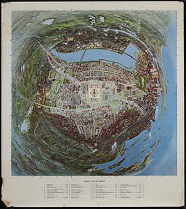
534.
Panoramic view of Boston showing golden semicircle
535.
Percent foreign-born
536.
Peremptory sale : this valuable property will positively be sold at public auction on Saturday the 29th day of April current at...
537.
Pianta della città di Boston
538.
Plan and profiles of surveys from Farm Pond in Framingham and Long Pond in Natick, for supplying water to the City of Boston
539.
Plan de Boston : cette ville est composée de quatre mille maisons, et d'environ vingt mille habitans, on compte par an jusqu'a...
540.
Plan de Boston : cette ville est composée de quatre mille maisons, et d'environ vingt mille habitans
‹ Prev
Next ›
1
2
…
23
24
25
26
27
28
29
30
31
…
52
53