Toggle navigation
LMEC Home
Exhibitions
Georeferencing
Tools for Teachers
Collections
My Favorites
Sign Up / Log In
Search
Search the map portal
Map Collection
Map Collection
Map Sets
Search
Search
Search for
Search In
All Fields
Creator
Title
Subject
Place
Search All Digital Collections
Advanced Search
8755 Results
My Search
Start Over
More Like
commonwealth:b85162574
Remove constraint More Like: commonwealth:b85162574
Filter your Search
Place
North and Central America
5,986
United States
4,900
Massachusetts
2,081
Europe
1,396
Suffolk (county)
1,046
Boston
1,019
Canada
455
Asia
438
more
Place
»
Topic
Boston (Mass.)--Maps
586
United States--Maps
282
Real property--Massachusetts--Boston--Maps
175
Massachusetts--Maps
164
Landowners--Massachusetts--Boston--Maps
133
New England--Maps
109
North America--Maps--Early works to 1800
103
New York (State)--Maps
85
more
Topic
»
Date
Date range begin
–
Date range end
Current results range from
1482
to
2023
View distribution
Creator
United States. Hydrographic Office
595
O.H. Bailey & Co
148
Des Barres, Joseph F. W. (Joseph Frederick Wallet), 1722-1824
123
United States. Post Office Dept
120
Ptolemy, 2nd cent
100
Walling, Henry Francis, 1825-1888
94
Geological Survey (U.S.)
86
Jefferys, Thomas, -1771
85
more
Creator
»
Format
Maps/Atlases
8,695
Manuscripts
217
Prints
56
Books
36
Objects/Artifacts
10
Drawings/Illustrations
9
Posters
5
Georeferenced
Yes
871
No
7,884
Collection
Norman B. Leventhal Map & Education Center Collection
8,695
Boston and New England Maps
2,233
Urban Maps
2,023
Maritime Charts and Atlases
1,083
American Revolutionary War-Era Maps
676
Boston Redevelopment Authority Collection
87
William L. Clements Library Collection
45
American Antiquarian Society Collection
9
more
Collection
»
Available to use
No known restrictions
8,554
Creative Commons license
48
Search Constraints
Sort by relevance
relevance
title
date (asc)
date (desc)
Number of results to display per page
20 per page
10
per page
20
per page
50
per page
100
per page
View results as:
grid view
map view
Search Results
6281.
[Plan of house lots on Briggs Place, Newton]
6282.
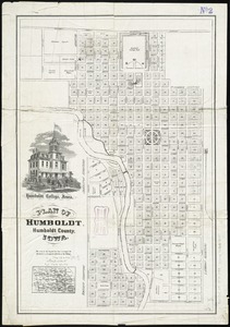
Plan of Humboldt, Humboldt County, Iowa
6283.
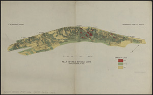
Plan of Isle Royale Lode : developments to 1925
6284.
Plan of La Vera Cruz, from Spanish draughts ; Plan of Port Royal Laguna, commonly called Logwood Creeks
6285.
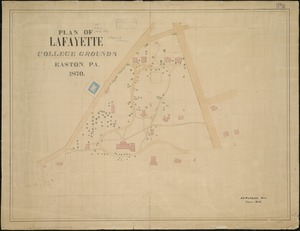
Plan of Lafayette College grounds Easton, Pa
6286.
Plan of Lafayette Mall (Boston Common)
6287.
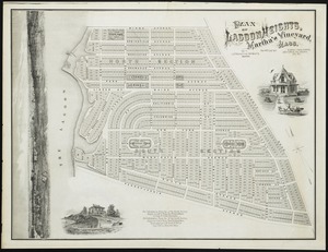
Plan of Lagoon Heights, Martha's Vineyard, Mass
6288.
Plan of land & wharves belonging to Mill Pond Wharf Co. near Bartons Point
6289.
Plan of land and street layout in Boston, Mass., Hyde Park : prepared for the Stoney Brook Land Trust
6290.
Plan of land at Buzzards Bay, Mass., belonging to the N.E. Telephone & Telegraph Co.
6291.
Plan of land belonging to J.M. & G.H. Pike : ward 16 - Boston
6292.
Plan of land belonging to William Kenrick : near the depot of Newton Corner
6293.
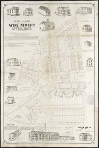
Plan of land in Ayers' New-City, Lowell, Mass : belonging to Daniel Ayer
6294.
Plan of land in Cambridgeport held by the receivers of the Phoenix Bank : to be sold by public auction Friday June 20, 1851 at...
6295.
Plan of land in Charlestown held by the receivers of the Phoenix Bank : to be sold by public auction [Tuesday] June 19 1851 at...
6296.
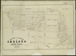
Plan of land in Chelsea belonging to the heirs of Joshua Carter
6297.
Plan of land in Newton, 6th ward : being a portion of the estate of J. Willey [sic]Edmands, decd. ... to be sold by...
6298.
Plan of land in Roxbury belonging to the heirs of Alfred Evans
6299.
Plan of land in Sharon belonging to the Massapoag Lake Company
6300.
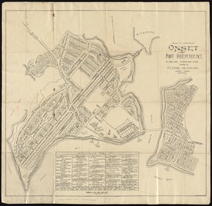
Plan of land of Onset and Point Independence
‹ Prev
Next ›
1
2
…
311
312
313
314
315
316
317
318
319
…
437
438
![[Plan of house lots on Briggs Place, Newton]](https://bpldcassets.blob.core.windows.net/derivatives/images/commonwealth:x059c973z/image_thumbnail_300.jpg)