Toggle navigation
LMEC Home
Exhibitions
Georeferencing
Tools for Teachers
Collections
My Favorites
Sign Up / Log In
Search
Search the map portal
Map Collection
Map Collection
Map Sets
Search
Search
Search for
Search In
All Fields
Creator
Title
Subject
Place
Search All Digital Collections
Advanced Search
680 Results
My Search
Start Over
More Like
commonwealth:b2776b386
Remove constraint More Like: commonwealth:b2776b386
Filter your Search
Place
North and Central America
677
United States
674
Suffolk (county)
667
Boston
666
Massachusetts
333
Roxbury
75
South End
55
Charlestown
49
more
Place
»
Topic
City planning--Massachusetts--Boston--Maps
417
Real property--Massachusetts--Boston--Maps
253
Urban renewal--Massachusetts--Boston--Maps
253
Boston (Mass.)--Maps
209
Landowners--Massachusetts--Boston--Maps
140
Buildings--Massachusetts--Boston--Maps
124
Land use--Massachusetts--Boston--Maps
100
Roxbury (Boston, Mass.)--Maps
72
more
Topic
»
Date
Date range begin
–
Date range end
Current results range from
1798
to
2023
View distribution
Creator
Boston Redevelopment Authority
379
Bromley, George Washington
68
Bromley, Walter Scott
68
G.W. Bromley & Co.
46
Wadsworth, Alexander, 1806-1898
19
Hopkins, Griffith Morgan, Jr.
15
Downtown Waterfront Corporation
10
Victor Gruen Associates
10
more
Creator
»
Format
Maps/Atlases
679
Manuscripts
5
Drawings/Illustrations
3
Prints
1
Georeferenced
Yes
9
No
671
Collection
Boston and New England Maps
636
Urban Maps
621
Boston Redevelopment Authority Collection
448
Norman B. Leventhal Map & Education Center Collection
259
Massachusetts Real Estate Atlases
35
American Revolutionary War-Era Maps
1
Applied Geographics, Inc. Records
1
Available to use
No known restrictions
642
Creative Commons license
2
Search Constraints
Sort by relevance
relevance
title
date (asc)
date (desc)
Number of results to display per page
20 per page
10
per page
20
per page
50
per page
100
per page
View results as:
grid view
map view
Search Results
661.
Off-street parking inventory within Boston proper
662.
Plan of the route of pipes from Jamaica Pond, in Roxbury to the reservoir, in Boston
663.
Port facilities at Boston, MA
664.
Public open space city of Boston
665.
Public outdoor recreation master plan
666.
Relationship between selected recreation sites and public transportation facilities Boston metropolitan area 1971
667.
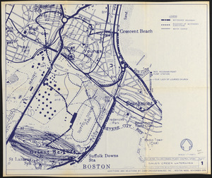
Revere, Sales Creek - flood control study
668.
Roxbury
669.
South Boston urban renewal area R-51 : existing population density
670.
South China Sea, Gulf of Tonkin, Vietnam--China, C'ua Nhuong to Leizhou Bandao including Hainan Dao
671.
Topographic map of Boston, Mass.
672.
Wards & precincts
673.
Wastewater system map, Boston proper, sheet no. 21h
674.
Water distribution system map, Boston proper, sheet no. 21h
675.
Water distribution system map, Boston proper, sheet no. 22h
676.
Water system map, Boston proper, sheet no. 22h
677.
The world according to Standard (N.J.)
678.
Zoning districts - city of Boston - map 1 - Boston proper
679.
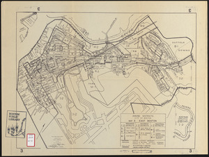
Zoning districts city of Boston map 3 East Boston
680.
Zoning districts city of Boston map 9 Jamaica Plain
‹ Prev
Next ›
1
2
…
30
31
32
33
34