Toggle navigation
LMEC Home
Exhibitions
Georeferencing
Tools for Teachers
Collections
My Favorites
Sign Up / Log In
Search
Search the map portal
Map Collection
Map Collection
Map Sets
Search
Search
Search for
Search In
All Fields
Creator
Title
Subject
Place
Search All Digital Collections
Advanced Search
8862 Results
My Search
Start Over
More Like
commonwealth:9s161j35d
Remove constraint More Like: commonwealth:9s161j35d
Filter your Search
Place
North and Central America
6,093
United States
5,009
Massachusetts
2,134
Europe
1,396
Suffolk (county)
1,208
Boston
1,181
Canada
449
Asia
438
more
Place
»
Topic
Boston (Mass.)--Maps
752
United States--Maps
282
Real property--Massachusetts--Boston--Maps
195
Massachusetts--Maps
166
City planning--Massachusetts--Boston--Maps
158
Landowners--Massachusetts--Boston--Maps
142
New England--Maps
104
North America--Maps--Early works to 1800
103
more
Topic
»
Date
Date range begin
–
Date range end
Current results range from
1482
to
2023
View distribution
Creator
United States. Hydrographic Office
595
Boston Redevelopment Authority
163
O.H. Bailey & Co
148
Des Barres, Joseph F. W. (Joseph Frederick Wallet), 1722-1824
124
United States. Post Office Dept
120
Ptolemy, 2nd cent
100
Walling, Henry Francis, 1825-1888
94
Geological Survey (U.S.)
87
more
Creator
»
Format
Maps/Atlases
8,802
Manuscripts
215
Prints
56
Books
36
Objects/Artifacts
10
Drawings/Illustrations
8
Posters
5
Georeferenced
Yes
885
No
7,977
Collection
Norman B. Leventhal Map & Education Center Collection
8,723
Boston and New England Maps
2,358
Urban Maps
2,142
Maritime Charts and Atlases
1,083
American Revolutionary War-Era Maps
638
Boston Redevelopment Authority Collection
192
Mapping Boston Collection
20
Massachusetts Real Estate Atlases
12
more
Collection
»
Available to use
No known restrictions
8,665
Creative Commons license
70
Search Constraints
Sort by relevance
relevance
title
date (asc)
date (desc)
Number of results to display per page
20 per page
10
per page
20
per page
50
per page
100
per page
View results as:
grid view
map view
Search Results
261.
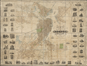
Map of part of Boston, Mass
262.
Map of public transportation routes in Greater Boston served by the Massachusetts Bay Transportation Authority comprising 64...
263.
[Map of Scollay Square and vicinity]
264.
Map of the Boston Elevated Ry. 1915
265.
Map of the Boston Elevated Ry. 1927
266.
Map of the central business district city of Boston showing the location of underground conduits
267.
Map of the central business district of Boston
268.
Map of the cities of Boston, Cambridge, Somerville and Chelsea, and the town of Brookline with parts of Newton, Malden and...
269.
Map of the city and vicinity of Boston Massachusetts
270.
Map of the city and vicinity of Boston, Massachusetts
271.
Map of the city of Boston
272.
[Map of the city of Boston]
273.
Map of the city of Boston
274.
Map of the city of Boston : from the recent surveys of the city and dist. surveyors, and from official records and actual surveys
275.
Map of the city of Boston and immediate neighborhood : from original surveys
276.
Map of the city of Boston and its environs
277.
Map of the city of Boston and its environs
278.
Map of the city of Boston and vicinity
279.
Map of the city of Boston and vicinity
280.
Map of the city of Boston and vicinity
‹ Prev
Next ›
1
2
…
10
11
12
13
14
15
16
17
18
…
443
444


![[Map of Scollay Square and vicinity]](https://bpldcassets.blob.core.windows.net/derivatives/images/commonwealth:x059cc25q/image_thumbnail_300.jpg)


![[Map of the city of Boston]](https://bpldcassets.blob.core.windows.net/derivatives/images/commonwealth:x059cc29t/image_thumbnail_300.jpg)