Map of the city of Boston and its environs
Item Information
- Title:
- Map of the city of Boston and its environs
- Description:
-
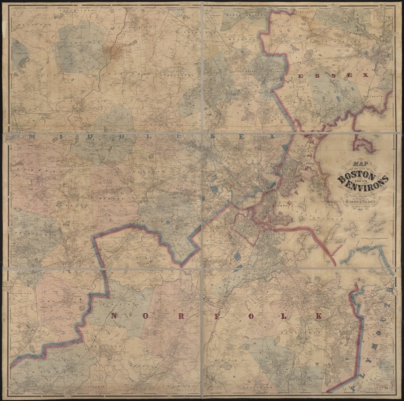
Although no battles were fought in Boston, many people in the greater Boston area were heavily involved in war-related activities. The accompanying map portrays Boston and its neighboring communities at the end of the war. With a population of approximately 180,000, Boston proper was the largest city in New England, and the fifth largest in the United States.
- Creator:
- Walling, Henry Francis, 1825-1888
- Name on Item:
-
executed under the direction of H.F. Walling ; engd. by Worley & Bracher.
- Date:
-
1866
- Format:
-
Maps/Atlases
- Location:
-
Boston Public Library
Norman B. Leventhal Map & Education Center - Collection (local):
-
Norman B. Leventhal Map & Education Center Collection
- Subjects:
-
Boston (Mass.)--Maps
- Places:
-
MassachusettsSuffolk (county)Boston
- Extent:
- 1 map : col. ; 157 x 158 cm., sheets 52 x 79 cm.
- Terms of Use:
-
No known copyright restrictions.
No known restrictions on use.
- Publisher:
-
New York :
Baker & Tilden
- Scale:
-
Scale 1:31,680.
- Language:
-
English
- Notes:
-
Relief shown by hachures.
Cocentric rings show distance from Boston.
"Longitude from State House."
"Entered according to Act of Congress in the year 1866 by Baker & Tilden, in the clerks office of the U.S. District Court for the District of Massachusetts."
- Notes (exhibitions):
-
Exhibited: "Torn in Two: The 150th Anniversary of the Civil War" organized by the Norman B. Leventhal Map Center at the Boston Public Library, 2011.
- Identifier:
-
06_01_000890
- Call #:
-
G3764.B6 1866 .W35
- Barcode:
-
39999058989102


