Toggle navigation
LMEC Home
Exhibitions
Georeferencing
Tools for Teachers
Collections
My Favorites
Sign Up / Log In
Search
Search the map portal
Map Collection
Map Collection
Map Sets
Search
Search
Search for
Search In
All Fields
Creator
Title
Subject
Place
Search All Digital Collections
Advanced Search
8871 Results
My Search
Start Over
More Like
commonwealth:9s161h94c
Remove constraint More Like: commonwealth:9s161h94c
Filter your Search
Place
North and Central America
6,102
United States
5,018
Massachusetts
2,127
Europe
1,396
Suffolk (county)
1,217
Boston
1,190
Canada
449
Asia
438
more
Place
»
Topic
Boston (Mass.)--Maps
752
United States--Maps
282
Real property--Massachusetts--Boston--Maps
195
Massachusetts--Maps
166
City planning--Massachusetts--Boston--Maps
163
Landowners--Massachusetts--Boston--Maps
142
New England--Maps
104
North America--Maps--Early works to 1800
103
more
Topic
»
Date
Date range begin
–
Date range end
Current results range from
1482
to
2023
View distribution
Creator
United States. Hydrographic Office
595
Boston Redevelopment Authority
166
O.H. Bailey & Co
148
Des Barres, Joseph F. W. (Joseph Frederick Wallet), 1722-1824
124
United States. Post Office Dept
120
Ptolemy, 2nd cent
100
Walling, Henry Francis, 1825-1888
94
Geological Survey (U.S.)
87
more
Creator
»
Format
Maps/Atlases
8,811
Manuscripts
215
Prints
56
Books
36
Objects/Artifacts
10
Drawings/Illustrations
8
Posters
5
Georeferenced
Yes
885
No
7,986
Collection
Norman B. Leventhal Map & Education Center Collection
8,723
Boston and New England Maps
2,367
Urban Maps
2,151
Maritime Charts and Atlases
1,083
American Revolutionary War-Era Maps
638
Boston Redevelopment Authority Collection
201
Mapping Boston Collection
20
Massachusetts Real Estate Atlases
12
more
Collection
»
Available to use
No known restrictions
8,674
Creative Commons license
70
Search Constraints
Sort by relevance
relevance
title
date (asc)
date (desc)
Number of results to display per page
20 per page
10
per page
20
per page
50
per page
100
per page
View results as:
grid view
map view
Search Results
3501.
The island of Jamaica, divided into its principal parishes, with the roads &c
3502.
Island of Luzon : from the latest official sources
3503.
Island of Moala, Feejee Group ; Island of Totoia, Feejee Group ; Island of Matuku, Feejee Group
3504.
Island of Ovolau, Feejee Group
3505.
Island of Savaii, Samoan Group
3506.
Island of Savaii, Samoan Group
3507.
The island of St. Christophers, alias St. Kitts
3508.
The island of St. Eustatius corruptly St. Eustatia
3509.
[Island of St. Peters]
3510.
Island of Upolu, Samoan Group
3511.
Island of Yendua, Feejee Group ; Nucumurry Harbour, west end of Vanua Levu ; Wailea Bay, north side of Vanua Levu
3512.
Island of Yendua, Feejee Group ; Nucumurry Harbour, west end of Vanua Levu ; Wailea Bay, north side of Vanua Levu
3513.
Islands in the North Pacific Ocean : from surveys by the U.S.S. "Portsmouth," Commander J.S. Skerrett, in 1874 ; (Fanning...
3514.
Islands of Manua, Ofoo & Oloosinga, Samoan Group ; Island of Tutuila, Samoan Group
3515.
Islands of Manua, Ofoo & Oloosinga, Samoan Group ; Island of Tutuila, Samoan Group
3516.
L'Isle de France et lieux circövoysins
3517.
Isle de la Guadeloupe
3518.
L'isle de la Martinique : scituée a 14 degrez 30 minutes de latitude septentrionale
3519.
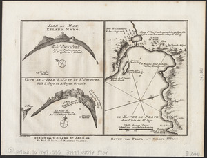
Isle de May ; Veue de l'isle de S. Jago ou St. Jacques, Ville S. Jago ou Ribeyro Grande ; Le havre de Praya dans l'isle de St....
3520.
The isle of California : New Mexico : Louisiane : The river Misisipi, and the lakes of Canada
‹ Prev
Next ›
1
2
…
172
173
174
175
176
177
178
179
180
…
443
444


![[Island of St. Peters]](https://bpldcassets.blob.core.windows.net/derivatives/images/commonwealth:cj82m507n/image_thumbnail_300.jpg)