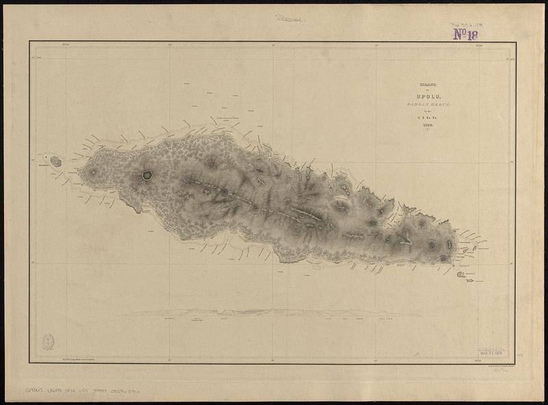
Island of Upolu, Samoan Group
Item Information
- Title:
- Island of Upolu, Samoan Group
- Engraver:
- Knight, J. (Engraver)
- Surveyor:
- Wilkes, Charles, 1798-1877
- Cartographer:
- United States Exploring Expedition (1838-1842)
- Name on Item:
-
by the U.S. Ex. Ex., 1839 ; engraved by J. Knight
- Date:
-
[1840–1849]
- Format:
-
Maps/Atlases
- Genre:
-
Nautical charts
- Location:
-
Boston Public Library
Norman B. Leventhal Map & Education Center - Collection (local):
-
Norman B. Leventhal Map & Education Center Collection
- Subjects:
-
Upolu (Samoa)--Maps
Nautical charts--Samoa--Upolu
United States Exploring Expedition (1838-1842)
- Places:
-
SamoaUpolu (island)
- Extent:
- 1 map ; 38 x 58 cm
- Terms of Use:
-
No known copyright restrictions.
No known restrictions on use.
- Scale:
-
Scale approximately 1:150,000
- Language:
-
English
- Table of Contents:
-
Harbour of Sanaapu, island of Upolu
Harbour of Falifa, island of Upolu
- Notes:
-
Relief shown by hachures. Depths shown by soundings and pictorially.
Includes coastal profile of the island from the north.
Published in Narrative of the United States Exploring Expedition : during the years 1838, 1839, 1840, 1841, 1842.
- Notes (date):
-
This date is inferred.
- Identifier:
-
06_01_017644
- Call #:
-
G9567.U6P5 1840 .U55
- Barcode:
-
39999085960910


