Toggle navigation
LMEC Home
Exhibitions
Georeferencing
Tools for Teachers
Collections
My Favorites
Sign Up / Log In
Search
Search the map portal
Map Collection
Map Collection
Map Sets
Search
Search
Search for
Search In
All Fields
Creator
Title
Subject
Place
Search All Digital Collections
Advanced Search
8718 Results
My Search
Start Over
More Like
commonwealth:9s161f59c
Remove constraint More Like: commonwealth:9s161f59c
Filter your Search
Place
North and Central America
5,949
United States
4,867
Massachusetts
2,083
Europe
1,396
Suffolk (county)
1,069
Boston
1,042
Canada
449
Asia
438
more
Place
»
Topic
Boston (Mass.)--Maps
589
United States--Maps
282
Real property--Massachusetts--Boston--Maps
175
Massachusetts--Maps
162
Landowners--Massachusetts--Boston--Maps
133
North America--Maps--Early works to 1800
103
New England--Maps
102
City planning--Massachusetts--Boston--Maps
88
more
Topic
»
Date
Date range begin
–
Date range end
Current results range from
1482
to
2023
View distribution
Creator
United States. Hydrographic Office
595
O.H. Bailey & Co
148
Des Barres, Joseph F. W. (Joseph Frederick Wallet), 1722-1824
123
United States. Post Office Dept
120
Ptolemy, 2nd cent
100
Walling, Henry Francis, 1825-1888
94
Boston Redevelopment Authority
90
Geological Survey (U.S.)
86
more
Creator
»
Format
Maps/Atlases
8,658
Manuscripts
215
Prints
56
Books
36
Objects/Artifacts
10
Drawings/Illustrations
8
Posters
5
Georeferenced
Yes
869
No
7,849
Collection
Norman B. Leventhal Map & Education Center Collection
8,693
Boston and New England Maps
2,257
Urban Maps
2,047
Maritime Charts and Atlases
1,083
American Revolutionary War-Era Maps
615
Boston Redevelopment Authority Collection
112
Available to use
No known restrictions
8,576
Creative Commons license
47
Search Constraints
Sort by relevance
relevance
title
date (asc)
date (desc)
Number of results to display per page
20 per page
10
per page
20
per page
50
per page
100
per page
View results as:
grid view
map view
Search Results
1.
Map of Arnold Arboretum showing location of the trees and shrubs
2.
Plan of the Arnold Arboretum Jamaica Plain Mass
3.
Jamaica Pond master plan
4.
Olmsted Park master plan
5.
Chart of Jamaica Pond and plan of surroundings
6.
Proposition as to a public ground to include the Harvard Arboretum
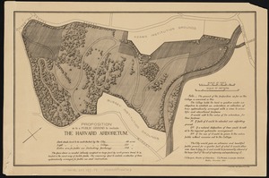
7.
Back Bay Fens master plan
8.
Back Bay park
9.
Back Bay park
10.
City of Boston plan of Columbia Road, showing connection with Franklin Park and Marine Park : under chapter 394 acts of 1897
11.
Gentlemen's driving map showing the park system of Boston
12.
James Hayes Park
13.
Location of public open spaces
14.
Map of Boston and of a part of its suburbs : showing public recreation grounds, burial grounds and certain other public...
15.
Map of Boston and the country adjacent, showing rural parks
16.
Map of Boston and the country adjacent, showing rural parks
17.
Map of Boston Common : with surrounding streets & adjacent parts of Beacon Hill
18.
Map of New York and vicinity
19.
Map of the Boston Metropolitan District showing park reservations and holdings of the Metropolitan District Commission and...
20.
Map of the metropolitan district of Boston, Massachusetts : showing local public reservations and holdings of the Metropolitan...
‹ Prev
Next ›
1
2
3
4
5
…
435
436