Toggle navigation
LMEC Home
Exhibitions
Georeferencing
Tools for Teachers
Collections
My Favorites
Sign Up / Log In
Search
Search the map portal
Map Collection
Map Collection
Map Sets
Search
Search
Search for
Search In
All Fields
Creator
Title
Subject
Place
Search All Digital Collections
Advanced Search
8651 Results
My Search
Start Over
More Like
commonwealth:9s161b95m
Remove constraint More Like: commonwealth:9s161b95m
Filter your Search
Place
North and Central America
5,886
United States
4,805
Massachusetts
2,068
Europe
1,392
Suffolk (county)
1,041
Boston
1,014
Canada
449
Asia
436
more
Place
»
Topic
Boston (Mass.)--Maps
582
United States--Maps
279
Real property--Massachusetts--Boston--Maps
175
Massachusetts--Maps
161
Landowners--Massachusetts--Boston--Maps
133
North America--Maps--Early works to 1800
103
New England--Maps
101
Europe--Maps
79
more
Topic
»
Date
Date range begin
–
Date range end
Current results range from
1482
to
2023
View distribution
Creator
United States. Hydrographic Office
595
O.H. Bailey & Co
148
Des Barres, Joseph F. W. (Joseph Frederick Wallet), 1722-1824
123
United States. Post Office Dept
120
Ptolemy, 2nd cent
100
Walling, Henry Francis, 1825-1888
94
Geological Survey (U.S.)
86
Jefferys, Thomas, -1771
85
more
Creator
»
Format
Maps/Atlases
8,591
Manuscripts
215
Prints
56
Books
36
Objects/Artifacts
10
Drawings/Illustrations
8
Posters
5
Georeferenced
Yes
868
No
7,783
Collection
Norman B. Leventhal Map & Education Center Collection
8,646
Boston and New England Maps
2,221
Urban Maps
1,992
Maritime Charts and Atlases
1,083
American Revolutionary War-Era Maps
615
Boston Redevelopment Authority Collection
87
MacLean Collection Map Library
5
Available to use
No known restrictions
8,504
Creative Commons license
47
Search Constraints
Sort by relevance
relevance
title
date (asc)
date (desc)
Number of results to display per page
20 per page
10
per page
20
per page
50
per page
100
per page
View results as:
grid view
map view
Search Results
1.
Agricultural areas of China
2.
Asia, Japan and Korea with the surrounding seas and the adjacent coastal region of China : from the latest information
3.
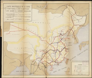
Carte industrielle de la Chine : contenant les lignes ferrées & lignes télégraphiques construites, concédées & probables,...
4.
Chart of the coast of China and of the Japan islands : including the Marianes and part of the Philippines
5.
China : waterways and stage routes
6.
China
7.
China : sheet IV south coast from Chauan Bay to Port Matheson including the Pescadore Islands
8.
China : sheet V eastern coast from Port Matheson to Ragged Point
9.
China : sheet VIII eastern coast Hieshan Isles to the Yang-Tse-Kiang including the Chusan Islands
10.
China
11.
China
12.
China
13.
China
14.
China, divided into it's great provinces according to the best authorities
15.
China east coast population density
16.
China, military regions
17.
China's situation in the world
18.
Clothing recommendations for travel in China
19.
Map of China : compiled from original surveys & sketches
20.
Map of China, Burma, Siam, Annam &c
‹ Prev
Next ›
1
2
3
4
5
…
432
433