Toggle navigation
LMEC Home
Exhibitions
Georeferencing
Tools for Teachers
Collections
My Favorites
Sign Up / Log In
Search
Search the map portal
Map Collection
Map Collection
Map Sets
Search
Search
Search for
Search In
All Fields
Creator
Title
Subject
Place
Search All Digital Collections
Advanced Search
8246 Results
My Search
Start Over
More Like
commonwealth:9g54xm78m
Remove constraint More Like: commonwealth:9g54xm78m
Filter your Search
Place
North and Central America
4,995
United States
3,827
Suffolk (county)
1,105
Boston
1,078
Europe
963
Canada
427
France
269
Massachusetts
265
more
Place
»
Topic
Boston (Mass.)--Maps
594
United States--Maps
270
Real property--Massachusetts--Boston--Maps
252
Landowners--Massachusetts--Boston--Maps
169
Massachusetts--Maps
160
City planning--Massachusetts--Boston--Maps
105
North America--Maps--Early works to 1800
103
New England--Maps
99
more
Topic
»
Date
Date range begin
–
Date range end
Current results range from
1482
to
2023
View distribution
Creator
United States. Hydrographic Office
357
O.H. Bailey & Co
148
Des Barres, Joseph F. W. (Joseph Frederick Wallet), 1722-1824
123
United States. Post Office Dept
120
Boston Redevelopment Authority
109
Ptolemy, 2nd cent
100
Walling, Henry Francis, 1825-1888
94
Bromley, George Washington
89
more
Creator
»
Format
Maps/Atlases
8,187
Manuscripts
215
Prints
51
Books
36
Objects/Artifacts
10
Drawings/Illustrations
8
Posters
4
Georeferenced
Yes
869
No
7,377
Collection
Norman B. Leventhal Map Center Collection
8,163
Boston and New England Maps
2,228
Urban Maps
1,969
Maritime Charts and Atlases
750
American Revolutionary War-Era Maps
616
Boston Redevelopment Authority Collection
130
Massachusetts Real Estate Atlases
39
Available to use
No known restrictions
8,066
Creative Commons license
46
Search Constraints
Sort by relevance
relevance
title
date (asc)
date (desc)
Number of results to display per page
100 per page
10
per page
20
per page
50
per page
100
per page
View results as:
grid view
map view
Search Results
1.
Copies of plans of various parts of Brookline and Roxbury
2.
Atlas of the town of Brookline 1969
3.
Atlas of the town of Brookline 1972
4.
Atlas of the town of Brookline, Massachusetts : from actual surveys & official records
5.
Atlas of the town of Brookline, Massachusetts : from official records, private plans and actual surveys
6.
Atlas of the town of Brookline, Norfolk County, Massachusetts : from actual surveys and official plans
7.
Atlas of the town of Brookline, Norfolk County, Massachusetts : from actual surveys and official plans
8.
Atlas of the town of Brookline, Norfolk County, Massachusetts : from actual surveys and official plans
9.
Atlas of the town of Brookline, Norfolk County, Massachusetts : from actual surveys and official plans
10.
Atlas of the town of Brookline, Norfolk County, Massachusetts : from actual surveys and official plans
11.
Atlas of the town of Brookline, Norfolk County, Massachusetts : from actual surveys and official plans
12.
Atlas of the town of Brookline, Norfolk County, Massachusetts : from actual surveys and official plans
13.
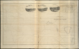
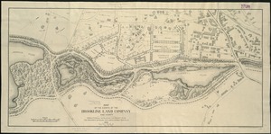
The estate of the Brookline Land Company : June 20, 1860
14.
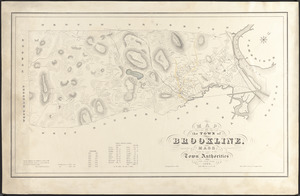
Map of the town of Brookline, Mass. : made by order of the town authorities from actual survey
15.
Plan of lands owned by The Aspinwall Land Company in Brookline : July 1886
16.
Town of Brookline, Mass. assessors' plans 1930
17.
Town of Brookline Mass. Assessors' plans 1943
18.
Town of Brookline, Mass. assessors' plans 1944
19.
Atlas of the town of Brookline, Norfolk County, Massachusetts
20.
Atlas of the town of Brookline, Norfolk County, Massachusetts
21.
Atlas of the town of Brookline, Norfolk County, Massachusetts
22.
Atlas of the town of Brookline, Norfolk County, Massachusetts
23.
Atlas of Dorchester, West Roxbury and Brighton, city of Boston
24.
Atlas of Suffolk, county, vol. 7th, late town of Brighton, now ward 19 of Boston, Massachusetts : from actual survey & official...
25.
Atlas of the city of Boston : Brighton : from actual surveys and official plans
26.
Atlas of the city of Boston : Charlestown and Brighton, volume six : from actual surveys and official records
27.
Atlas of the city of Boston : volume 7: Brighton : from actual surveys and official plans
28.
Atlas of the city of Boston : ward 25, Brighton : from actual surveys and official plans
29.
Atlas of the city of Boston : wards 25 & 26, Brighton : from actual surveys and official plans
30.
Atlas of the city of Boston, volume seven, Brighton, Mass. : from actual surveys and official plans
31.
Plan of 82 building lots, in the town of Brighton, comprising 48 acres of the Parkman Farm next the estate of Saml. Bigelow...
32.
Atlas of Dorchester, West Roxbury, and Brighton, City of Boston
33.
Atlas of the city of Boston : volume 7, Brighton
34.
Atlas of the city of Boston : ward 25 Brighton
35.
Atlas of the city of Boston : wards 25 and 26, Brighton
36.
Atlas of the county of Suffolk, Massachusetts, vol. 7 : late town of Brighton, now ward 19 of Boston, Massachusetts
37.
Map of Brookline and vicinity
38.
Map of the estate of the Brookline Land Company and vicinity : showing especially the relation of this property to the park...
39.
Plan of land owned by the Aspinwall Land Company on Aspinwall Hill in Brookline, Mass
40.
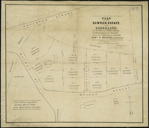
Plan of the Sumner Estate in Brookline : to be sold at public auction, on the premises on Saturday June 1st, 1850, at 3 o'clock...
41.
Atlas of the city of Boston : Boston proper : from actual surveys and official plans
42.
Atlas of the city of Boston : Boston proper and Back Bay : from actual surveys and official plans
43.
Atlas of the city of Boston : Boston proper and Back Bay : from actual surveys and official plans
44.
Atlas of the city of Boston : Boston proper and Back Bay : from actual surveys and official plans
45.
Atlas of the city of Boston : Boston proper and Back Bay : from actual surveys and official plans
46.
Atlas of the city of Boston : Boston proper and Back Bay : from actual surveys and official plans
47.
Atlas of the city of Boston : Boston proper and Back Bay : from actual surveys and official plans
48.
Atlas of the city of Boston : Boston proper and Back Bay : from actual surveys and official plans
49.
Atlas of the city of Boston : Boston proper and Roxbury : from actual surveys and official plans
50.
Atlas of the city of Boston : Charlestown : from actual surveys and official plans
51.
Atlas of the city of Boston : Charlestown and East Boston : from actual surveys and official plans
52.
Atlas of the city of Boston : Charlestown and East Boston : from actual surveys and official plans
53.
Atlas of the city of Boston : Charlestown, Mass. : volume ten : from actual surveys and official plans
54.
Atlas of the city of Boston : city proper : volume 1 : from actual surveys and official records
55.
Atlas of the city of Boston : city proper and Roxbury : from actual surveys and official plans
56.
Atlas of the city of Boston : city proper, volume one : from actual surveys and official plans
57.
Atlas of the city of Boston : city proper, volume two : from actual surveys and official plans
58.
Atlas of the city of Boston : Dorchester : from actual surveys and official plans
59.
Atlas of the city of Boston : Dorchester : from actual surveys and official plans
60.
Atlas of the city of Boston : Dorchester : from actual surveys and official plans
61.
Atlas of the city of Boston : Dorchester : volume three : from actual surveys and official records
62.
Atlas of the city of Boston : Dorchester, Mass., vol. 5 : from actual surveys and official plans
63.
Atlas of the city of Boston : Dorchester, Mass., vol. 5 : from actual surveys and official plans
64.
Atlas of the city of Boston : Dorchester, Mass., vol. 5 : from actual surveys and official plans
65.
Atlas of the city of Boston : East Boston : from actual surveys and official plans
66.
Atlas of the city of Boston : East Boston, Mass. : volume nine : from actual surveys and official plans
67.
Atlas of the city of Boston : Roxbury : from actual surveys and official plans
68.
Atlas of the city of Boston : Roxbury : from actual surveys and official plans
69.
Atlas of the city of Boston : Roxbury : from actual surveys and official plans
70.
Atlas of the city of Boston : Roxbury : from actual surveys and official plans
71.
Atlas of the city of Boston : Roxbury : volume two : from actual surveys and official records
72.
Atlas of the city of Boston : Roxbury, Mass. : volume four : from actual surveys and official records
73.
Atlas of the city of Boston : Roxbury, Mass. : volume three : from actual surveys and official records
74.
Atlas of the city of Boston : South & East Boston : volume four
75.
Atlas of the city of Boston : South Boston : from actual surveys and official plans
76.
Atlas of the city of Boston : South Boston : from actual surveys and official plans
77.
Atlas of the city of Boston : South Boston : from actual surveys and official plans
78.
Atlas of the city of Boston : volume 6 : West Roxbury : from actual surveys and official plans
79.
Atlas of the city of Boston : volume 6 : West Roxbury : from actual surveys and official plans
80.
Atlas of the city of Boston : ward 26, Hyde Park : from actual surveys and official plans
81.
Atlas of the city of Boston : West Roxbury : from actual surveys and official plans
82.
Atlas of the city of Boston : West Roxbury : from actual surveys and official plans
83.
Atlas of the city of Boston : West Roxbury : volume five : from actual surveys and official records
84.
Atlas of the city of Boston, volume eight, South Boston, Mass. : from actual surveys and official plans
85.
Atlas of the city of Boston, volume five, Dorchester Mass. : from actual surveys and official plans
86.
Atlas of the city of Boston, West Roxbury, Mass., volume six : from actual surveys and official plans
87.
Atlas of the city of Medford, Middlesex County, Mass. ; Atlas of the town of Hyde Park, Norfolk County, Mass. ; Atlas of the...
88.
Atlas of the county of Suffolk, Massachusetts : vol. 1st including Boston proper : from actual surveys and official records
89.
Atlas of the county of Suffolk, Massachusetts : vol. 2nd late city of Roxbury, now wards 13-14 and 15, city of Boston
90.
Atlas of the county of Suffolk, Massachusetts : vol. 3rd including Boston and Dorchester : from actual surveys and official...
91.
Atlas of the county of Suffolk, Massachusetts : vol. 4th including East Boston, city of Chelsea, Revere and Winthrop : from...
92.
Atlas of the county of Suffolk, Massachusetts : vol. 5th, West Roxbury, now ward 17, Boston : from actual survey & official...
93.
Atlas of the county of Suffolk, Massachusetts : vol. 6th including the late city of Charlestown, now wards 20,21 and 22, city...
94.
Boylston Street : Fenway to Massachusetts Avenue
95.
Campus High School urban renewal area Mass. r-129 : property map
96.
City atlas of Boston, Massachusetts : complete in one volume : from official records, private plans and actual surveys
97.
East Boston flood risk
98.
Plan of an estate belonging to the City of Boston to be sold by public auction on Wednesday, Sept. 14th, 1881 ... : per order...
99.
Plan of building lots on Phillips Place, Tremont & Somerset Streets
100.
Plan of building lots on Phillips Place, Tremont & Somerset Streets
‹ Prev
Next ›
1
2
3
4
5
…
82
83