Toggle navigation
LMEC Home
Exhibitions
Georeferencing
Tools for Teachers
Collections
My Favorites
Sign Up / Log In
Search
Search the map portal
Map Collection
Map Collection
Map Sets
Search
Search
Search for
Search In
All Fields
Creator
Title
Subject
Place
Search All Digital Collections
Advanced Search
1217 Results
My Search
Start Over
More Like
commonwealth:7h14cx71c
Remove constraint More Like: commonwealth:7h14cx71c
Filter your Search
Place
North and Central America
1,213
United States
1,208
Suffolk (county)
1,193
Boston
1,192
Massachusetts
858
Roxbury
82
South End
60
Charlestown
50
more
Place
»
Topic
Boston (Mass.)--Maps
752
City planning--Massachusetts--Boston--Maps
418
Real property--Massachusetts--Boston--Maps
253
Urban renewal--Massachusetts--Boston--Maps
253
Landowners--Massachusetts--Boston--Maps
160
Buildings--Massachusetts--Boston--Maps
120
Land use--Massachusetts--Boston--Maps
102
Roxbury (Boston, Mass.)--Maps
81
more
Topic
»
Date
Date range begin
–
Date range end
Current results range from
1743
to
2023
View distribution
Creator
Boston Redevelopment Authority
389
Bromley, George Washington
69
Bromley, Walter Scott
68
G.W. Bromley & Co.
46
Geo. H. Walker & Co
27
Boynton, George W., d. 1884
21
Sampson, Davenport & Co
21
Sampson, Murdock & Co
20
more
Creator
»
Format
Maps/Atlases
1,216
Manuscripts
10
Drawings/Illustrations
3
Prints
1
Georeferenced
Yes
104
No
1,113
Collection
Boston and New England Maps
1,010
Urban Maps
910
Norman B. Leventhal Map & Education Center Collection
770
Boston Redevelopment Authority Collection
450
Massachusetts Real Estate Atlases
38
American Revolutionary War-Era Maps
26
Mapping Boston Collection
20
William L. Clements Library Collection
10
more
Collection
»
Available to use
No known restrictions
1,121
Creative Commons license
36
Search Constraints
Sort by relevance
relevance
title
date (asc)
date (desc)
Number of results to display per page
20 per page
10
per page
20
per page
50
per page
100
per page
View results as:
grid view
map view
Search Results
341.
Long Wharf DEM/BRA master plan : master plan scheme
342.
Long Wharf DEM/BRA master plan : proposed dredging scheme
343.
Longwood Medical Area
344.
Map of Boston naval shipyard, Boston, Mass. showing conditions on Jan. 1, 1966
345.
Mattapan project : building deficiencies
346.
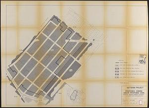
Mattapan project : proposed zoning under proposed code
347.
Mattapan project : right-of-way adjustment plan
348.
Mattapan project : land use and disposition plan
349.
Mattapan project : existing zoning under proposed code
350.
Mattapan project : existing land use
351.
Mattapan project : proposed zoning
352.
Mattapan project : existing zoning
353.
McConnell Park
354.
McConnell Park Dorchester : site plan
355.
Metropolitan District Commission combined sewer overflow project Dorchester Bay area
356.
North Harvard project area : location map
357.
North Harvard project area : land use of project area
358.
North Harvard project area : conditions in project area
359.
Parcel 10 : Sears Crescent, Government Center
360.
Park Plaza building study stage environmental impact analysis : environmental base : sanitary sewerage and storm drainage
‹ Prev
Next ›
1
2
…
14
15
16
17
18
19
20
21
22
…
60
61