Toggle navigation
LMEC Home
Exhibitions
Georeferencing
Tools for Teachers
Collections
My Favorites
Sign Up / Log In
Search
Search the map portal
Map Collection
Map Collection
Map Sets
Search
Search
Search for
Search In
All Fields
Creator
Title
Subject
Place
Search All Digital Collections
Advanced Search
491 Results
My Search
Start Over
More Like
commonwealth:7h14cx26j
Remove constraint More Like: commonwealth:7h14cx26j
Filter your Search
Place
North and Central America
488
United States
485
Suffolk (county)
478
Boston
477
Massachusetts
175
Roxbury
50
South End
49
South Boston
42
more
Place
»
Topic
City planning--Massachusetts--Boston--Maps
418
Urban renewal--Massachusetts--Boston--Maps
253
Boston (Mass.)--Maps
128
Land use--Massachusetts--Boston--Maps
101
Buildings--Massachusetts--Boston--Maps
83
Real property--Massachusetts--Boston--Maps
63
Roxbury (Boston, Mass.)--Maps
46
South Boston (Boston, Mass.)--Maps
44
more
Topic
»
Date
Date range begin
–
Date range end
Current results range from
1835
to
2003
View distribution
Creator
Boston Redevelopment Authority
368
Downtown Waterfront Corporation
10
Victor Gruen Associates
10
Boston (Mass.). Parks and Recreation Department
8
Bromley, George Washington
7
Bromley, Walter Scott
7
Boston (Mass.). Department of Parks
6
Sasaki Associates
6
more
Creator
»
Format
Maps/Atlases
490
Drawings/Illustrations
3
Manuscripts
1
Prints
1
Georeferenced
Yes
6
No
485
Collection
Boston and New England Maps
479
Urban Maps
462
Boston Redevelopment Authority Collection
438
Norman B. Leventhal Map & Education Center Collection
102
Massachusetts Real Estate Atlases
3
Applied Geographics, Inc. Records
1
Mapping Boston Collection
1
Available to use
No known restrictions
486
Creative Commons license
1
Search Constraints
Sort by relevance
relevance
title
date (asc)
date (desc)
Number of results to display per page
20 per page
10
per page
20
per page
50
per page
100
per page
View results as:
grid view
map view
Search Results
261.
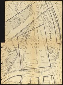
Plan for construction of a new city hall in Boston
262.
Plan of land of the Boston Terminal Corporation Boston, Mass.
263.
Property map, South Cove urban renewal area R-92
264.
Property map, South Cove urban renewal area R-92
265.
Proposed land use plan and circulation system
266.
Recommended geometrics plan : Back Bay study area
267.
Relationship of TNEMC development plan area to New York streets land assembly and redevelopment project
268.
Report on improvements to the Boston main drainage system
269.
Report on the alternate master highway plan for the Boston metropolitan area
270.
Roxbury - N. Dorchester G.N.R.P. : preliminary land use plan
271.
Roxbury - N. Dorchester G.N.R.P. : preliminary circulation plan
272.
Roxbury-N. Dorchester G.N.R.P. r-50 : existing & proposed community facilities
273.
Roxbury-N. Dorchester G.N.R.P. r-50 : existing circulation
274.
Roxbury-N. Dorchester G.N.R.P. r-50 : proposed treatment and title I projects
275.
Roxbury-N. Dorchester G.N.R.P. r-50 : proposed circulation
276.
Roxbury-N. Dorchester G.N.R.P. r-50 : proposed land use
277.
Roxbury-N. Dorchester G.N.R.P. r-50 : existing building conditions
278.
Roxbury-N. Dorchester G.N.R.P. r-50 : existing population density
279.
Ruggles Center : existing condition plan
280.
Ruggles Center : site area diagram
‹ Prev
Next ›
1
2
…
10
11
12
13
14
15
16
17
18
…
24
25