Roxbury - N. Dorchester G.N.R.P. : preliminary circulation plan
Item Information
- Title:
- Roxbury - N. Dorchester G.N.R.P. : preliminary circulation plan
- Cartographer:
- Boston Redevelopment Authority
- Name on Item:
-
drawn by E.D.L. ; checked by A.L.S.
- Date:
-
December 9, 1962
- Format:
-
Maps/Atlases
- Location:
-
Boston Public Library
Central Library in Copley Square - Collection (local):
-
Boston Public Library Collection
- Subjects:
-
Roxbury (Boston, Mass.)--Maps
City planning--Massachusetts--Boston--Maps
Express highways--Massachusetts--Boston--Maps
Streets--Massachusetts--Boston--Maps
Urban renewal--Massachusetts--Boston--Maps
- Places:
-
Suffolk (county)BostonRoxbury
- Extent:
- 1 map ; 112 x 82 cm
- Terms of Use:
-
No known copyright restrictions.
No known restrictions on use.
- Publisher:
-
[Boston] :
Boston Redevelopment Authority
- Language:
-
English
- Catalog Record:
-
Accompanying text
- Notes:
-
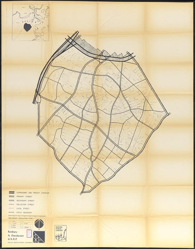
Part of a set of 11 maps (Boston Public Library lacking map 2 showing proposed land use and map 7 showing existing land use) accompanying a loan/grant application submitted to the US Urban Renewal Administration seeking funds for an urban renewal project in the Washington Park area of Boston's Roxbury neighborhood.
Shows expressway and transit corridor, primary street, secondary street, collector street and local street.
Inset: [Location map].
- Identifier:
-
06_01_017322i
- Call #:
-
BRA/3008 map 11
- Barcode:
-
39999065832477


