Toggle navigation
LMEC Home
Exhibitions
Georeferencing
Tools for Teachers
Collections
My Favorites
Sign Up / Log In
Search
Search the map portal
Map Collection
Map Collection
Map Sets
Search
Search
Search for
Search In
All Fields
Creator
Title
Subject
Place
Search All Digital Collections
Advanced Search
8706 Results
My Search
Start Over
More Like
commonwealth:7h14b522q
Remove constraint More Like: commonwealth:7h14b522q
Filter your Search
Place
North and Central America
5,937
United States
4,852
Massachusetts
2,079
Europe
1,396
Suffolk (county)
1,046
Boston
1,019
Canada
449
Asia
438
more
Place
»
Topic
Boston (Mass.)--Maps
586
United States--Maps
282
Real property--Massachusetts--Boston--Maps
175
Massachusetts--Maps
162
Landowners--Massachusetts--Boston--Maps
133
North America--Maps--Early works to 1800
103
New England--Maps
102
Europe--Maps
79
more
Topic
»
Date
Date range begin
–
Date range end
Current results range from
1482
to
2023
View distribution
Creator
United States. Hydrographic Office
595
O.H. Bailey & Co
148
Des Barres, Joseph F. W. (Joseph Frederick Wallet), 1722-1824
123
United States. Post Office Dept
119
Ptolemy, 2nd cent
100
Walling, Henry Francis, 1825-1888
94
Geological Survey (U.S.)
86
Jefferys, Thomas, -1771
86
more
Creator
»
Format
Maps/Atlases
8,646
Manuscripts
215
Prints
56
Books
36
Objects/Artifacts
10
Drawings/Illustrations
8
Posters
5
Georeferenced
Yes
869
No
7,837
Collection
Norman B. Leventhal Map & Education Center Collection
8,694
Boston and New England Maps
2,233
Urban Maps
2,023
Maritime Charts and Atlases
1,083
American Revolutionary War-Era Maps
628
Boston Redevelopment Authority Collection
87
William L. Clements Library Collection
8
American Antiquarian Society Collection
3
more
Collection
»
Available to use
No known restrictions
8,552
Creative Commons license
47
Search Constraints
Sort by relevance
relevance
title
date (asc)
date (desc)
Number of results to display per page
20 per page
10
per page
20
per page
50
per page
100
per page
View results as:
grid view
map view
Search Results
21.
Delaware, from the best authorities
22.
An historical and literary map of the Old Line State of Maryland : showing forth divers curious and notable facts relating to...
23.
Index chart of natural oyster bars, crab bottoms, clam bars and triangulation stations of Maryland surveyed by Maryland Shell...
24.
Manuscript maps of U.S. states, possibly drawn by a schoolchild
25.
Map of eastern Virginia
26.
Map of eastern Virginia
27.
Map of the country embracing the several routes examined with a view to a national road from Washington to Lake Ontario
28.
Map of Virginia and Maryland, constructed from the latest authorities
29.
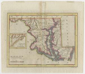
Maryland
30.
The new war map of Virginia, Maryland & Pennsylvania
31.
Official map of the state of Virginia : from actual surveys by order of the executive, 1828 & 1859
32.
Seat of war in Virginia and Maryland
33.
Smith's topographical map of Virginia and Maryland
34.
The state of Maryland, from the best authorities
35.
State of West Virginia and part of Maryland : coal fields and producing districts
36.
A compleat plan of part of the province of Pennsylvania East and West Jersey shewing the transactions of the royal army under...
37.
Carte de la Virginie, : de la Baye Chesapeack, et pays voisins. : Pour servir à l'Histoire générale des voyages. : Tirée...
38.
A draft of the Ohio from an Indian account
39.
A map of the country between Will's Creek & Monongahela River shewing the rout and encampments of the English army, in 1755
40.
Maryland
‹ Prev
Next ›
1
2
3
4
5
6
…
435
436