Toggle navigation
LMEC Home
Exhibitions
Georeferencing
Tools for Teachers
Collections
My Favorites
Sign Up / Log In
Search
Search the map portal
Map Collection
Map Collection
Map Sets
Search
Search
Search for
Search In
All Fields
Creator
Title
Subject
Place
Search All Digital Collections
Advanced Search
8772 Results
My Search
Start Over
More Like
commonwealth:7h14b1499
Remove constraint More Like: commonwealth:7h14b1499
Filter your Search
Place
North and Central America
6,003
United States
4,903
Massachusetts
2,149
Europe
1,396
Suffolk (county)
1,047
Boston
1,020
Canada
450
Asia
438
more
Place
»
Topic
Boston (Mass.)--Maps
590
United States--Maps
282
Massachusetts--Maps
235
Real property--Massachusetts--Boston--Maps
175
Landowners--Massachusetts--Boston--Maps
133
New England--Maps
104
North America--Maps--Early works to 1800
103
Europe--Maps
79
more
Topic
»
Date
Date range begin
–
Date range end
Current results range from
1482
to
2023
View distribution
Creator
United States. Hydrographic Office
595
O.H. Bailey & Co
148
Des Barres, Joseph F. W. (Joseph Frederick Wallet), 1722-1824
123
United States. Post Office Dept
120
Ptolemy, 2nd cent
100
Walling, Henry Francis, 1825-1888
95
Geological Survey (U.S.)
92
Jefferys, Thomas, -1771
85
more
Creator
»
Format
Maps/Atlases
8,711
Manuscripts
217
Prints
56
Books
36
Objects/Artifacts
10
Drawings/Illustrations
8
Posters
5
Ephemera
1
Georeferenced
Yes
878
No
7,894
Collection
Norman B. Leventhal Map & Education Center Collection
8,737
Boston and New England Maps
2,279
Urban Maps
2,024
Maritime Charts and Atlases
1,083
American Revolutionary War-Era Maps
639
Boston Redevelopment Authority Collection
90
Applied Geographics, Inc. Records
20
David Judkins Weaver Papers
18
more
Collection
»
Available to use
No known restrictions
8,595
Creative Commons license
51
Search Constraints
Sort by relevance
relevance
title
date (asc)
date (desc)
Number of results to display per page
20 per page
10
per page
20
per page
50
per page
100
per page
View results as:
grid view
map view
Search Results
8001.
[The natural shape of England with the names of rivers, seaports, sands, hills, moors, forrests, and many other remarks which...
8002.
[The south east coast of the island of St. John]
8003.
[The St. Lawrence River from the Chaudiere River to Pointe aux Coques]
8004.
[The World]
8005.
[The World]
8006.
Théatre de la guerre d'orient en 1854
8007.
Theatre de la guerre en Amerique
8008.
Théatre de la guerre en Amerique, avec les Isles Antilles : projetté et assujettie aux observations
8009.
Théatre de la guerre en Amerique, avec les Isles Antilles : projetté et assujettie aux observations
8010.
The theatre of war in North America, with the roads, and tables, of the superficial contents, distances, &ca
8011.
Thermal map of North America, delineating the isothermal zodiac, the isothermal axis of intensity, and its expansions up and...
8012.
These United States : products & industries
8013.
Thirteenth Amendment, January 31, 1865, Vote on passage of resolution submitting
8014.
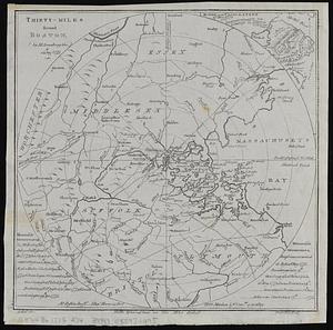
Thirty-miles round Boston
8015.
Thirty-miles round Boston
8016.
This harbour of Boston
8017.
This harbour of Boston
8018.
This map of North America, according to ye newest and most exact observations is most humbly dedicated by your Lordship's most...
8019.
This map of Scotland
8020.
This map of South America, according to the newest and most exact observations
‹ Prev
Next ›
1
2
…
397
398
399
400
401
402
403
404
405
…
438
439

![[The south east coast of the island of St. John]](https://bpldcassets.blob.core.windows.net/derivatives/images/commonwealth:7h149v93n/image_thumbnail_300.jpg)
![[The St. Lawrence River from the Chaudiere River to Pointe aux Coques]](https://bpldcassets.blob.core.windows.net/derivatives/images/commonwealth:7h149v425/image_thumbnail_300.jpg)
![[The World]](https://bpldcassets.blob.core.windows.net/derivatives/images/commonwealth:st74cx537/image_thumbnail_300.jpg)
![[The World]](https://bpldcassets.blob.core.windows.net/derivatives/images/commonwealth:9g54xj67p/image_thumbnail_300.jpg)