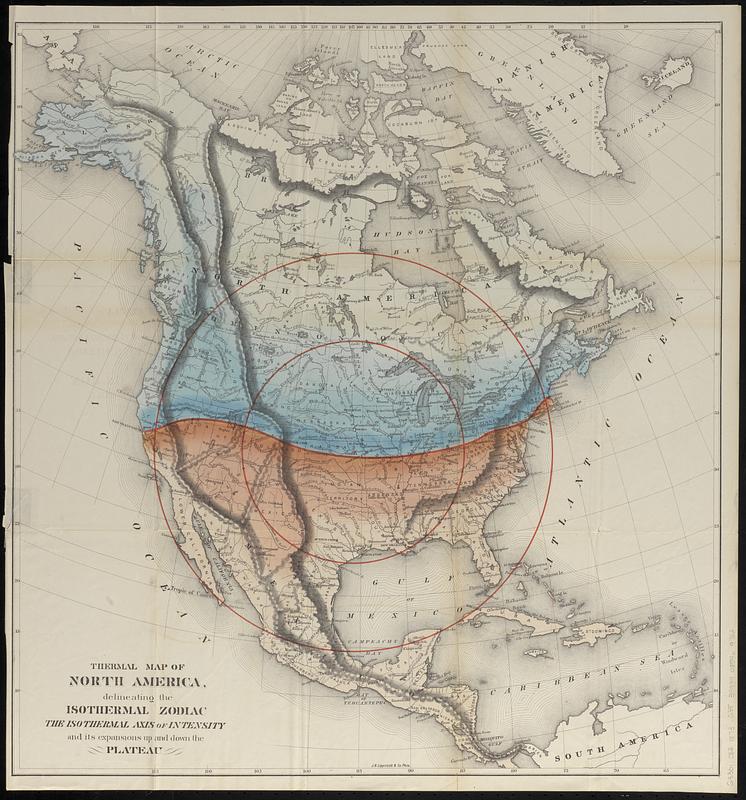
Thermal map of North America, delineating the isothermal zodiac, the isothermal axis of intensity, and its expansions up and down the plateau
Item Information
- Title:
- Thermal map of North America, delineating the isothermal zodiac, the isothermal axis of intensity, and its expansions up and down the plateau
- Cartographer:
- Gilpin, William, 1813-1894
- Publisher:
- J.B. Lippincott & Co.
- Date:
-
[1873]
- Format:
-
Maps/Atlases
- Location:
-
Boston Public Library
Norman B. Leventhal Map & Education Center - Collection (local):
-
Norman B. Leventhal Map & Education Center Collection
- Subjects:
-
Atmospheric temperature--North America--Maps
North America--Maps
- Places:
-
North America (area)
- Extent:
- 1 map : color ; 60 x 57 cm
- Terms of Use:
-
No known copyright restrictions.
No known restrictions on use.
- Publisher:
-
Phila. :
J.B. Lippincott & Co.
- Scale:
-
Scale approximately 1:13,500,000
- Language:
-
English
- Notes:
-
Relief shown by hachures.
Indicates cooler and warmer regions north and south of an isothermal axis around 40°N.
Includes two concentric circles centered on Topeka, Kansas.
Detached from Gilpin's "Mission of the North American people" (Philadelphia : J.B. Lippincott & Co., 1873).
- Notes (date):
-
This date is inferred.
- Identifier:
-
06_01_018777
- Call #:
-
G3301.C82 1873 .G55
- Barcode:
-
39999085969762


