Toggle navigation
LMEC Home
Exhibitions
Georeferencing
Tools for Teachers
Collections
My Favorites
Sign Up / Log In
Search
Search the map portal
Map Collection
Map Collection
Map Sets
Search
Search
Search for
Search In
All Fields
Creator
Title
Subject
Place
Search All Digital Collections
Advanced Search
8719 Results
My Search
Start Over
More Like
commonwealth:7h14b0183
Remove constraint More Like: commonwealth:7h14b0183
Filter your Search
Place
North and Central America
5,950
United States
4,858
Massachusetts
2,079
Europe
1,396
Suffolk (county)
1,046
Boston
1,019
Canada
450
Asia
438
more
Place
»
Topic
Boston (Mass.)--Maps
586
United States--Maps
282
Real property--Massachusetts--Boston--Maps
175
Massachusetts--Maps
162
Landowners--Massachusetts--Boston--Maps
133
North America--Maps--Early works to 1800
105
New England--Maps
102
Europe--Maps
79
more
Topic
»
Date
Date range begin
–
Date range end
Current results range from
1482
to
2023
View distribution
Creator
United States. Hydrographic Office
595
O.H. Bailey & Co
148
Des Barres, Joseph F. W. (Joseph Frederick Wallet), 1722-1824
123
United States. Post Office Dept
120
Ptolemy, 2nd cent
100
Walling, Henry Francis, 1825-1888
94
Jefferys, Thomas, -1771
90
Geological Survey (U.S.)
86
more
Creator
»
Format
Maps/Atlases
8,659
Manuscripts
217
Prints
56
Books
36
Objects/Artifacts
10
Drawings/Illustrations
8
Posters
5
Georeferenced
Yes
871
No
7,848
Collection
Norman B. Leventhal Map & Education Center Collection
8,695
Boston and New England Maps
2,233
Urban Maps
2,023
Maritime Charts and Atlases
1,083
American Revolutionary War-Era Maps
639
Boston Redevelopment Authority Collection
87
MacLean Collection Map Library
7
New York Public Library Collection
5
more
Collection
»
Available to use
No known restrictions
8,554
Creative Commons license
61
Search Constraints
Sort by relevance
relevance
title
date (asc)
date (desc)
Number of results to display per page
20 per page
10
per page
20
per page
50
per page
100
per page
View results as:
grid view
map view
Search Results
2841.
Indians of the U.S.A.
2842.
Indicazione del piu rimarcabile in Napoli e contorni
2843.
Indie interioris civitates decima Asia tabula continet India int. Gangem
2844.
Indie Occidentali
2845.
Indo-Chine, carte de la mission Pavie
2846.
Industrial map of New England
2847.
Infrastructure around Tobin Bridge/US route 1 in Charlestown
2848.
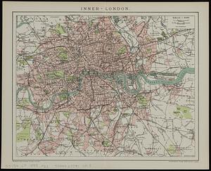
Inner-London
2849.
Innocence abroad
2850.
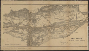
Innsbruck und dessen nächste umgebung
2851.
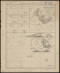
Die inseln des Südl. Indischen Oceans, meist nach Englischen aufnahmen zusammengestellt
2852.
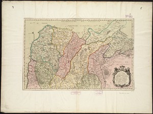
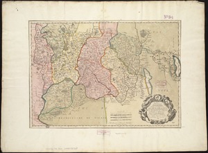
Insubres in Segusianis : partie du dioecese et archevche de Lyon : partie septentrionale de Bresse, Bugey, et Valromey,...
2853.
Insubres in Segusianis : partie du dioecese, et Archevesché de Lyon : partie méridionale de la Bresse du Bugey, et Valromey,...
2854.
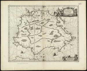
Insula Borneo et occidentalis pars Celebris, cum adjacentibus insulis
2855.
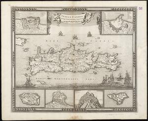
Insula Candia : ejusque fortificatio
2856.
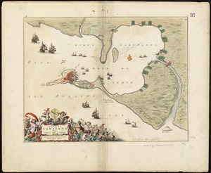
Insula Gaditana, vulgo Isla de Cadiz
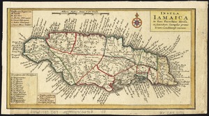
2857.
Insula Iamaica : in suas parochias divisa et secundum exemplar primitivum Londinense excusa
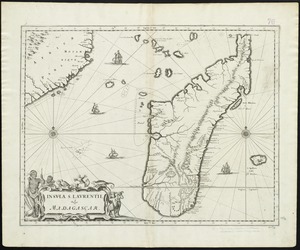
2858.
Insula S. Laurentii, vulgo Madagascar
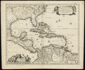
2859.
Insulæ Americanæ in Oceano Septentrionali ac regiones adiacentes : a C. de May usque ad Lineam Æquinoctialem
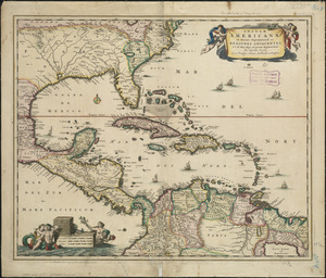
2860.
Insulæ Americanæ in Oceano Septentrionali ac regiones adiacentes : a C. de May usque ad Lineam Æquinoctialem
‹ Prev
Next ›
1
2
…
139
140
141
142
143
144
145
146
147
…
435
436