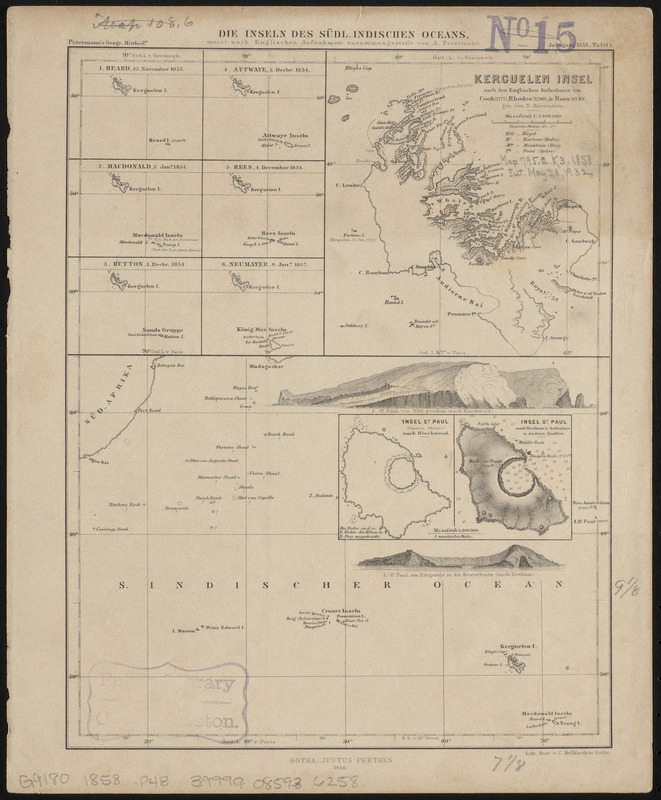
Die inseln des Südl. Indischen Oceans, meist nach Englischen aufnahmen zusammengestellt
Item Information
- Title:
- Die inseln des Südl. Indischen Oceans, meist nach Englischen aufnahmen zusammengestellt
- Cartographer:
- Petermann, A. (August), 1822-1878
- Publisher:
- Justus Perthes (Firm : Gotha, Germany)
- Lithographer:
- Hellfarth, C.
- Name on Item:
-
von A. Petermann
- Date:
-
1858
- Format:
-
Maps/Atlases
- Location:
-
Boston Public Library
Norman B. Leventhal Map & Education Center - Collection (local):
-
Norman B. Leventhal Map & Education Center Collection
- Subjects:
-
Islands of the Indian Ocean--Maps
Indian Ocean--Maps
Kerguelen Islands--Maps
- Places:
-
FranceKerguélen, Îles (area)
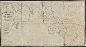
Indian Ocean
- Extent:
- 1 map ; 14 x 18 cm, on sheet 28 x 23 cm
- Terms of Use:
-
No known copyright restrictions.
No known restrictions on use.
- Publisher:
-
Gotha ; Gotha :
Justus Perthes ; Lith. anst. v. C. Hellfarth.
- Scale:
-
Scale approximately 1:26,000,000
- Language:
-
German
- Notes:
-
Relief shown by hachures and spot heights. Depths shown by soundings.
Prime meridians: Paris and Greenwich.
Ancillary maps: 1. Heard, 25 November 1853 -- 2. Macdonald, 3 Janr. 1854 -- 3. Hutton, 1 Decbr. 1854 -- 4. Attwaye, 3 Decbr. 1854 -- 5. Rees, 4 December 1854 -- 6. Neumayer, 9 Janr. 1857 -- Kerguelen Insel nach den Englischen aufnahmen von Cook (1777), Rhodes (1799), & Ross (1840) / gez. von B. Bassenstein.
Insets: Insel St. Paul (umriss skizze) nach Blackwood -- Insel St. Paul nach Denham's aufnahme u. andern quellen.
Includes 2 illustrations of coasts.
"Petermann's geogr. mittheiln."
"Jahrgang 1858, tafel 1."
From Petermann's geographische mitteilungen.
- Identifier:
-
06_01_015394
- Call #:
-
G9180 1858 .P48
- Barcode:
-
39999085936258