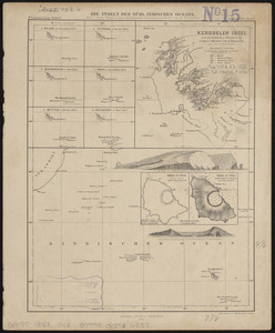
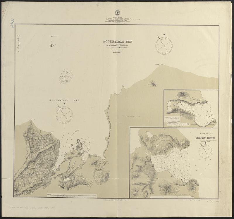
Indian Ocean, harbors of Kerguelen Island : republication of Brit. Admty chart no. 800
Item Information
- Title:
- Indian Ocean, harbors of Kerguelen Island : republication of Brit. Admty chart no. 800
- Issuing body:
- United States. Hydrographic Office
- Date:
-
1874
- Format:
-
Maps/Atlases
- Genre:
-
Nautical charts
- Location:
-
Boston Public Library
Norman B. Leventhal Map & Education Center - Collection (local):
-
Norman B. Leventhal Map & Education Center Collection
- Subjects:
-
Kerguelen Islands--Maps
Harbors--Kerguelen Islands--Maps
Nautical charts--Kerguelen Islands
- Places:
-
FranceKerguélen, Îles (area)
- Extent:
- 3 maps on 1 sheet ; 61 x 72 cm
- Terms of Use:
-
No known copyright restrictions.
No known restrictions on use.
- Publisher:
-
Washington, D.C. :
Hydrographic Office
- Scale:
-
Scale approximately 1:3,800
Scale approximately 1:25,900
Scale approximately 1:37,300
- Language:
-
English
- Table of Contents:
-
Accessible Bay
Christmas Harbor
Accessible Bay, Betsy Cove
- Notes:
-
Relief shown by hachures, form lines and spot heights. Depths shown by soundings.
- Identifier:
-
06_01_017697
- Call #:
-
G9096.P5 svar .U55 no. 602
- Barcode:
-
39999085962098