Toggle navigation
LMEC Home
Exhibitions
Georeferencing
Tools for Teachers
Collections
My Favorites
Sign Up / Log In
Search
Search the map portal
Map Collection
Map Collection
Map Sets
Search
Search
Search for
Search In
All Fields
Creator
Title
Subject
Place
Search All Digital Collections
Advanced Search
8627 Results
My Search
Start Over
More Like
commonwealth:7h14b012f
Remove constraint More Like: commonwealth:7h14b012f
Filter your Search
Place
North and Central America
5,865
United States
4,784
Massachusetts
2,052
Europe
1,359
Suffolk (county)
1,034
Boston
1,007
Canada
453
Asia
422
more
Place
»
Topic
Boston (Mass.)--Maps
577
United States--Maps
273
North America--Maps--Early works to 1800
180
Real property--Massachusetts--Boston--Maps
174
Massachusetts--Maps
160
Landowners--Massachusetts--Boston--Maps
132
New England--Maps
99
Europe--Maps
78
more
Topic
»
Date
Date range begin
–
Date range end
Current results range from
1482
to
2023
View distribution
Creator
United States. Hydrographic Office
594
O.H. Bailey & Co
148
Des Barres, Joseph F. W. (Joseph Frederick Wallet), 1722-1824
123
United States. Post Office Dept
120
Ptolemy, 2nd cent
100
Walling, Henry Francis, 1825-1888
94
Jefferys, Thomas, -1771
90
Geological Survey (U.S.)
86
more
Creator
»
Format
Maps/Atlases
8,568
Manuscripts
217
Prints
56
Books
36
Objects/Artifacts
10
Drawings/Illustrations
8
Posters
4
Georeferenced
Yes
872
No
7,755
Collection
Norman B. Leventhal Map & Education Center Collection
8,558
Boston and New England Maps
2,205
Urban Maps
1,936
Maritime Charts and Atlases
1,081
American Revolutionary War-Era Maps
679
Boston Redevelopment Authority Collection
87
New York Public Library Collection
32
Richard H. Brown Revolutionary War Map Collection at Mount Vernon
18
more
Collection
»
Available to use
No known restrictions
8,411
Creative Commons license
110
Search Constraints
Sort by relevance
relevance
title
date (asc)
date (desc)
Number of results to display per page
20 per page
10
per page
20
per page
50
per page
100
per page
View results as:
grid view
map view
Search Results
7301.
Skeleton map of the territory of the United States west of the Mississippi River : exhibiting the relations existing between...
7302.
Skeleton map showing the rail roads completed and in progress in the United States and their connection as proposed with the...
7303.
Skeleton plan, showing location of the Suffolk & Metropolitan rail road routes in Boston
7304.
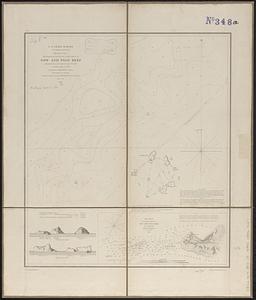
Sketch A no. 5 showing proposed site for a light house on Sow and Pigs Reef
7305.
Sketch map from the Dardanelles to the Bosphorus showing the positions of the British fleet
7306.
Sketch map of Boston and the Public Library system
7307.
Sketch map of Boston and the Public Library system
7308.
Sketch map of Boston and the Public Library system
7309.
Sketch map of New South Wales showing the localities of the principal minerals 1876
7310.
Sketch map of part of Cassiar District : shewing Atlin Gold Fields B.C. ; to accompany report of Minister of Mines Victoria 1898
7311.
Sketch map of the British coast showing the relative positions of Liverpool, Beaumaris, Moelfra Bay & Point Lynas (taken from...
7312.
Sketch of Boston Harbor and Bay
7313.
Sketch of Bunker Hill Battle
7314.
Sketch of Charleston Harbor
7315.
Sketch of Charleston Harbor
7316.
Sketch of Charleston Harbor
7317.
Sketch of Guadalupe Island : west coast of Lower California
7318.
A sketch of part of the Island of New York shewing the operations of His Majesty's troops on the 16 Novr. 1776 which terminated...
7319.
Sketch of Pensacola Navy Yard and Fort Pickens from U.S. coast surveys
7320.
Sketch of sea coast of South Carolina and Georgia from Bull's Bay to Ossabaw Sound
‹ Prev
Next ›
1
2
…
362
363
364
365
366
367
368
369
370
…
431
432