Toggle navigation
LMEC Home
Exhibitions
Georeferencing
Tools for Teachers
Collections
My Favorites
Sign Up / Log In
Search
Search the map portal
Map Collection
Map Collection
Map Sets
Search
Search
Search for
Search In
All Fields
Creator
Title
Subject
Place
Search All Digital Collections
Advanced Search
8608 Results
My Search
Start Over
More Like
commonwealth:7h149z386
Remove constraint More Like: commonwealth:7h149z386
Filter your Search
Place
North and Central America
5,893
United States
4,822
Massachusetts
2,056
Europe
1,359
Suffolk (county)
1,038
Boston
1,011
Canada
462
Asia
422
more
Place
»
Topic
Boston (Mass.)--Maps
580
United States--Maps
320
Real property--Massachusetts--Boston--Maps
175
Massachusetts--Maps
160
Landowners--Massachusetts--Boston--Maps
133
North America--Maps--Early works to 1800
103
New England--Maps
101
Europe--Maps
78
more
Topic
»
Date
Date range begin
–
Date range end
Current results range from
1482
to
2023
View distribution
Creator
United States. Hydrographic Office
594
O.H. Bailey & Co
148
Des Barres, Joseph F. W. (Joseph Frederick Wallet), 1722-1824
123
United States. Post Office Dept
120
Ptolemy, 2nd cent
100
Walling, Henry Francis, 1825-1888
94
Geological Survey (U.S.)
87
Jefferys, Thomas, -1771
85
more
Creator
»
Format
Maps/Atlases
8,549
Manuscripts
215
Prints
56
Books
36
Objects/Artifacts
10
Drawings/Illustrations
8
Posters
4
Georeferenced
Yes
871
No
7,737
Collection
Norman B. Leventhal Map & Education Center Collection
8,571
Boston and New England Maps
2,210
Urban Maps
1,940
Maritime Charts and Atlases
1,081
American Revolutionary War-Era Maps
651
Boston Redevelopment Authority Collection
87
American Antiquarian Society Collection
20
William L. Clements Library Collection
13
more
Collection
»
Available to use
No known restrictions
8,428
Creative Commons license
49
Search Constraints
Sort by relevance
relevance
title
date (asc)
date (desc)
Number of results to display per page
20 per page
10
per page
20
per page
50
per page
100
per page
View results as:
grid view
map view
Search Results
2961.
Illustration of a building at 290 Tremont St. in Boston
2962.
Illustration of the south side of Boylston Street between Clarendon and Berkeley Streets
2963.
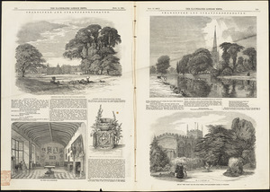
Illustrations of Charlecote Hall, Church of the Holy Trinity, and New Place
2964.
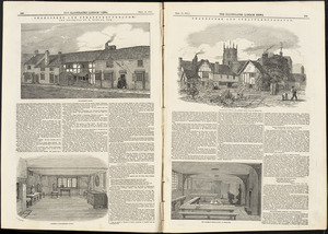
Illustrations of Shakespeare's house and school
2965.
Illustrative site plan : Government Center urban renewal area, Massachusetts R-35
2966.
Illustrative site plan : Washington Park urban renewal area, Massachusetts R-24
2967.
Illustrissimo celsissimoque principi Carolo Emanueli D. G. Sabaudiae Duci, Pedemontii principi etc. hanc accuratam status...
2968.
Illustrissimo Celsissimoque Principii Guiljelmo Henrico D.G. Arausionum Principi Domino suo Clementissimo hanc Comitatus...
2969.
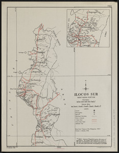
Ilocos Sur : northern portion
2970.
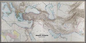
Imperia Persarum et Macedonum in usum scholarum descripta
2971.
Imperial Federation, map of the world showing the extent of the British Empire in 1886
2972.
Imperii Sinarum nova descriptio
2973.
An improved map of Vermont : compiled from the latest authorities
2974.
In notitiam ecclesiasticam Africæ tabula geographica
2975.
L'incendie de Boston : plan montrant les ravages causés par l'incendie (extrait de l'American Register)
2976.
Index chart of natural oyster bars, crab bottoms, clam bars and triangulation stations of Maryland surveyed by Maryland Shell...
2977.
Index diagram of sheets for the International map on the scale of 1:1,000,000
2978.
Index map, city of Manila
2979.
Index map of land near Anacostia River D.C. between district line and Baltimore & Potomac R.R. : from records of the District...
2980.
Index map showing the principal river basins within the state of Massachusetts
‹ Prev
Next ›
1
2
…
145
146
147
148
149
150
151
152
153
…
430
431