Toggle navigation
LMEC Home
Exhibitions
Georeferencing
Tools for Teachers
Collections
My Favorites
Sign Up / Log In
Search
Search the map portal
Map Collection
Map Collection
Map Sets
Search
Search
Search for
Search In
All Fields
Creator
Title
Subject
Place
Search All Digital Collections
Advanced Search
9052 Results
My Search
Start Over
More Like
commonwealth:7d27c9549
Remove constraint More Like: commonwealth:7d27c9549
Filter your Search
Place
North and Central America
6,283
United States
5,201
Massachusetts
2,155
Suffolk (county)
1,403
Europe
1,396
Boston
1,376
Canada
449
Asia
438
more
Place
»
Topic
Boston (Mass.)--Maps
677
City planning--Massachusetts--Boston--Maps
418
United States--Maps
282
Urban renewal--Massachusetts--Boston--Maps
252
Real property--Massachusetts--Boston--Maps
217
Massachusetts--Maps
162
Landowners--Massachusetts--Boston--Maps
136
North America--Maps--Early works to 1800
103
more
Topic
»
Date
Date range begin
–
Date range end
Current results range from
1482
to
2023
View distribution
Creator
United States. Hydrographic Office
595
Boston Redevelopment Authority
390
O.H. Bailey & Co
148
Des Barres, Joseph F. W. (Joseph Frederick Wallet), 1722-1824
123
United States. Post Office Dept
120
Ptolemy, 2nd cent
100
Walling, Henry Francis, 1825-1888
94
Geological Survey (U.S.)
86
more
Creator
»
Format
Maps/Atlases
8,991
Manuscripts
215
Prints
56
Books
36
Objects/Artifacts
10
Drawings/Illustrations
9
Posters
5
Georeferenced
Yes
870
No
8,182
Collection
Norman B. Leventhal Map & Education Center Collection
8,696
Boston and New England Maps
2,586
Urban Maps
2,373
Maritime Charts and Atlases
1,083
American Revolutionary War-Era Maps
620
Boston Redevelopment Authority Collection
438
William L. Clements Library Collection
3
Mapping Boston Collection
2
more
Collection
»
Available to use
No known restrictions
8,904
Creative Commons license
49
Search Constraints
Sort by relevance
relevance
title
date (asc)
date (desc)
Number of results to display per page
20 per page
10
per page
20
per page
50
per page
100
per page
View results as:
grid view
map view
Search Results
5141.
Mer noire
5142.
A Mercator map of the starry heavens, comprehending the whole equinoctial, and terminated by the polar circles
5143.
Mercator map of the world
5144.
Mercator map of the world united : a pictorial history of transport and communications and paths to permanent peace
5145.
A Mercators chart
5146.
Meredith Village, N.H
5147.
Merrimac, Mass
5148.
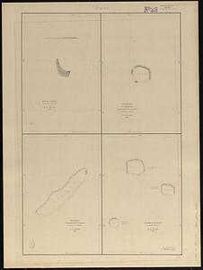
Metia Island, Paumotu Group ; Taweree or St. Simeon or Resolution Island, Paumotu Group ; Takurea or Wolconsky Island, Paumotu...
5149.
Metropolitan Boston transportation map : subway, bus, rail
5150.
Metropolitan Boston transportation map : subway, bus, rail
5151.
Metropolitan Boston transportation map : subway, bus, rail
5152.
Metropolitan Boston transportation map : subway, bus, rail
5153.
Metropolitan Boston transportation map : subway, bus, rail
5154.
Metropolitan Boston transportation map : subway, bus, rail
5155.
Metropolitan district - inner section : population of cities & towns by five year periods from 1910 to 1925
5156.
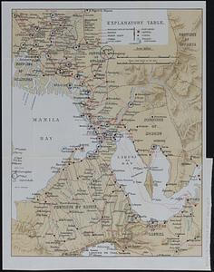
Metropolitan Manila
5157.
Metropolitan Transit Authority system route map
5158.
Metropolitan Transit Authority system route map
5159.
Metropolitan Transit Authority system route map
5160.
Metropolitan Transit Authority system route map
‹ Prev
Next ›
1
2
…
254
255
256
257
258
259
260
261
262
…
452
453