Metropolitan Manila
Item Information
- Title:
- Metropolitan Manila
- Cartographer:
- United States. War Department
- Date:
-
[1900]
- Format:
-
Maps/Atlases
- Location:
-
Boston Public Library
Norman B. Leventhal Map & Education Center - Collection (local):
-
Norman B. Leventhal Map & Education Center Collection
- Subjects:
-
Manila Metropolitan Area (Philippines)--Maps
- Places:
-
PhilippinesNational Capital Region (region)
- Extent:
- 1 map : color ; 48 x 37 cm
- Terms of Use:
-
No known copyright restrictions.
No known restrictions on use.
- Publisher:
-
[Washington, D.C.] :
[Government Printing Office]
- Scale:
-
Scale 1:250,000
- Language:
-
English
- Notes:
-
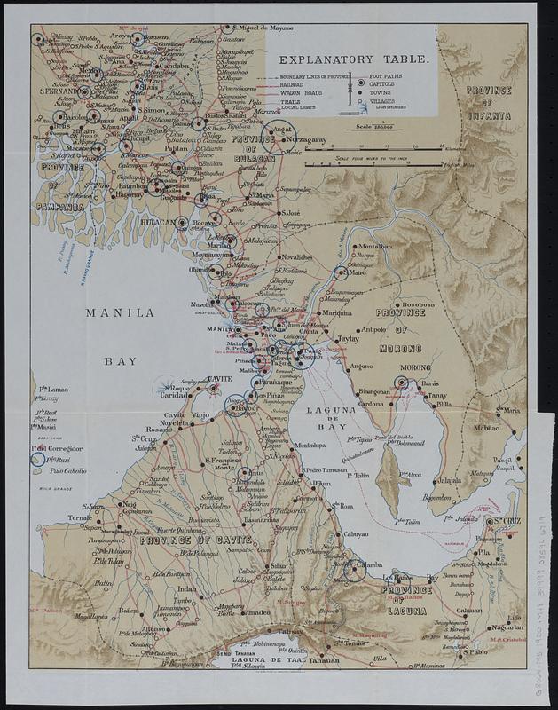
Map of Metropolitan Manila and surroundings showing province boundaries, railroads, wagon roads, trails, local lights, foot paths, capitals, towns, villages, and lighthouses.
Some cities circled in blue.
Relief shown by shading.
"The Norris Peters Co., photo-litho., Washington, D.C."
From Annual reports of the War Department for the fiscal year ended June 30, 1900. Report of chiefs of bureaus (Washington, D.C. : Government Printing Office, 1900).
- Notes (date):
-
This date is inferred.
- Identifier:
-
06_01_018372
- Call #:
-
G8064 .M5 1900 .M48
- Barcode:
-
39999085966719


