Toggle navigation
LMEC Home
Exhibitions
Georeferencing
Tools for Teachers
Collections
My Favorites
Sign Up / Log In
Search
Search the map portal
Map Collection
Map Collection
Map Sets
Search
Search
Search for
Search In
All Fields
Creator
Title
Subject
Place
Search All Digital Collections
Advanced Search
9052 Results
My Search
Start Over
More Like
commonwealth:7d27c9549
Remove constraint More Like: commonwealth:7d27c9549
Filter your Search
Place
North and Central America
6,283
United States
5,201
Massachusetts
2,155
Suffolk (county)
1,403
Europe
1,396
Boston
1,376
Canada
449
Asia
438
more
Place
»
Topic
Boston (Mass.)--Maps
677
City planning--Massachusetts--Boston--Maps
418
United States--Maps
282
Urban renewal--Massachusetts--Boston--Maps
252
Real property--Massachusetts--Boston--Maps
217
Massachusetts--Maps
162
Landowners--Massachusetts--Boston--Maps
136
North America--Maps--Early works to 1800
103
more
Topic
»
Date
Date range begin
–
Date range end
Current results range from
1482
to
2023
View distribution
Creator
United States. Hydrographic Office
595
Boston Redevelopment Authority
390
O.H. Bailey & Co
148
Des Barres, Joseph F. W. (Joseph Frederick Wallet), 1722-1824
123
United States. Post Office Dept
120
Ptolemy, 2nd cent
100
Walling, Henry Francis, 1825-1888
94
Geological Survey (U.S.)
86
more
Creator
»
Format
Maps/Atlases
8,991
Manuscripts
215
Prints
56
Books
36
Objects/Artifacts
10
Drawings/Illustrations
9
Posters
5
Georeferenced
Yes
870
No
8,182
Collection
Norman B. Leventhal Map & Education Center Collection
8,696
Boston and New England Maps
2,586
Urban Maps
2,373
Maritime Charts and Atlases
1,083
American Revolutionary War-Era Maps
620
Boston Redevelopment Authority Collection
438
William L. Clements Library Collection
3
Mapping Boston Collection
2
more
Collection
»
Available to use
No known restrictions
8,904
Creative Commons license
49
Search Constraints
Sort by relevance
relevance
title
date (asc)
date (desc)
Number of results to display per page
20 per page
10
per page
20
per page
50
per page
100
per page
View results as:
grid view
map view
Search Results
2781.
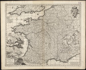
Galliae seu Franciae tabula, qua omnes provinciae, via angiariae, et aliae res notatu dignae distincte et accurate ostendatur
2782.
Gallup's map of Louisiana
2783.
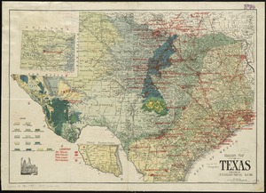
Gallup's map of Texas
2784.
The game of American story and glory : [cards]
2785.
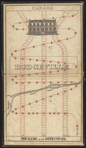
The game of the detectives
2786.
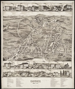
Gardner, Mass., 1880
2787.
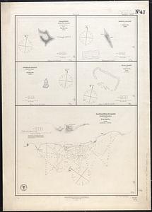
Gardner's or Kemins Island, Phœnix Group ; Flint's Island ; McKeans Island, Phœnix Group ; Maro Reef ; Lahaina Roads, Island of...
2788.
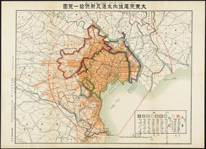
Gas and water-supply in greater Tokyo - 1928
2789.
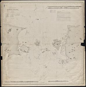
Gaspar Straits
2790.
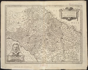
Gastinois et Senonois
2791.
Gay days around America : a pleasure map of festivals, pageants, and special events best reached by Greyhound ... the...
2792.
Die gegend um Boston
2793.
Geldria ducatus, et Zutfania comitatus
2794.
Gen. Washington's Revolutionary campaign war map : after a survey ordered by him showing the position of his army in defence of...
2795.
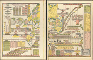
Genealogical, chronological and geographical chart embracing Biblical and profane history of ancient times from Adam to Christ
2796.
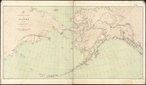
General chart of Alaska
2797.
General chart of Lake Huron
2798.
A general chart of the Indian and part of the Pacific Oceans, shewing the various passages to & from China, Australia, New...
2799.
A general chart of the island of Newfoundland with the rocks & soundings
2800.
General chart, of the North Atlantic, or Western Ocean, from the equator to 62° north latitude, according to the latest,...
‹ Prev
Next ›
1
2
…
136
137
138
139
140
141
142
143
144
…
452
453