Toggle navigation
LMEC Home
Exhibitions
Georeferencing
Tools for Teachers
Collections
My Favorites
Sign Up / Log In
Search
Search the map portal
Map Collection
Map Collection
Map Sets
Search
Search
Search for
Search In
All Fields
Creator
Title
Subject
Place
Search All Digital Collections
Advanced Search
384 Results
My Search
Start Over
More Like
commonwealth:7079bt02f
Remove constraint More Like: commonwealth:7079bt02f
Filter your Search
Place
North and Central America
335
United States
213
North America
68
Canada
59
New York
23
Pennsylvania
18
Asia
17
South Carolina
14
more
Place
»
Topic
North America--Maps--Early works to 1800
59
United States--Maps--Early works to 1800
43
Canada--Maps--Early works to 1800
38
Great Lakes Region (North America)--Maps--Early works to 1800
12
Pennsylvania--Maps--Early works to 1800
11
Northeastern States--Maps--Early works to 1800
9
United States--Maps
9
New York (State)--Maps--Early works to 1800
8
more
Topic
»
Date
Date range begin
–
Date range end
Current results range from
1623
to
1999
View distribution
Creator
Jefferys, Thomas, -1771
19
Bellin, Jacques Nicolas, 1703-1772
15
Gibson, J. (John), active 1750-1792
14
Robert Sayer and John Bennett (Firm)
14
Carleton, Osgood, 1742-1816
13
Faden, William, 1749-1836
13
Bowles, Carington, 1724-1793
10
Carey, Mathew, 1760-1839
10
more
Creator
»
Format
Maps/Atlases
382
Manuscripts
5
Paintings
3
Ephemera
1
Objects/Artifacts
1
Prints
1
Georeferenced
No
384
Collection
MacLean Collection Map Library
379
American Revolutionary War-Era Maps
333
Norman B. Leventhal Map & Education Center Collection
3
Urban Maps
3
Newberry Library Collection
2
Available to use
No known restrictions
3
Search Constraints
Sort by relevance
relevance
title
date (asc)
date (desc)
Number of results to display per page
20 per page
10
per page
20
per page
50
per page
100
per page
View results as:
grid view
map view
Search Results
341.
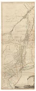
The provinces of New York, and New Jersey; with part of Pensilvania, and the governments of Trois Rivieres, and Montreal
342.
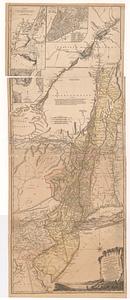
The provinces of New York and New Jersey; with part of Pensilvania, and the province of Quebec
343.
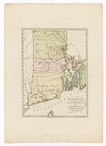
Rhode Island
344.
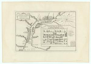
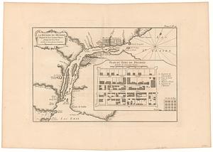
La riviere du Detroit depuis la Lac Sainte Claire jusqu' au Lac Erie
345.
La riviere du Detroit depuis la Lac Sainte Claire jusqu'au Lac Erie
346.
Schauplatz des kriegs zwischen Engelland und seinen collonien in America
347.
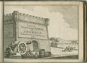
A set of plans and forts in America : reduced from actual surveys 1763
348.
A set of plans and forts in America, reduced from actual surveys
349.
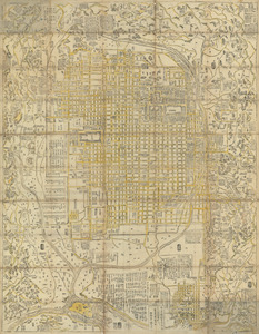
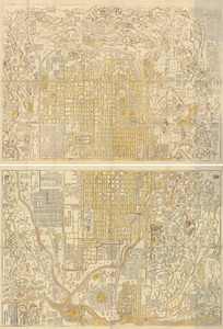
Shinsen zouho Kyo oezu
350.
Shinsen zouho Kyo oezu
351.
Shinsen zouho Kyo oezu
352.
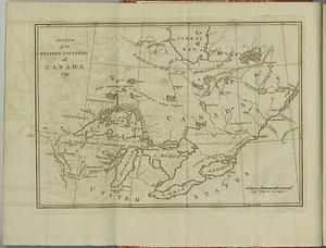
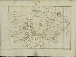
Sketch of the western countries of Canada
353.
Sketch of the western countries of Canada
354.
South-Carolina and parts adjacent : shewing the movements of the American and British armies
355.
The state of South Carolina: from the best authorities
356.
Gli Stati Uniti dell' America delineati fulle ultime offervazioni : quinto foglio che comprende la Georgia, e parte della...
357.
Gli Stati Uniti dell' America delineati fulle ultime offervazioni : terzo foglio che comprende parte della Virginia e della...
358.
Suite du theatre de la guerre dans l'Amerique Septentrionale y compris le Golfe du Mexique
359.
Survey of 1150 acres belonging to the London Company situated on Conestogo Creek in Lancr. County
360.
Theatre des operations des armees Americaine et Britanique en 1776 et 1777, depuis la Riviere de Rariton, dans le Jersey de...
‹ Prev
Next ›
1
2
…
14
15
16
17
18
19
20