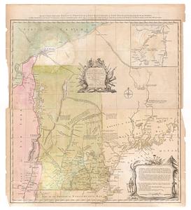
A set of plans and forts in America, reduced from actual surveys
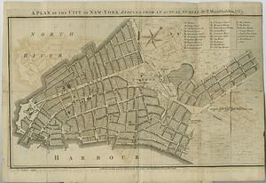
This map is also available in American Revolutionary Geographies Online (ARGO), a collections portal especially built for material relating to the American Revolutionary War Era. Visit ARGO to learn more about this item and explore the historical geography of North America in the late eighteenth century.
Item Information
- Title:
- A set of plans and forts in America, reduced from actual surveys
- Contributor:
- Rocque, John, -1762
- Contributor:
- Andrews, Peter, active 1765-1782
- Publisher:
- Rocque, Mary Ann
- Date:
-
1765
- Format:
-
Maps/Atlases
- Location:
- MacLean Collection Map Library
- Collection (local):
-
MacLean Collection Map Library
- Subjects:
-
Cities and towns--North America--Maps--Early works to 1800
- Places:
-
North America (area)
- Extent:
- 30 maps ; 255 x 400 mm
- Terms of Use:
-
Public Domain/No known restrictions on use. Contact host institution to download image.
Contact host institution for more information.
- Publisher:
-
London :
Publish'd according to act of Parliament, by Mary Ann Rocque topographer to His Royal Highness the Duke of Gloucester, in the Strand
- Language:
-
English
- Table of Contents:
-
A plan of the city of New-York. Reduced from an actual survey by T. Maerschalck, 1775
Plan of Quebec
Plan of the city and fortress of Louisbourg, with the attacks
Plan of the town and fortifications of Montreal or Ville Marie in Canada
A plan of Schenectady
A plan of the city of Albany
A plan of the town of Halifax in Nova Scotia
Plan of Fort Frontenac
Sketch of Fort Brewerton at the west end of Oneda Lake
Sketch of the stockade fort at Oswego Falls
Fort William Henry
Plan of the narrows, about 10 miles from New York
Plan and profile of retrenched work round Harkemeis House as the German flats 1756
Sketch of the blockhouse at the east of Oneda Lake
A plan of the royal block house, with the environs at Fort Edward
A plan of Fort William Henry and the English camps & retrenchments with the French different camps and attack thereupon
A plan of the fort at Saratoga
Plan of part of Fort George with the barracks &c. 1759
Plan of the retrench'd camp at Fort Ligonier
Plan of Fort Frederick at Albany
A plan of the new fort at Pitts-Burgh or Du Quesne nov. 1759
Plan of Fort Edward
Fort Bedford
Plan of the new fort & redoubts at Crown Point
Plan of the new fort and redoubts at new Crown Point
Plan of Fort Stanwix, built at Oneida Station by provincial troops in 1758
A plan of Fort Frederick situated at the entrance of St. Johns River
Plan of Fort Niagara with its environ
Plan of the fort at Tienderoga at the head of Lake Champlain 1759
A plan of Fort Ontario
- Identifier:
-
MC_255
- Call #:
-
255
 IIIF Manifest