Toggle navigation
LMEC Home
Exhibitions
Georeferencing
Tools for Teachers
Collections
My Favorites
Sign Up / Log In
Search
Search the map portal
Map Collection
Map Collection
Map Sets
Search
Search
Search for
Search In
All Fields
Creator
Title
Subject
Place
Search All Digital Collections
Advanced Search
8809 Results
My Search
Start Over
More Like
commonwealth:6t053p295
Remove constraint More Like: commonwealth:6t053p295
Filter your Search
Place
North and Central America
6,030
United States
4,955
Massachusetts
2,102
Europe
1,396
Suffolk (county)
1,068
Boston
1,041
Canada
459
Asia
438
more
Place
»
Topic
Boston (Mass.)--Maps
586
United States--Maps
282
Real property--Massachusetts--Boston--Maps
175
Massachusetts--Maps
162
Landowners--Massachusetts--Boston--Maps
133
North America--Maps--Early works to 1800
108
New England--Maps
102
New England--Maps--Early works to 1800
97
more
Topic
»
Date
Date range begin
–
Date range end
Current results range from
1482
to
2023
View distribution
Creator
United States. Hydrographic Office
595
O.H. Bailey & Co
148
Des Barres, Joseph F. W. (Joseph Frederick Wallet), 1722-1824
125
United States. Post Office Dept
120
Ptolemy, 2nd cent
100
Walling, Henry Francis, 1825-1888
94
Jefferys, Thomas, -1771
89
Geological Survey (U.S.)
86
more
Creator
»
Format
Maps/Atlases
8,749
Manuscripts
217
Prints
56
Books
36
Objects/Artifacts
10
Drawings/Illustrations
8
Posters
5
Georeferenced
Yes
877
No
7,932
Collection
Norman B. Leventhal Map & Education Center Collection
8,737
Boston and New England Maps
2,259
Urban Maps
2,029
Maritime Charts and Atlases
1,093
American Revolutionary War-Era Maps
693
Boston Redevelopment Authority Collection
87
Mapping Boston Collection
41
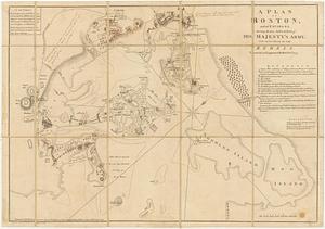
Richard H. Brown Revolutionary War Map Collection at Mount Vernon
19
more
Collection
»
Available to use
No known restrictions
8,558
Creative Commons license
128
Search Constraints
Sort by relevance
relevance
title
date (asc)
date (desc)
Number of results to display per page
20 per page
10
per page
20
per page
50
per page
100
per page
View results as:
grid view
map view
Search Results
121.
A new and accurate chart of the harbour of Boston in New England in North America
122.
A new suruey of the harbour of Boston in New England
123.
Plan de Boston avec les sondes et les directions pour la navigation : traduit de l'anglais
124.
A plan of the town and harbour of Boston : and the country adjacent with the road from Boston to Concord, shewing the place of...
125.
Boston
126.
Grundriss von der Stadt Boston und ihren Gegenden
127.
A Map of forty miles north, thirty miles west, and twentyfive miles south of Boston : including an accurate draft of the...
128.
Map of the environs of Boston
129.
A new and correct plan of the town of Boston
130.
A New Plan of ye Great Town of BOSTON in New England in AMERICA with the many Additionall Buildings & New Streets to the Year,...
131.
Plan de Boston
132.
Plan de la ville de Boston
133.
Plan de la ville et du port de Boston : capitale de la Nouvelle Angleterre
134.
Plan de la ville et du port de Boston : capitale de la Nouvelle Angleterre
135.
A plan of Boston, and its environs : shewing the true situation of His Majesty's army, and also those of the rebels
136.
A plan of Boston, from actual survey
137.
A Plan of the Battle of Bunker Hill
138.
An accurate map of Rhode Island, part of Connecticut and Massachusets, shewing Admiral Arbuthnot's station in blocking up...
139.
An accurate map of the four New England states : shewing in a distinct manner all the mountains, forts, rivers, swamps,...
140.
An actual survey of the sea coast from New York to the I. Cape Brition : with tables of the direct and thwart courses &...
‹ Prev
Next ›
1
2
3
4
5
6
7
8
9
10
11
…
440
441