Toggle navigation
LMEC Home
Exhibitions
Georeferencing
Tools for Teachers
Collections
My Favorites
Sign Up / Log In
Search
Search the map portal
Map Collection
Map Collection
Map Sets
Search
Search
Search for
Search In
All Fields
Creator
Title
Subject
Place
Search All Digital Collections
Advanced Search
8904 Results
My Search
Start Over
More Like
commonwealth:6t053n87v
Remove constraint More Like: commonwealth:6t053n87v
Filter your Search
Place
North and Central America
6,060
United States
4,927
Massachusetts
2,079
Europe
1,396
Suffolk (county)
1,046
Boston
1,019
Canada
472
Asia
441
more
Place
»
Topic
Boston (Mass.)--Maps
586
United States--Maps
282
North America--Maps--Early works to 1800
240
Real property--Massachusetts--Boston--Maps
175
Massachusetts--Maps
162
Landowners--Massachusetts--Boston--Maps
133
United States--Maps--Early works to 1800
103
New England--Maps
102
more
Topic
»
Date
Date range begin
–
Date range end
Current results range from
1482
to
2023
View distribution
Creator
United States. Hydrographic Office
595
O.H. Bailey & Co
148
Des Barres, Joseph F. W. (Joseph Frederick Wallet), 1722-1824
123
United States. Post Office Dept
120
Ptolemy, 2nd cent
100
Jefferys, Thomas, -1771
94
Walling, Henry Francis, 1825-1888
94
Sayer, Robert, 1725-1794
87
more
Creator
»
Format
Maps/Atlases
8,844
Manuscripts
217
Prints
56
Books
36
Objects/Artifacts
10
Drawings/Illustrations
8
Posters
5
Georeferenced
Yes
874
No
8,030
Collection
Norman B. Leventhal Map & Education Center Collection
8,706
Boston and New England Maps
2,234
Urban Maps
2,023
Maritime Charts and Atlases
1,083
American Revolutionary War-Era Maps
808
MacLean Collection Map Library
102
Boston Redevelopment Authority Collection
87
New York Public Library Collection
46
more
Collection
»
Available to use
No known restrictions
8,558
Creative Commons license
136
Search Constraints
Sort by relevance
relevance
title
date (asc)
date (desc)
Number of results to display per page
20 per page
10
per page
20
per page
50
per page
100
per page
View results as:
grid view
map view
Search Results
181.
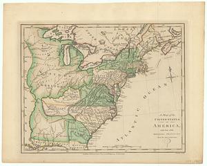
A map of the United States of America, as settled by the peace of 1783
182.
A map of the United States of America, with part of the adjoining provinces from the latest authorities
183.
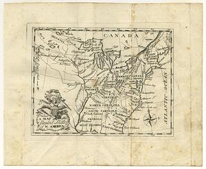
A map of the United States of N. America
184.
A map of the United States of N. America
185.
A map of the United States of North America : drawn from a number of critical researches
186.
A map of the United States of North America drawn from a number of critical researches
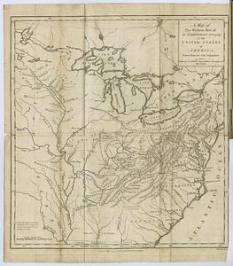
187.
A map of the western part of the territories belonging to the United States of America : drawn from the best authorities
188.
A new and accurate map of North America : (wherein the errors of all preceeding British, French and Dutch maps, respecting the...
189.
A new and accurate map of the British dominions in America, according to the treaty of 1763 : divided into the several...
190.
A new and correct map of North America : in which the places of the principal engagements during the present war are accurately...
191.
A new and correct map of North America : in which the places of the principal engagements during the present war are accurately...
192.
A new and correct map of North America in which the places of the principal engagements during the present war, are accurately...
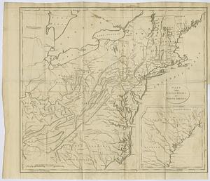
193.
Part of the United States of North America
194.
Part of the United States of North America
195.
Partie de l'Amerique Septentrionale qui comprend le cours de l'Ohio, la N.lle Angleterre, la N.lle York, le New Jersey, la...
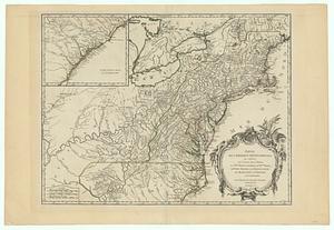
196.
Partie des Etats-Unis de l'Amerique Septentrional
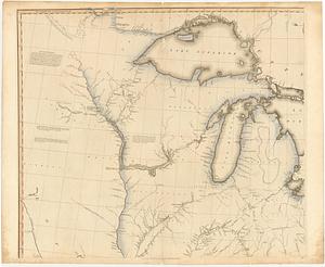
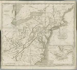
197.
Partie occidentale du Canada et septentrionale de la Louisiane avec une partie de la Pensilvanie
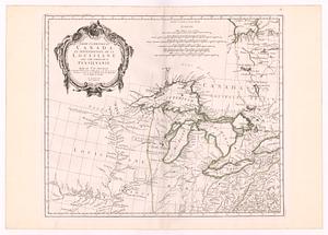
198.
Partie septentrionale des possessions angloise en Amérique : pour servire d'intelligence à la guerre présente entre les...
199.
Schauplatz des Kriegs zwischen Engelland und seinen Collonien in America
200.
Schauplatz des kriegs zwischen Engelland und seinen collonien in America
‹ Prev
Next ›
1
2
…
6
7
8
9
10
11
12
13
14
…
445
446