Toggle navigation
LMEC Home
Exhibitions
Georeferencing
Tools for Teachers
Collections
My Favorites
Sign Up / Log In
Search
Search the map portal
Map Collection
Map Collection
Map Sets
Search
Search
Search for
Search In
All Fields
Creator
Title
Subject
Place
Search All Digital Collections
Advanced Search
8781 Results
My Search
Start Over
More Like
commonwealth:6h446w43d
Remove constraint More Like: commonwealth:6h446w43d
Filter your Search
Place
North and Central America
6,012
United States
4,930
Massachusetts
2,091
Europe
1,396
Suffolk (county)
1,132
Boston
1,105
Canada
449
Asia
438
more
Place
»
Topic
Boston (Mass.)--Maps
606
United States--Maps
282
Real property--Massachusetts--Boston--Maps
254
Landowners--Massachusetts--Boston--Maps
170
Massachusetts--Maps
162
City planning--Massachusetts--Boston--Maps
113
North America--Maps--Early works to 1800
103
New England--Maps
102
more
Topic
»
Date
Date range begin
–
Date range end
Current results range from
1482
to
2023
View distribution
Creator
United States. Hydrographic Office
595
O.H. Bailey & Co
148
Des Barres, Joseph F. W. (Joseph Frederick Wallet), 1722-1824
123
United States. Post Office Dept
120
Boston Redevelopment Authority
113
Ptolemy, 2nd cent
100
Walling, Henry Francis, 1825-1888
94
Geological Survey (U.S.)
86
more
Creator
»
Format
Maps/Atlases
8,721
Manuscripts
215
Prints
56
Books
36
Objects/Artifacts
10
Drawings/Illustrations
8
Posters
5
Georeferenced
Yes
869
No
7,912
Collection
Norman B. Leventhal Map & Education Center Collection
8,697
Boston and New England Maps
2,284
Urban Maps
2,073
Maritime Charts and Atlases
1,083
American Revolutionary War-Era Maps
616
Boston Redevelopment Authority Collection
136
Massachusetts Real Estate Atlases
35
Applied Geographics, Inc. Records
2
Available to use
No known restrictions
8,604
Creative Commons license
47
Search Constraints
Sort by relevance
relevance
title
date (asc)
date (desc)
Number of results to display per page
20 per page
10
per page
20
per page
50
per page
100
per page
View results as:
grid view
map view
Search Results
2901.
Hispaniae novae nova descriptio
2902.
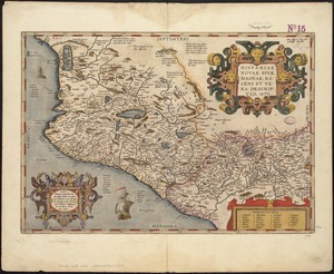
Hispaniae novae sivae magnae, recens et vera desciptio : 1579
2903.
Hispaniae veteris descriptio
2904.
Historic and modern Boston-Cambridge-Salem Lexington Concord
2905.
Historic Massachusetts : a travel map to help you feel at home in the Bay State
2906.
Historic Massachusetts : a travel map to help you feel at home in the Bay State
2907.
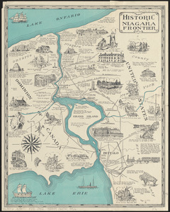
Historic Niagara Frontier
2908.
An historical and literary map of the Old Line State of Maryland : showing forth divers curious and notable facts relating to...
2909.
Historical map of Nantucket
2910.
An historical map of Pennsylvania : showing the Indian names of streams and villages, and paths of travel : the sites of old...
2911.
Historical map of the Emerald Necklace
2912.
Historical map of the north and central parts of Old Boston with explanatory key
2913.
An historical map of the Roman Empire and the neighbouring barbarous nations to the year of our Lord four hundred when the...
2914.
Historical map of the town of Scituate, Plymouth County, Massachusetts, incorporated 1636
2915.
Historical map of Watertown, 1630-1930
2916.
Historical sketch of the rebellion
2917.
The historical war map
2918.
History 2
2919.
Hodgman's new map showing location and classification golf and country clubs of New England with automobile roads and distances
2920.
Holbrook, Massachusetts, 1892 : incorporated Feb. 29, 1872
‹ Prev
Next ›
1
2
…
142
143
144
145
146
147
148
149
150
…
439
440