Toggle navigation
LMEC Home
Exhibitions
Georeferencing
Tools for Teachers
Collections
My Favorites
Sign Up / Log In
Search
Search the map portal
Map Collection
Map Collection
Map Sets
Search
Search
Search for
Search In
All Fields
Creator
Title
Subject
Place
Search All Digital Collections
Advanced Search
132 Results
My Search
Start Over
More Like
commonwealth:6d574815g
Remove constraint More Like: commonwealth:6d574815g
Filter your Search
Place
North and Central America
117
United States
116
Massachusetts
82
Boston
36
Suffolk (county)
36
Virginia
13
Connecticut
5
Essex (county)
5
more
Place
»
Topic
Massachusetts--Maps
25
Boston Metropolitan Area (Mass.)--Maps
24
Boston (Mass.)--Maps
15
United States--History--Civil War, 1861-1865--Maps
10
Open spaces--Massachusetts--Maps
8
Land use--Massachusetts--Maps
7
Recreation areas--Massachusetts--Boston--Maps
7
Virginia--History--Civil War, 1861-1865--Maps
7
more
Topic
»
Date
Date range begin
–
Date range end
Current results range from
1840
to
2023
View distribution
Creator
MassGIS (Office : Mass.)
21
Massachusetts. Executive Office of Environmental Affairs
16
Michler, N. (Nathaniel), 1827-1881
15
New York Lithographing, Engraving and Printing Co.
12
Strasser, J.
12
Theilkuhl, F.
12
Weyss, J. E.
12
Geological Survey (U.S.)
10
more
Creator
»
Format
Maps/Atlases
129
Ephemera
2
Documents
1
Posters
1
Georeferenced
Yes
2
No
130
Collection
Norman B. Leventhal Map & Education Center Collection
129
David Judkins Weaver Papers
98
Boston and New England Maps
93
Urban Maps
20
Applied Geographics, Inc. Records
3
Boston Redevelopment Authority Collection
3
Mapping Boston Collection
1
Mapping Inequality Collection
1
Available to use
No known restrictions
126
Creative Commons license
5
Search Constraints
Sort by relevance
relevance
title
date (asc)
date (desc)
Number of results to display per page
20 per page
10
per page
20
per page
50
per page
100
per page
View results as:
grid view
map view
Search Results
1.
Map of the Boston Metropolitan District showing park reservations and holdings of the Metropolitan District Commission and...
2.
Massachusetts areas of critical environmental concern
3.
Massachusetts open space and recreation facilities
4.
Properties of the Trustees of Reservations and other protected open space
5.
Boston's bikemap : Arlington, Belmont, Brookline, Cambridge, Chelsea, Everett, Lexington, Malden, Medford, Needham, Newton,...
6.
Major transportation system : Boston region MAPC area
7.
The regional open space system : [Boston, Massachusetts metropolitan area]
8.
Plan of portion of park system from Common to Franklin Park : including Charles River Basin, Charlesbank, Commonwealth Avenue,...
9.
Relationship between selected recreation sites and public transportation facilities Boston metropolitan area 1971
10.
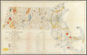
Map of existing and proposed open spaces in Massachusetts
11.
Mother Brook recreation study
12.
DEM protected open space
13.
Western Massachusetts closed to the public
14.
Western Massachusetts open space abounds
15.
Map of Boston and vicinity : 1895
16.
Map of Boston and vicinity including the metropolitan park system
17.
Map of the metropolitan district of Boston, Massachusetts : showing the existing public reservations and such new open spaces...
18.
Road map of the Boston District, showing the metropolitan park system
19.
Road map of the Boston district showing the metropolitan park system
20.
Sketch showing arrangement for park-way with adjacent streets and building lots
‹ Prev
Next ›
1
2
3
4
5
6
7