Toggle navigation
LMEC Home
Exhibitions
Georeferencing
Tools for Teachers
Collections
My Favorites
Sign Up / Log In
Search
Search the map portal
Map Collection
Map Collection
Map Sets
Search
Search
Search for
Search In
All Fields
Creator
Title
Subject
Place
Search All Digital Collections
Advanced Search
8888 Results
My Search
Start Over
More Like
commonwealth:69701g66q
Remove constraint More Like: commonwealth:69701g66q
Filter your Search
Place
North and Central America
6,119
United States
5,035
Massachusetts
2,143
Europe
1,396
Suffolk (county)
1,234
Boston
1,207
Canada
449
Asia
438
more
Place
»
Topic
Boston (Mass.)--Maps
752
United States--Maps
282
Real property--Massachusetts--Boston--Maps
195
City planning--Massachusetts--Boston--Maps
182
Massachusetts--Maps
166
Landowners--Massachusetts--Boston--Maps
142
New England--Maps
104
North America--Maps--Early works to 1800
103
more
Topic
»
Date
Date range begin
–
Date range end
Current results range from
1482
to
2023
View distribution
Creator
United States. Hydrographic Office
595
Boston Redevelopment Authority
186
O.H. Bailey & Co
148
Des Barres, Joseph F. W. (Joseph Frederick Wallet), 1722-1824
124
United States. Post Office Dept
120
Ptolemy, 2nd cent
100
Walling, Henry Francis, 1825-1888
94
Geological Survey (U.S.)
87
more
Creator
»
Format
Maps/Atlases
8,828
Manuscripts
215
Prints
56
Books
36
Objects/Artifacts
10
Drawings/Illustrations
8
Posters
5
Georeferenced
Yes
886
No
8,002
Collection
Norman B. Leventhal Map & Education Center Collection
8,723
Boston and New England Maps
2,384
Urban Maps
2,168
Maritime Charts and Atlases
1,083
American Revolutionary War-Era Maps
638
Boston Redevelopment Authority Collection
218
Mapping Boston Collection
20
Massachusetts Real Estate Atlases
12
more
Collection
»
Available to use
No known restrictions
8,691
Creative Commons license
70
Search Constraints
Sort by relevance
relevance
title
date (asc)
date (desc)
Number of results to display per page
20 per page
10
per page
20
per page
50
per page
100
per page
View results as:
grid view
map view
Search Results
6141.
Part of Flushing, town of Flushing, Queens Co.
6142.
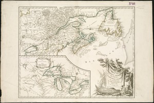
Part of New England
6143.
Part of New York City
6144.
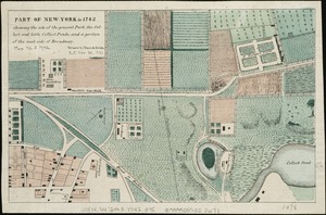
Part of New York in 1742 : showing the site of the present park, the collect and the little collect ponds, and a portion of the...
6145.
Part of the city of Honolulu, Oahu H.I.
6146.
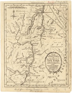
Part of the counties of Charlotte and Albany, in the Province of New York : being the seat of war between the King's forces...
6147.
Part of the metropolitan district
6148.
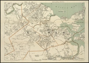
Part of the (Quincy) metropolitan district
6149.
Part of Turkey in Europe
6150.
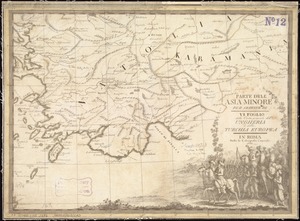
Parte dell'Asia Minore per servire di VI foglio della carta generale dell'Ungheria e della Turchia Europea
6151.
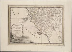
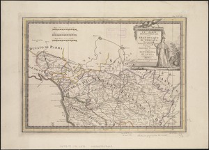
La Parte meridionale del gran ducato di Toscana : che comprende lo stato Senese e porzione del territorio Pisano col principato...
6152.
La parte settentrionale del Gran Ducato di Toscana : che comprehendo porzioni dello Stato Florentino e del Territorio Pisano...
6153.
Particular draughts and plans of some of the principal towns and harbours belonging to the English, French, and Spaniards, in...
6154.
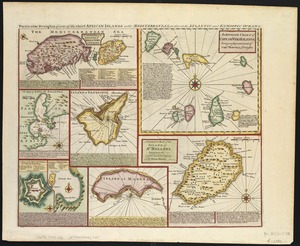
Particular draughts of some of the chief African Islands in the Mediterranean : as also in the Atlantic and Ethiopic Oceans
6155.
A particular map of the River Sanaga, from its mouth, to the desart, exhibiting its several branches, and the islands formed by...
6156.
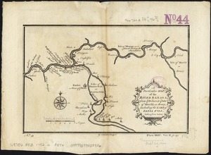
A particular map of the River Sanaga, from ye desart, to ye Isle of Morfil or Jvory, including the Lake of Pania Fuli
6157.
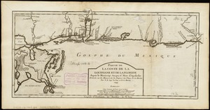
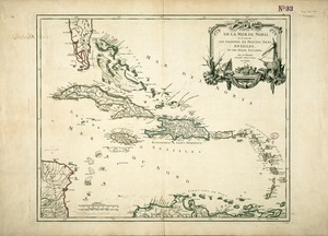
Partie de la coste de la Louisiane et de la Floride : depuis le Mississipi jusqua St. Marc d'Apalache
6158.
Partie de la mer du Nord, où se trouvent les grandes et petites isles Antilles, et les isles Lucayes
6159.
Partie de l'Amérique septent? qui comprend la Nouvelle France ou le Canada
6160.
Partie de l'Amerique Septentrionale, qui comprend le Canada, la Louisiane, le Labrador, le Groenland, la Nouvelle Angleterre,...
‹ Prev
Next ›
1
2
…
304
305
306
307
308
309
310
311
312
…
444
445