Toggle navigation
LMEC Home
Exhibitions
Georeferencing
Tools for Teachers
Collections
My Favorites
Sign Up / Log In
Search
Search the map portal
Map Collection
Map Collection
Map Sets
Search
Search
Search for
Search In
All Fields
Creator
Title
Subject
Place
Search All Digital Collections
Advanced Search
8717 Results
My Search
Start Over
More Like
commonwealth:61091c59n
Remove constraint More Like: commonwealth:61091c59n
Filter your Search
Place
North and Central America
5,948
United States
4,861
Massachusetts
2,079
Europe
1,396
Suffolk (county)
1,046
Boston
1,019
Canada
471
Asia
438
more
Place
»
Topic
Boston (Mass.)--Maps
586
United States--Maps
294
Real property--Massachusetts--Boston--Maps
175
Massachusetts--Maps
162
Landowners--Massachusetts--Boston--Maps
133
New England--Maps
107
North America--Maps--Early works to 1800
103
Europe--Maps
79
more
Topic
»
Date
Date range begin
–
Date range end
Current results range from
1482
to
2023
View distribution
Creator
United States. Hydrographic Office
595
O.H. Bailey & Co
148
Des Barres, Joseph F. W. (Joseph Frederick Wallet), 1722-1824
123
United States. Post Office Dept
120
Ptolemy, 2nd cent
100
Walling, Henry Francis, 1825-1888
94
Geological Survey (U.S.)
86
Jefferys, Thomas, -1771
85
more
Creator
»
Format
Maps/Atlases
8,657
Manuscripts
215
Prints
56
Books
36
Objects/Artifacts
10
Drawings/Illustrations
8
Posters
5
Georeferenced
Yes
869
No
7,848
Collection
Norman B. Leventhal Map & Education Center Collection
8,694
Boston and New England Maps
2,233
Urban Maps
2,023
Maritime Charts and Atlases
1,083
American Revolutionary War-Era Maps
639
Boston Redevelopment Authority Collection
87
Maps from AAS
14
William L. Clements Library Collection
8
more
Collection
»
Available to use
No known restrictions
8,552
Creative Commons license
47
Search Constraints
Sort by relevance
relevance
title
date (asc)
date (desc)
Number of results to display per page
20 per page
10
per page
20
per page
50
per page
100
per page
View results as:
grid view
map view
Search Results
21.
Map of North America : showing all routes to Alaska and Klondike country
22.
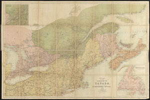
Map of the Dominion of Canada
23.
A map of the province of Upper Canada, describing all the new settlements, townships, & cc. with the countries adjacent, from...
24.
Map of the provinces of upper & lower Canada with the adjacent parts of the United States of America, &c
25.
Map shewing the railways of Canada, to accompany annual report on railway statistics 1884
26.
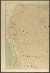
Map showing mounted police stations in north-western Canada
27.
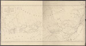
Map to accompany the report on the exploratory survey of the Canadian Pacific Railway
28.
Minerals
29.
New map of the Dominion of Canada
30.
Relief map of Canada and the United States
31.
Relief map of the Dominion of Canada
32.
Schonberg's imperial map of the United States and Canada : constructed, drawn and compiled from the latest and best authorities...
33.
Trans-continental map : showing the main lines and proposed extensions of the various trans-continental railroad systems of the...
34.
Williams' telegraph and rail road map of the New England states, eastern protion of New York state and Canada : compiled from...
35.
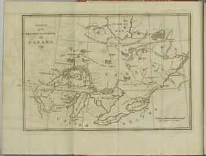
Sketch of the western countries of Canada
36.
An accurate map of Canada, with the adjacent countries; exhibiting the late seat of war between the English & French in those...
37.
America Septentrionalis : a Domino d'Anville in Galliis edita nune in Anglia Coloniss in Interiorem Virginiam deductis nec non...
38.
The British governments in Nth. America : laid down agreeable to the proclamation of Octr. 7, 1763
39.
Canada
40.
Carte des pays connus sous le nom de Canada, : dans laquelle sont distinguées les possessions françoises, et angl?
‹ Prev
Next ›
1
2
3
4
5
6
…
435
436