Toggle navigation
LMEC Home
Exhibitions
Georeferencing
Tools for Teachers
Collections
My Favorites
Sign Up / Log In
Search
Search the map portal
Map Collection
Map Collection
Map Sets
Search
Search
Search for
Search In
All Fields
Creator
Title
Subject
Place
Search All Digital Collections
Advanced Search
8699 Results
My Search
Start Over
More Like
commonwealth:5q47zt322
Remove constraint More Like: commonwealth:5q47zt322
Filter your Search
Place
North and Central America
5,930
United States
4,848
Massachusetts
2,079
Europe
1,396
Suffolk (county)
1,046
Boston
1,019
Canada
449
Asia
438
more
Place
»
Topic
Boston (Mass.)--Maps
586
United States--Maps
282
Real property--Massachusetts--Boston--Maps
175
Massachusetts--Maps
162
Landowners--Massachusetts--Boston--Maps
133
North America--Maps--Early works to 1800
103
New England--Maps
102
Europe--Maps
79
more
Topic
»
Date
Date range begin
–
Date range end
Current results range from
1482
to
2023
View distribution
Creator
United States. Hydrographic Office
595
O.H. Bailey & Co
148
Des Barres, Joseph F. W. (Joseph Frederick Wallet), 1722-1824
123
United States. Post Office Dept
120
Ptolemy, 2nd cent
100
Walling, Henry Francis, 1825-1888
94
Geological Survey (U.S.)
86
Jefferys, Thomas, -1771
85
more
Creator
»
Format
Maps/Atlases
8,639
Manuscripts
216
Prints
56
Books
36
Objects/Artifacts
10
Drawings/Illustrations
8
Posters
5
Georeferenced
Yes
869
No
7,830
Collection
Norman B. Leventhal Map & Education Center Collection
8,694
Boston and New England Maps
2,233
Urban Maps
2,022
Maritime Charts and Atlases
1,084
American Revolutionary War-Era Maps
620
Boston Redevelopment Authority Collection
87
William L. Clements Library Collection
2
Library of Congress Collection
1
more
Collection
»
Available to use
No known restrictions
8,552
Creative Commons license
49
Search Constraints
Sort by relevance
relevance
title
date (asc)
date (desc)
Number of results to display per page
20 per page
10
per page
20
per page
50
per page
100
per page
View results as:
grid view
map view
Search Results
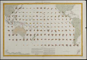
5621.
Océan Pacifique : cartes de la direction et de l'intensité probables des vents
5622.
Oceani occidetalis seu terre nove tabula
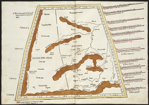
5623.
Octava Asiae tabula
5624.
Octava Asie tabula continet Scythiam que citra Imaū est & seras
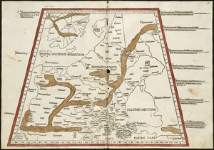
5625.
Octava Europae tabula
5626.
Octava Europe tabula continet Sarmatiam
5627.
Official highway map of the state of Vermont
5628.
Official map of American and Canadian airways and aerial mail routes
5629.
Official map of Boston
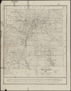
5630.
Official map of New Mexico
5631.
The official map of New York : compiled from United States government surveys, official state surveys, and other sources
5632.
Official map of North Dakota
5633.
Official map of the Philadelphia Rapid Transit Co
5634.
Official map of the state of Virginia : from actual surveys by order of the executive, 1828 & 1859
5635.
Official map of the territory of Dakota, showing the two general divisions of Dakota, South and North, the land districts,...
5636.
The official map of the world : showing the four quarters of the globe on the quarter-spherical or orange peel projection
5637.
Official plan of the siege of Yorktown, Va. conducted by the Army of the Potomac under command of Maj. Gen. George B....
5638.
The official plat "City of Miami," Florida
5639.
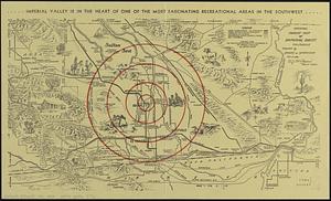
Official tourist map of Imperial County, California
5640.
Off-street parking inventory for the Boston regional core
‹ Prev
Next ›
1
2
…
278
279
280
281
282
283
284
285
286
…
434
435