Toggle navigation
LMEC Home
Exhibitions
Georeferencing
Tools for Teachers
Collections
My Favorites
Sign Up / Log In
Search
Search the map portal
Map Collection
Map Collection
Map Sets
Search
Search
Search for
Search In
All Fields
Creator
Title
Subject
Place
Search All Digital Collections
Advanced Search
493 Results
My Search
Start Over
More Like
commonwealth:5m60tf456
Remove constraint More Like: commonwealth:5m60tf456
Filter your Search
Place
North and Central America
493
United States
490
Suffolk (county)
387
Boston
385
Massachusetts
260
Roxbury
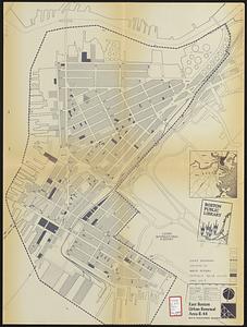
44
East Boston
33
Dorchester
31
more
Place
»
Topic
Real property--Massachusetts--Boston--Maps
253
Landowners--Massachusetts--Boston--Maps
169
Boston (Mass.)--Maps
142
Buildings--Massachusetts--Boston--Maps
125
City planning--Massachusetts--Boston--Maps
124
Urban renewal--Massachusetts--Boston--Maps
85
Roxbury (Boston, Mass.)--Maps
45
Land tenure--Massachusetts--Boston--Maps
37
more
Topic
»
Date
Date range begin
–
Date range end
Current results range from
1798
to
2023
View distribution
Creator
Boston Redevelopment Authority
127
Bromley, George Washington
79
Bromley, Walter Scott
79
G.W. Bromley & Co.
57
Hopkins, Griffith Morgan, Jr.
27
Geo. H. Walker & Co.
23
Wadsworth, Alexander, 1806-1898
19
Lamb, George
16
more
Creator
»
Format
Maps/Atlases
492
Manuscripts
4
Drawings/Illustrations
1
Georeferenced
Yes
14
No
479
Collection
Boston and New England Maps
340
Urban Maps
337
Norman B. Leventhal Map & Education Center Collection
233
Massachusetts Real Estate Atlases
143
Boston Redevelopment Authority Collection
138
American Revolutionary War-Era Maps
1
Applied Geographics, Inc. Records
1
Available to use
No known restrictions
348
Creative Commons license
2
Search Constraints
Sort by relevance
relevance
title
date (asc)
date (desc)
Number of results to display per page
20 per page
10
per page
20
per page
50
per page
100
per page
View results as:
grid view
map view
Search Results
41.
East Boston flood risk
42.
Plans of estates of William C. Barstow
43.
East Boston urban renewal area r-44 : building conditions
44.
City of Boston : topographic and planimetric survey
45.
City of Boston planimetric survey sheet no. 23I
46.
Columbia Point updated base maps
47.
Park Plaza urban renewal area : environmental deficiencies and blighting influences map
48.
Park Plaza urban renewal area : environmental deficiencies and blighting influences map
49.
South End urban renewal area R-56 : re-use parcels
50.
South End urban renewal area R-56 : re-use parcels
51.
Topographic map, Washington Park project r-24
52.
Washington Park urban renewal area Massachusetts r-24 : property map acquisitions
53.
Washington Park urban renewal area Massachusetts r-24 : property map acquisitions
54.
Waterfront land inventory South Boston : CRP port study
55.
Insurance map of Boston : volume 2
56.
Insurance map of Boston : volume 2
57.
Plan of East Boston : shewing the location of a mill dam and other improvements
58.
Plan of East Boston showing the land and water lots sold and unsold, also all buildings and other improvements
59.
Plan of sections of 1, 2 & 3, East Boston
60.
Atlas of Dorchester, West Roxbury and Brighton, city of Boston
‹ Prev
Next ›
1
2
3
4
5
6
7
…
24
25