Toggle navigation
LMEC Home
Exhibitions
Georeferencing
Tools for Teachers
Collections
My Favorites
Sign Up / Log In
Search
Search the map portal
Map Collection
Map Collection
Map Sets
Search
Search
Search for
Search In
All Fields
Creator
Title
Subject
Place
Search All Digital Collections
Advanced Search
8729 Results
My Search
Start Over
More Like
commonwealth:5999vb167
Remove constraint More Like: commonwealth:5999vb167
Filter your Search
Place
North and Central America
5,960
United States
4,878
Massachusetts
2,083
Europe
1,396
Suffolk (county)
1,048
Boston
1,021
Canada
456
Asia
438
more
Place
»
Topic
Boston (Mass.)--Maps
588
United States--Maps
282
Real property--Massachusetts--Boston--Maps
175
Massachusetts--Maps
164
Landowners--Massachusetts--Boston--Maps
133
New England--Maps
127
North America--Maps--Early works to 1800
103
Europe--Maps
79
more
Topic
»
Date
Date range begin
–
Date range end
Current results range from
1482
to
2023
View distribution
Creator
United States. Hydrographic Office
595
O.H. Bailey & Co
148
Des Barres, Joseph F. W. (Joseph Frederick Wallet), 1722-1824
123
United States. Post Office Dept
120
Ptolemy, 2nd cent
100
Walling, Henry Francis, 1825-1888
94
Jefferys, Thomas, -1771
87
Geological Survey (U.S.)
86
more
Creator
»
Format
Maps/Atlases
8,669
Manuscripts
215
Prints
56
Books
36
Objects/Artifacts
10
Drawings/Illustrations
8
Posters
5
Georeferenced
Yes
871
No
7,858
Collection
Norman B. Leventhal Map & Education Center Collection
8,698
Boston and New England Maps
2,239
Urban Maps
2,023
Maritime Charts and Atlases
1,083
American Revolutionary War-Era Maps
642
Boston Redevelopment Authority Collection
87
American Antiquarian Society Collection
9
MacLean Collection Map Library
9
more
Collection
»
Available to use
No known restrictions
8,556
Creative Commons license
50
Search Constraints
Sort by relevance
relevance
title
date (asc)
date (desc)
Number of results to display per page
20 per page
10
per page
20
per page
50
per page
100
per page
View results as:
grid view
map view
Search Results
7401.
Sketch map from the Dardanelles to the Bosphorus showing the positions of the British fleet
7402.
Sketch map of Boston and the Public Library system
7403.
Sketch map of Boston and the Public Library system
7404.
Sketch map of Boston and the Public Library system
7405.
Sketch map of New South Wales showing the localities of the principal minerals 1876
7406.
Sketch map of part of Cassiar District : shewing Atlin Gold Fields B.C. ; to accompany report of Minister of Mines Victoria 1898
7407.
Sketch map of the British coast showing the relative positions of Liverpool, Beaumaris, Moelfra Bay & Point Lynas (taken from...
7408.
Sketch of Boston Harbor and Bay
7409.
Sketch of Bunker Hill Battle
7410.
Sketch of Charleston Harbor
7411.
Sketch of Charleston Harbor
7412.
Sketch of Charleston Harbor
7413.
Sketch of Guadalupe Island : west coast of Lower California
7414.
A sketch of part of the Island of New York shewing the operations of His Majesty's troops on the 16 Novr. 1776 which terminated...
7415.
Sketch of Pensacola Navy Yard and Fort Pickens from U.S. coast surveys
7416.
Sketch of sea coast of South Carolina and Georgia from Bull's Bay to Ossabaw Sound
7417.
Sketch of sea coast of South Carolina and Georgia from Bull's Bay to Ossabaw Sound
7418.
Sketch of the 11th district of western Tennessee
7419.
Sketch of the Battle of Bunker Hill
7420.
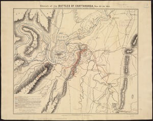
Sketch of the battles of Chattanooga, Nov. 23-26, 1863
‹ Prev
Next ›
1
2
…
367
368
369
370
371
372
373
374
375
…
436
437