Toggle navigation
LMEC Home
Exhibitions
Georeferencing
Tools for Teachers
Collections
My Favorites
Sign Up / Log In
Search
Search the map portal
Map Collection
Map Collection
Map Sets
Search
Search
Search for
Search In
All Fields
Creator
Title
Subject
Place
Search All Digital Collections
Advanced Search
8572 Results
My Search
Start Over
More Like
commonwealth:4m90fd842
Remove constraint More Like: commonwealth:4m90fd842
Filter your Search
Place
North and Central America
5,867
United States
4,786
Massachusetts
2,052
Europe
1,359
Suffolk (county)
1,034
Boston
1,007
Canada
448
Asia
422
more
Place
»
Topic
Boston (Mass.)--Maps
577
United States--Maps
273
Real property--Massachusetts--Boston--Maps
174
Massachusetts--Maps
160
Landowners--Massachusetts--Boston--Maps
132
North America--Maps--Early works to 1800
103
New England--Maps
99
Europe--Maps
78
more
Topic
»
Date
Date range begin
–
Date range end
Current results range from
1482
to
2023
View distribution
Creator
United States. Hydrographic Office
594
O.H. Bailey & Co
148
Des Barres, Joseph F. W. (Joseph Frederick Wallet), 1722-1824
123
United States. Post Office Dept
120
Ptolemy, 2nd cent
100
Walling, Henry Francis, 1825-1888
94
Geological Survey (U.S.)
86
Jefferys, Thomas, -1771
86
more
Creator
»
Format
Maps/Atlases
8,513
Manuscripts
215
Prints
56
Books
36
Objects/Artifacts
10
Drawings/Illustrations
8
Posters
4
Georeferenced
Yes
869
No
7,703
Collection
Norman B. Leventhal Map & Education Center Collection
8,550
Boston and New England Maps
2,204
Urban Maps
1,936
Maritime Charts and Atlases
1,081
American Revolutionary War-Era Maps
638
Boston Redevelopment Authority Collection
87
William L. Clements Library Collection
17
American Antiquarian Society Collection
5
Available to use
No known restrictions
8,409
Creative Commons license
46
Search Constraints
Sort by relevance
relevance
title
date (asc)
date (desc)
Number of results to display per page
20 per page
10
per page
20
per page
50
per page
100
per page
View results as:
grid view
map view
Search Results
61.
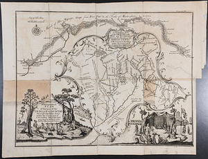
A draft of the Ohio from an Indian account
62.
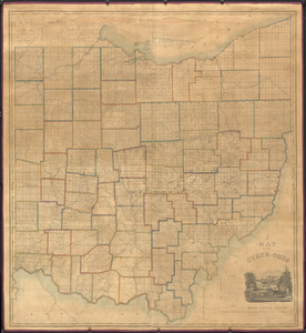
A map of the state of Ohio : from actual survey
63.
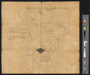
Mr. Mathew's draft of the Scioto & Ohio Companies purchase
64.
Plan of St. Clairs battle ground
65.
Plan of the Indian countrys through which the troops marchd in 1764 under the command of Col. Henry Bouquet
66.
A sketch of the several Indian roads leading from Fort Pitt to Sioto, Lake Erie &c. : takn. from a draft (made on a tour thro'...
67.
A topographical plan of that part of the Indian-country through which the army under the command of Colonel Bouquet marched in...
68.
Carte de la Virginie, : de la Baye Chesapeack, et pays voisins. : Pour servir à l'Histoire générale des voyages. : Tirée...
69.
Confluence of the James River, York River, and Chesapeake Bay
70.
Delaware Bay and Chesapeake Bay
71.
Delaware Bay and Chesapeake Bay
72.
A map of the country between Will's Creek & Monongahela River shewing the rout and encampments of the English army, in 1755
73.
A map of the Delaware and Chesapeak bays with the peninsula between them
74.
A map of the western parts of the colony of Virginia
75.
A Map of the western parts of the colony of Virginia
76.
Plan of part of the province of Virginia
77.
The State of Virginia form the best authorities. 1799
78.
The State of Virginia from the best authorities. 1796
79.
Virginia
80.
Yorktown, Virginia, and the surrounding area, ca. 1781
‹ Prev
Next ›
1
2
3
4
5
6
7
8
…
428
429