Toggle navigation
LMEC Home
Exhibitions
Georeferencing
Tools for Teachers
Collections
My Favorites
Sign Up / Log In
Search
Search the map portal
Map Collection
Map Collection
Map Sets
Search
Search
Search for
Search In
All Fields
Creator
Title
Subject
Place
Search All Digital Collections
Advanced Search
903 Results
My Search
Start Over
More Like
commonwealth:3f4634997
Remove constraint More Like: commonwealth:3f4634997
Filter your Search
Place
North and Central America
879
United States
868
Boston
765
Suffolk (county)
765
Massachusetts
714
Boston Harbor
84
Downtown Boston
35
New England
35
more
Place
»
Topic
Boston (Mass.)--Maps
745
City planning--Massachusetts--Boston--Maps
104
Real property--Massachusetts--Boston--Maps
99
Landowners--Massachusetts--Boston--Maps
74
Boston Harbor (Mass.)--Maps
66
Urban renewal--Massachusetts--Boston--Maps
63
Massachusetts--Maps
50
Local transit--Massachusetts--Boston--Maps
48
more
Topic
»
Date
Date range begin
–
Date range end
Current results range from
1493
to
2023
View distribution
Creator
Boston Redevelopment Authority
114
Geo. H. Walker & Co
28
Boynton, George W., d. 1884
21
Sampson, Davenport & Co
21
Sampson, Murdock & Co
20
Bromley, George Washington
18
Boston (Mass.). Engineering Dept
17
Bromley, Walter Scott
17
more
Creator
»
Format
Maps/Atlases
902
Manuscripts
9
Posters
1
Prints
1
Georeferenced
Yes
113
No
790
Collection
Norman B. Leventhal Map & Education Center Collection
759
Boston and New England Maps
662
Urban Maps
495
Mapping Boston Collection
139
Boston Redevelopment Authority Collection
121
American Revolutionary War-Era Maps
64
Maritime Charts and Atlases
34
William L. Clements Library Collection
15
more
Collection
»
Available to use
No known restrictions
714
Creative Commons license
151
Search Constraints
Sort by relevance
relevance
title
date (asc)
date (desc)
Number of results to display per page
20 per page
10
per page
20
per page
50
per page
100
per page
View results as:
grid view
map view
Search Results
521.
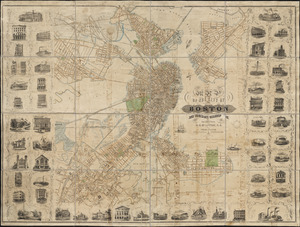
Map of part of Boston, Mass
522.
Map of public transportation routes in Greater Boston served by the Massachusetts Bay Transportation Authority comprising 64...
523.
[Map of Scollay Square and vicinity]
524.
Map of the Boston Elevated Ry. 1915
525.
Map of the Boston Elevated Ry. 1927
526.
Map of the central business district city of Boston showing the location of underground conduits
527.
Map of the central business district of Boston
528.
Map of the cities of Boston, Cambridge, Somerville and Chelsea, and the town of Brookline with parts of Newton, Malden and...
529.
Map of the city and vicinity of Boston Massachusetts
530.
Map of the city and vicinity of Boston, Massachusetts
531.
Map of the city of Boston
532.
[Map of the city of Boston]
533.
Map of the city of Boston
534.
Map of the city of Boston : from the recent surveys of the city and dist. surveyors, and from official records and actual surveys
535.
Map of the city of Boston and immediate neighborhood : from original surveys
536.
Map of the city of Boston and its environs
537.
Map of the city of Boston and its environs
538.
Map of the city of Boston and vicinity
539.
Map of the city of Boston and vicinity
540.
Map of the city of Boston and vicinity
‹ Prev
Next ›
1
2
…
23
24
25
26
27
28
29
30
31
…
45
46


![[Map of Scollay Square and vicinity]](https://bpldcassets.blob.core.windows.net/derivatives/images/commonwealth:x059cc25q/image_thumbnail_300.jpg)


![[Map of the city of Boston]](https://bpldcassets.blob.core.windows.net/derivatives/images/commonwealth:x059cc29t/image_thumbnail_300.jpg)