Toggle navigation
LMEC Home
Exhibitions
Georeferencing
Tools for Teachers
Collections
My Favorites
Sign Up / Log In
Search
Search the map portal
Map Collection
Map Collection
Map Sets
Search
Search
Search for
Search In
All Fields
Creator
Title
Subject
Place
Search All Digital Collections
Advanced Search
8554 Results
My Search
Start Over
More Like
commonwealth:3f4634911
Remove constraint More Like: commonwealth:3f4634911
Filter your Search
Place
North and Central America
5,849
United States
4,772
Massachusetts
2,052
Europe
1,359
Suffolk (county)
1,034
Boston
1,007
Canada
448
Asia
422
more
Place
»
Topic
Boston (Mass.)--Maps
578
United States--Maps
273
Real property--Massachusetts--Boston--Maps
174
Massachusetts--Maps
161
Landowners--Massachusetts--Boston--Maps
132
North America--Maps--Early works to 1800
103
New England--Maps
99
Europe--Maps
78
more
Topic
»
Date
Date range begin
–
Date range end
Current results range from
1482
to
2023
View distribution
Creator
United States. Hydrographic Office
594
O.H. Bailey & Co
148
Des Barres, Joseph F. W. (Joseph Frederick Wallet), 1722-1824
123
United States. Post Office Dept
120
Ptolemy, 2nd cent
100
Walling, Henry Francis, 1825-1888
94
Geological Survey (U.S.)
87
Jefferys, Thomas, -1771
85
more
Creator
»
Format
Maps/Atlases
8,495
Manuscripts
214
Prints
56
Books
36
Objects/Artifacts
10
Drawings/Illustrations
8
Posters
4
Georeferenced
Yes
869
No
7,685
Collection
Norman B. Leventhal Map & Education Center Collection
8,549
Boston and New England Maps
2,203
Urban Maps
1,936
Maritime Charts and Atlases
1,081
American Revolutionary War-Era Maps
616
Boston Redevelopment Authority Collection
87
Massachusetts Real Estate Atlases
5
Available to use
No known restrictions
8,408
Creative Commons license
46
Search Constraints
Sort by relevance
relevance
title
date (asc)
date (desc)
Number of results to display per page
100 per page
10
per page
20
per page
50
per page
100
per page
View results as:
grid view
map view
Search Results
401.
Atlas of the city of Boston : Roxbury : from actual surveys and official plans
402.
Atlas of the city of Boston : Roxbury : from actual surveys and official plans
403.
Atlas of the city of Boston : Roxbury : volume two : from actual surveys and official records
404.
Atlas of the city of Boston : Roxbury, Mass. : volume four : from actual surveys and official records
405.
Atlas of the city of Boston : Roxbury, Mass. : volume three : from actual surveys and official records
406.
Atlas of the city of Boston : South & East Boston : volume four
407.
Atlas of the city of Boston : South Boston : from actual surveys and official plans
408.
Atlas of the city of Boston : South Boston : from actual surveys and official plans
409.
Atlas of the city of Boston : South Boston : from actual surveys and official plans
410.
Atlas of the city of Boston : volume 6 : West Roxbury : from actual surveys and official plans
411.
Atlas of the city of Boston : volume 6 : West Roxbury : from actual surveys and official plans
412.
Atlas of the city of Boston : volume 7: Brighton : from actual surveys and official plans
413.
Atlas of the city of Boston : ward 25, Brighton : from actual surveys and official plans
414.
Atlas of the city of Boston : ward 26, Hyde Park : from actual surveys and official plans
415.
Atlas of the city of Boston : wards 25 & 26, Brighton : from actual surveys and official plans
416.
Atlas of the city of Boston : West Roxbury : from actual surveys and official plans
417.
Atlas of the city of Boston : West Roxbury : from actual surveys and official plans
418.
Atlas of the city of Boston : West Roxbury : volume five : from actual surveys and official records
419.
Atlas of the city of Boston, volume eight, South Boston, Mass. : from actual surveys and official plans
420.
Atlas of the city of Boston, volume five, Dorchester Mass. : from actual surveys and official plans
421.
Atlas of the city of Boston, volume seven, Brighton, Mass. : from actual surveys and official plans
422.
Atlas of the city of Boston, West Roxbury, Mass., volume six : from actual surveys and official plans
423.
Atlas of the city of Cambridge, Massachusetts : from actual surveys and official plans
424.
Atlas of the city of Cambridge, Massachusetts : from actual surveys and official plans
425.
Atlas of the city of Cambridge, Massachusetts : from actual surveys and official plans
426.
Atlas of the city of Cambridge, Massachusetts : from official records, private plan and actual surveys
427.
Atlas of the city of Cambridge, Massachusetts : from actual surveys and official plans
428.
Atlas of the city of Cambridge, Middlesex Co., Massachusetts
429.
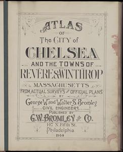
Atlas of the city of Chelsea and the towns of Revere & Winthrop, Massachusetts : from actual surveys and official plans
430.
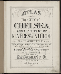
Atlas of the city of Chelsea and the towns of Revere & Winthrop, Massachusetts : from actual surveys and official plans
431.
Atlas of the city of Chelsea and the towns of Revere and Winthrop : from actual surveys and official plans
432.
Atlas of the city of Lawrence and the towns of Methuen, Andover and North Andover, Massachusetts
433.
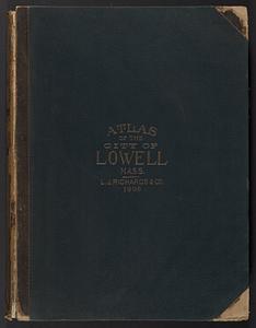
Atlas of the City of Lowell, Massachusetts : based upon and carefully compiled from the triangulation surveys, and maps in the...
434.
Atlas of the city of Lynn, Massachusetts : including, also, the towns of Swampscott and Saugus : based upon, and carefully...
435.
Atlas of the city of Medford, Middlesex County, Mass. ; Atlas of the town of Hyde Park, Norfolk County, Mass. ; Atlas of the...
436.
Atlas of the city of New Bedford, Massachusetts : based on plans in the office of the city engineer
437.
Atlas of the city of Newton, Massachusetts : from actual surveys and official plans
438.
Atlas of the city of Newton, Massachusetts : from actual surveys and official plans
439.
Atlas of the city of Newton, Massachusetts
440.
Atlas of the city of Newton, Massachusetts : compiled from actual surveys and records
441.
Atlas of the city of Newton Massachusetts : assessors block system
442.
Atlas of the city of Newton, Middlesex Co., Massachusetts : from actual survey, official records & private plans
443.
Atlas of the city of Northampton and the town of Easthampton, Hampshire County, Massachusetts
444.
Atlas of the city of Quincy, Norfolk County, Mass. : from official plans and actual surveys
445.
Atlas of the city of Quincy, Norfolk County, Massachusetts
446.
Atlas of the city of Salem, Massachusetts : based on plans in the office of the City Engineer
447.
Atlas of the city of Salem, Massachusetts : from actual survey and official records
448.
Atlas of the city of Somerville, Massachusetts : from actual surveys and official plans
449.
Atlas of the city of Somerville, Massachusetts : from actual surveys and official records
450.
Atlas of the county of Suffolk, Massachusetts : vol. 1st including Boston proper : from actual surveys and official records
451.
Atlas of the county of Suffolk, Massachusetts : vol. 2nd late city of Roxbury, now wards 13-14 and 15, city of Boston
452.
Atlas of the county of Suffolk, Massachusetts : vol. 3rd including Boston and Dorchester : from actual surveys and official...
453.
Atlas of the county of Suffolk, Massachusetts : vol. 4th including East Boston, city of Chelsea, Revere and Winthrop : from...
454.
Atlas of the county of Suffolk, Massachusetts : vol. 5th, West Roxbury, now ward 17, Boston : from actual survey & official...
455.
Atlas of the county of Suffolk, Massachusetts : vol. 6th including the late city of Charlestown, now wards 20,21 and 22, city...
456.
Atlas of the North Shore : Beverly to Magnolia, Essex Co. Mass. : from official plans and records and actual surveys
457.
Atlas of the town of Beverly, Massachusetts : from official records, private plans and actual surveys
458.
Atlas of the town of Brookline 1969
459.
Atlas of the town of Brookline 1972
460.
Atlas of the town of Brookline, Massachusetts : from official records, private plans and actual surveys
461.
Atlas of the town of Brookline, Massachusetts : from actual surveys & official records
462.
Atlas of the town of Brookline, Norfolk County, Massachusetts : from actual surveys and official plans
463.
Atlas of the town of Brookline, Norfolk County, Massachusetts : from actual surveys and official plans
464.
Atlas of the town of Brookline, Norfolk County, Massachusetts : from actual surveys and official plans
465.
Atlas of the town of Brookline, Norfolk County, Massachusetts : from actual surveys and official plans
466.
Atlas of the town of Brookline, Norfolk County, Massachusetts : from actual surveys and official plans
467.
Atlas of the town of Brookline, Norfolk County, Massachusetts : from actual surveys and official plans
468.
Atlas of the town of Brookline, Norfolk County, Massachusetts : from actual surveys and official plans
469.
Atlas of the town of Hull, Plymouth County, and part of the Jerusalem Road, Norfolk County, Massachussetts, from actual surveys...
470.
Atlas of the town of Marblehead, Massachusetts : based on plans in the office of the Board of Assessors
471.
Atlas of the town of Milton Norfolk County Mass. : from official plans and private surveys
472.
Atlas of the town of Milton Norfolk County, Massachusetts
473.
Atlas of the town of Swampscott, Essex County, Mass. : from official plans and actual surveys
474.
Atlas of the town of Wayland
475.
Atlas of the towns of Braintree and Weymouth, Norfolk County, Massachusetts : from official plans and actual surveys
476.
Atlas of the towns of Needham, Dover, Westwood, Millis and Medfield, Norfolk County, Massachusetts : from official plans and...
477.
Atlas of the towns of Revere and Winthrop, Suffolk County, Massachusetts
478.
Atlas of the towns of Topsfield, Ipswich, Essex, Hamilton and Wenham, Essex County, Massachusetts : from official plans and...
479.
Atlas of the towns of Watertown, Belmont, Arlington and Lexington, Middlesex County, Mass. : from official plans and actual...
480.
Atlas of town of Weymouth Massachusetts
481.
Atlas of town of Weymouth Massachusetts
482.
Atlas of town of Weymouth Massachusetts
483.
Atlas of Westfield town, Massachusetts
484.
Atlas of Worcester county, Massachusetts : from actual surveys
485.
Atlas to Marshall's life of Washington
486.
Atlas town of Wellesley
487.
Atrebates : Evesché d'Arras comté d'Artois subdivisé en toutes ses Iurisdictions scav. gouvernance d'Arras, com.te de St Pol...
488.
The attack and defeat of the American fleet under Benedict Arnold, by the King's fleet commanded by Capt. Thos. Pringle, upon...
489.
Attack of the rebels upon Fort Penobscot in the province of New England in which their fleet was totally destroyed and their...
490.
The attack on Bunker Hill in the peninsula of Charlestown the 17th of June 1775
491.
Auburn, Rhode Island : 1890
492.
Die aufnahmen der Engländer, Franzosen und Russen in hinter-Asien bis zum jahre 1858
493.
Ausicht von Boston : nach der natur aufgenommen
494.
Australien und Polynesien
495.
Austria archiducatus
496.
Austria Hungary
497.
Austria Hungary
498.
Austriae archiducatus pars inferior in omnes ejusdem quadrantes ditiones accuratissime et distincte delineata
499.
Austriae archiducatus pars superior in omnes ejusdem quadrantes ditiones accuratissime et distincte delineata
500.
Austria-Hungary
‹ Prev
Next ›
1
2
3
4
5
6
7
8
9
…
85
86