Toggle navigation
LMEC Home
Exhibitions
Georeferencing
Tools for Teachers
Collections
My Favorites
Sign Up / Log In
Search
Search the map portal
Map Collection
Map Collection
Map Sets
Search
Search
Search for
Search In
All Fields
Creator
Title
Subject
Place
Search All Digital Collections
Advanced Search
1082 Results
My Search
Start Over
More Like
commonwealth:3f4632358
Remove constraint More Like: commonwealth:3f4632358
Filter your Search
Place
North and Central America
1,058
United States
1,034
Massachusetts
879
Boston
768
Suffolk (county)
768
Boston Harbor
50
New England
48
Rhode Island
48
more
Place
»
Topic
Boston (Mass.)--Maps
752
Massachusetts--Maps
235
City planning--Massachusetts--Boston--Maps
104
Real property--Massachusetts--Boston--Maps
99
Landowners--Massachusetts--Boston--Maps
74
Urban renewal--Massachusetts--Boston--Maps
63
Rhode Island--Maps
50
Local transit--Massachusetts--Boston--Maps
47
more
Topic
»
Date
Date range begin
–
Date range end
Current results range from
1493
to
2023
View distribution
Creator
Boston Redevelopment Authority
114
Geo. H. Walker & Co
32
Boynton, George W., d. 1884
22
Boston Public Library. Norman B. Leventhal Map and Education Center
21
Sampson, Davenport & Co
21
MassGIS (Office : Mass.)
20
Sampson, Murdock & Co
20
Bromley, George Washington
18
more
Creator
»
Format
Maps/Atlases
1,079
Manuscripts
12
Prints
2
Ephemera
1
Georeferenced
Yes
164
No
918
Collection
Norman B. Leventhal Map & Education Center Collection
911
Boston and New England Maps
784
Urban Maps
505
Mapping Boston Collection
142
Boston Redevelopment Authority Collection
123
American Revolutionary War-Era Maps
88
Maritime Charts and Atlases
31
Applied Geographics, Inc. Records
21
more
Collection
»
Available to use
No known restrictions
860
Creative Commons license
160
Search Constraints
Sort by relevance
relevance
title
date (asc)
date (desc)
Number of results to display per page
20 per page
10
per page
20
per page
50
per page
100
per page
View results as:
grid view
map view
Search Results
701.
Map of public transportation routes in Greater Boston served by the Massachusetts Bay Transportation Authority comprising 64...
702.
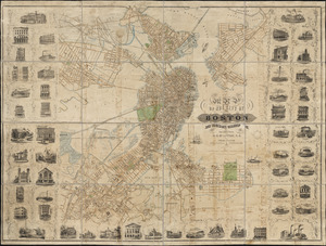
[Map of Scollay Square and vicinity]
703.
Map of the Boston Elevated Ry. 1915
704.
Map of the Boston Elevated Ry. 1927
705.
Map of the central business district city of Boston showing the location of underground conduits
706.
Map of the central business district of Boston
707.
Map of the cities of Boston, Cambridge, Somerville and Chelsea, and the town of Brookline with parts of Newton, Malden and...
708.
Map of the city of Boston
709.
[Map of the city of Boston]
710.
Map of the city of Boston
711.
Map of the city of Boston : from the recent surveys of the city and dist. surveyors, and from official records and actual surveys
712.
Map of the city of Boston and immediate neighborhood : from original surveys
713.
Map of the city of Boston and its environs
714.
Map of the city of Boston and vicinity
715.
Map of the city of Boston and vicinity
716.
Map of the city of Boston and vicinity
717.
Map of the city of Boston and vicinity
718.
Map of the city of Boston and vicinity
719.
Map of the city of Boston and vicinity
720.
Map of the city of Boston and vicinity
‹ Prev
Next ›
1
2
…
32
33
34
35
36
37
38
39
40
…
54
55

![[Map of Scollay Square and vicinity]](https://bpldcassets.blob.core.windows.net/derivatives/images/commonwealth:x059cc25q/image_thumbnail_300.jpg)


![[Map of the city of Boston]](https://bpldcassets.blob.core.windows.net/derivatives/images/commonwealth:x059cc29t/image_thumbnail_300.jpg)