Toggle navigation
LMEC Home
Exhibitions
Georeferencing
Tools for Teachers
Collections
My Favorites
Sign Up / Log In
Search
Search the map portal
Map Collection
Map Collection
Map Sets
Search
Search
Search for
Search In
All Fields
Creator
Title
Subject
Place
Search All Digital Collections
Advanced Search
8713 Results
My Search
Start Over
More Like
commonwealth:3f4631769
Remove constraint More Like: commonwealth:3f4631769
Filter your Search
Place
North and Central America
5,944
United States
4,862
Massachusetts
2,088
Europe
1,396
Suffolk (county)
1,063
Boston
1,036
Canada
449
Asia
438
more
Place
»
Topic
Boston (Mass.)--Maps
586
United States--Maps
282
Real property--Massachusetts--Boston--Maps
175
Massachusetts--Maps
162
Landowners--Massachusetts--Boston--Maps
133
North America--Maps--Early works to 1800
103
New England--Maps
102
Europe--Maps
79
more
Topic
»
Date
Date range begin
–
Date range end
Current results range from
1482
to
2023
View distribution
Creator
United States. Hydrographic Office
595
O.H. Bailey & Co
148
Des Barres, Joseph F. W. (Joseph Frederick Wallet), 1722-1824
123
United States. Post Office Dept
120
Ptolemy, 2nd cent
100
Walling, Henry Francis, 1825-1888
94
Geological Survey (U.S.)
86
Jefferys, Thomas, -1771
85
more
Creator
»
Format
Maps/Atlases
8,653
Manuscripts
216
Prints
56
Books
36
Objects/Artifacts
10
Drawings/Illustrations
8
Posters
5
Georeferenced
Yes
871
No
7,842
Collection
Norman B. Leventhal Map & Education Center Collection
8,702
Boston and New England Maps
2,241
Urban Maps
2,028
Maritime Charts and Atlases
1,083
American Revolutionary War-Era Maps
633
Boston Redevelopment Authority Collection
87
Mapping Boston Collection
8
Library of Congress Collection
3
more
Collection
»
Available to use
No known restrictions
8,554
Creative Commons license
62
Search Constraints
Sort by relevance
relevance
title
date (asc)
date (desc)
Number of results to display per page
20 per page
10
per page
20
per page
50
per page
100
per page
View results as:
grid view
map view
Search Results
4241.
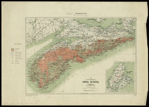
Map of the province of Nova Scotia including Cape Breton Prince Edwards Island and part of New Brunswick
4242.
Map of the province of Nova Scotia to illustrate report by E.R. Faribault, B.A. Sc. on the "Gold fields of Nova Scotia"
4243.
A map of the province of Upper Canada, describing all the new settlements, townships, & cc. with the countries adjacent, from...
4244.
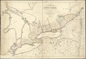
Map of the province of Upper Canada shewing the organized part thereof and the adjacent county
4245.
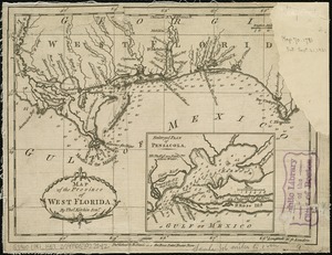
Map of the province of West Florida
4246.
A map of the provinces of New-York and New Jersey, with a part of Pennsylvania and the Province of Quebec
4247.
Map of the provinces of upper & lower Canada with the adjacent parts of the United States of America, &c
4248.
Map of the public land states and territories : constructed from the Public Surveys and other official sources in the General...
4249.
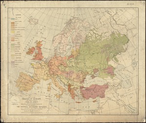
Map of the races of Europe and adjoining portions of Asia and Africa
4250.
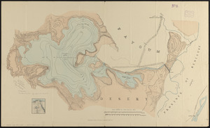
Map of the Raïan Basin
4251.
Map of the rail road from Boston to Stanstead
4252.
Map of the rail roads of New Jersey 1887
4253.
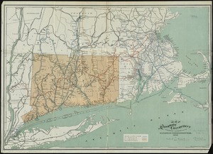
Map of the railroads of Connecticut : to accompany the report of the Railroad Commissioners
4254.
[Map of the railroads of Massachusetts running west from Boston]
4255.
Map of the railroads of the state of Massachusetts : accompanying the report of the railroad commissioners : 1887
4256.
Map of the railroads of the state of Massachusetts : accompanying the report of the railroad commissioners : 1899
4257.
Map of the railroads of the state of Massachusetts : accompanying the report of the Railroad Commissioners : 1884
4258.
Map of the railroads of the state of Massachusetts : accompanying the report of the Railroad Commissioners : 1900
4259.
Map of the railroads of the state of Massachusetts : accompanying the report of the railroad Commissioners : 1897
4260.
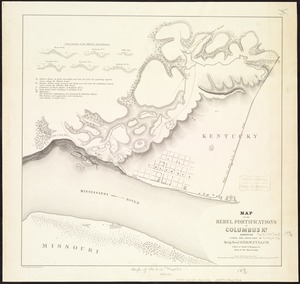
Map of the Rebel fortifications at Columbus, Ky
‹ Prev
Next ›
1
2
…
209
210
211
212
213
214
215
216
217
…
435
436


![[Map of the railroads of Massachusetts running west from Boston]](https://bpldcassets.blob.core.windows.net/derivatives/images/commonwealth:x059cc84w/image_thumbnail_300.jpg)