Map of the railroads of the state of Massachusetts : accompanying the report of the Railroad Commissioners : 1900
Item Information
- Title:
- Map of the railroads of the state of Massachusetts : accompanying the report of the Railroad Commissioners : 1900
- Cartographer:
- Massachusetts. Board of Railroad Commissioners
- Date:
-
1890
- Format:
-
Maps/Atlases
- Location:
-
Boston Public Library
Norman B. Leventhal Map & Education Center - Collection (local):
-
Norman B. Leventhal Map & Education Center Collection
- Subjects:
-
Massachusetts--Maps
Railroads--Massachusetts--Maps
- Places:
-
Massachusetts
- Extent:
- 1 map : color ; 68 x 84 cm
- Terms of Use:
-
No known copyright restrictions.
No known restrictions on use.
- Publisher:
-
[Boston] :
[Massachusetts. Board of Railroad Commissioners]
- Scale:
-
Scale approximately 1:400,000
- Language:
-
English
- Notes:
-
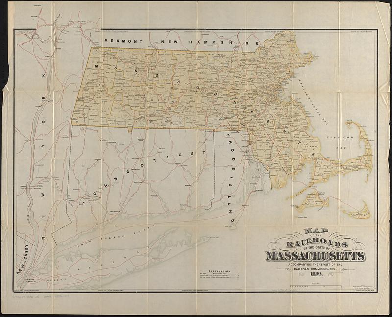
From the 1890 Annual report of the Board of Railroad Commissioners.
Shows railroads; money order post offices; county towns; county towns if also a money order office; and railroads stations, villages and ordinary post offices.
Shows continuation of railroads into neighboring states.
Prime meridian: Washington, D.C.
- Identifier:
-
06_01_017654
- Call #:
-
G3761.P3 1890 .M3
- Barcode:
-
39999085961447
![[Boston and Northwestern Junction Railroad]](https://bpldcassets.blob.core.windows.net/derivatives/images/commonwealth:x059cc74n/image_thumbnail_300.jpg)


