Toggle navigation
LMEC Home
Exhibitions
Georeferencing
Tools for Teachers
Collections
My Favorites
Sign Up / Log In
Search
Search the map portal
Map Collection
Map Collection
Map Sets
Search
Search
Search for
Search In
All Fields
Creator
Title
Subject
Place
Search All Digital Collections
Advanced Search
375 Results
My Search
Start Over
More Like
commonwealth:3f4630606
Remove constraint More Like: commonwealth:3f4630606
Filter your Search
Place
North and Central America
352
United States
326
Massachusetts
301
Boston
86
Suffolk (county)
86
New England
43
Boston Harbor
33
Rhode Island
31
more
Place
»
Topic
Massachusetts--Maps
235
Boston (Mass.)--Maps
65
Rhode Island--Maps
32
Railroads--Massachusetts--Maps
31
New England--Maps--Early works to 1800
23
Connecticut--Maps
20
Roads--Massachusetts--Maps
19
World maps--Early works to 1800
19
more
Topic
»
Date
Date range begin
–
Date range end
Current results range from
1493
to
2020
View distribution
Creator
MassGIS (Office : Mass.)
20
Geo. H. Walker & Co
15
Massachusetts. Executive Office of Environmental Affairs
14
Boston Public Library. Norman B. Leventhal Map and Education Center
9
Applied Geographics, Inc.
7
Carleton, Osgood, 1742-1816
7
Geo. H. Walker & Co.
7
Geological Survey (U.S.)
7
more
Creator
»
Format
Maps/Atlases
372
Manuscripts
3
Prints
2
Ephemera
1
Georeferenced
Yes
91
No
284
Collection
Norman B. Leventhal Map & Education Center Collection
344
Boston and New England Maps
239
Mapping Boston Collection
142
American Revolutionary War-Era Maps
56
Urban Maps
35
Maritime Charts and Atlases
31
Applied Geographics, Inc. Records
20
David Judkins Weaver Papers
18
more
Collection
»
Available to use
No known restrictions
202
Creative Commons license
146
Search Constraints
Sort by relevance
relevance
title
date (asc)
date (desc)
Number of results to display per page
20 per page
10
per page
20
per page
50
per page
100
per page
View results as:
grid view
map view
Search Results
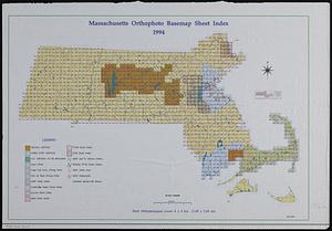
141.
Massachusetts : eastern part, no.11
142.
Massachusetts and Rhode Island
143.
Massachusetts areas of critical environmental concern
144.
Massachusetts Bays Program community resource atlas
145.
Massachusetts coastal towns
146.
Massachusetts coastal watersheds
147.
Massachusetts coastal zone management
148.
Massachusetts coastal zone management program : volume 1, summary map
149.
Massachusetts CZM shoreline change analysis project
150.
Massachusetts drainage basins
151.
Massachusetts highway program for 1965
152.
The Massachusetts interstate highway program
153.
Massachusetts land use - 1985
154.
Massachusetts land use - 1985
155.
Massachusetts navigation and dredging management study
156.
Massachusetts official transportation map
157.
Massachusetts official transportation map
158.
Massachusetts open space and recreation facilities
159.
Massachusetts orthophoto basemap sheet index
160.
Massachusetts orthophoto basemap sheet index
‹ Prev
Next ›
1
2
…
4
5
6
7
8
9
10
11
12
…
18
19